Nelson Lakes National Park
Woo hoo, Nelson Lakes National Park, fantastic place. There are a lot of images following (140 or so). Each set is a separate gallery. The text separates the galleries.
After my Mt. Richmond Forest Park trip, I was feeling a bit beat up , and not just physically. I took a couple of days to recover, but also because the weather forecast was terrible. I finally realized that the iPhone weather is pretty useless for this because the weather changes so quickly and while rain may be likely every day, that does not mean most of the might be glorious. I finally decided to get a move on.
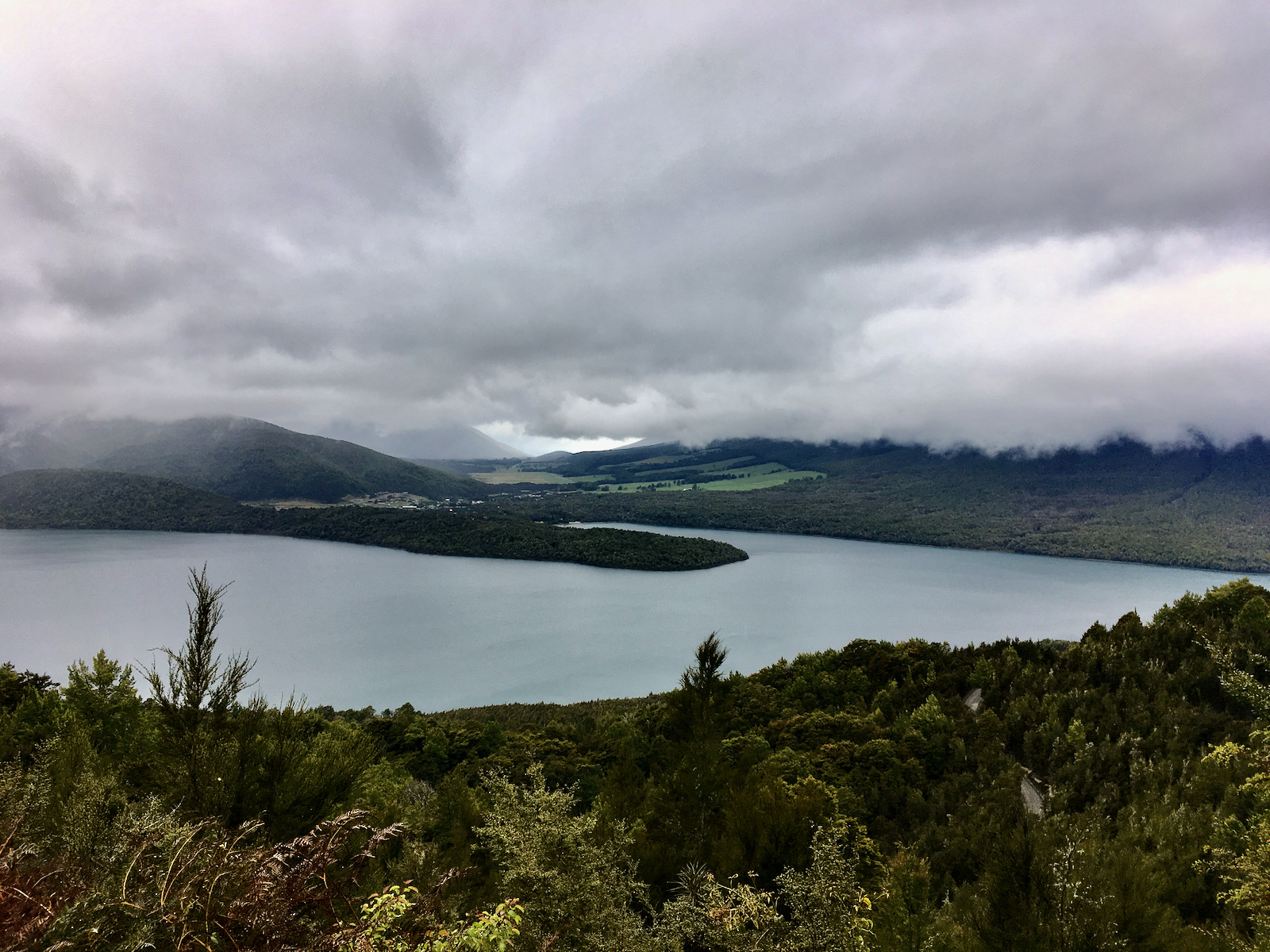
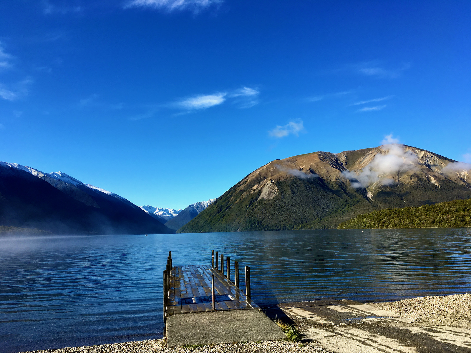
My plan was to head to Nelson Lakes. It is located just a couple of hours south of Nelson. There is no reliable transportation, no buses heading to St. Arnaud, the tiny tiny town that is the gateway to the park. It seems this is so even in the busy season. I kept hearing from travelers and reading that hitchhiking is a perfectly acceptable way to get around. I was a bit skeptical, but thought I would try. So, I took a bus to Richmond, just south and contiguous with Nelson, and positioned myself on the route to St. Arnaud. After about an hour, and good amount of traffic, I decided this was not going to work for an old white guy. I also thought, I have a credit card and the will to use it. So, I humped it back to the bus, and headed to the airport and rented a car. This was correct decision. St. Arnaud was not only way way smaller than I expected, it was deserted, as it was still the off season. If I had gotten a ride there, I would have been hard pressed to get one back to Nelson. I got my car in the early afternoon, drove carefully back to the hostel where I had left some non backpacking stuff, and then off to St. Arnaud. Driving on the left was not a big deal. It actually helped to start out in some traffic in Nelson, so I had cars to follow and keep me from doing stupid things. I managed to only do a couple of stupid things while driving, and nothing too serious.
I got to the park early evening, and explored around a bit. The weather was not so nice, but it was beautiful. The park office was closed for evening so I planned on going back in the morning to talk to ranger and get some trip planning done.

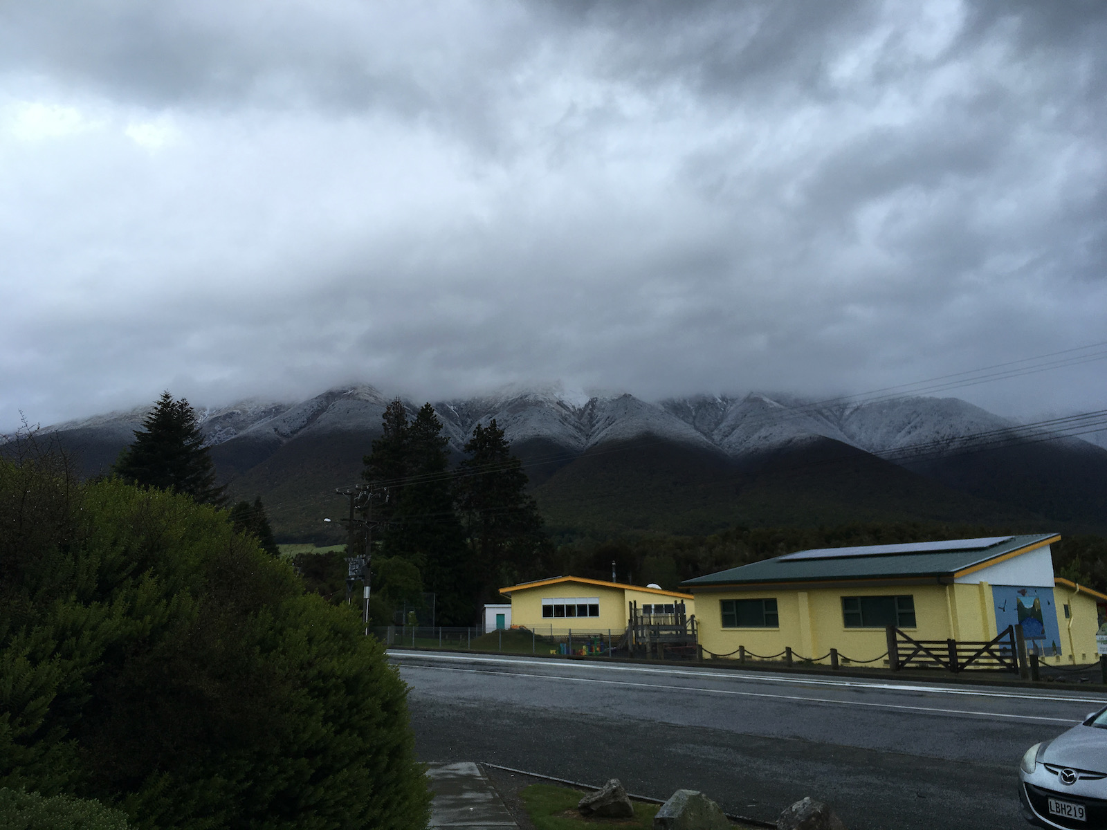

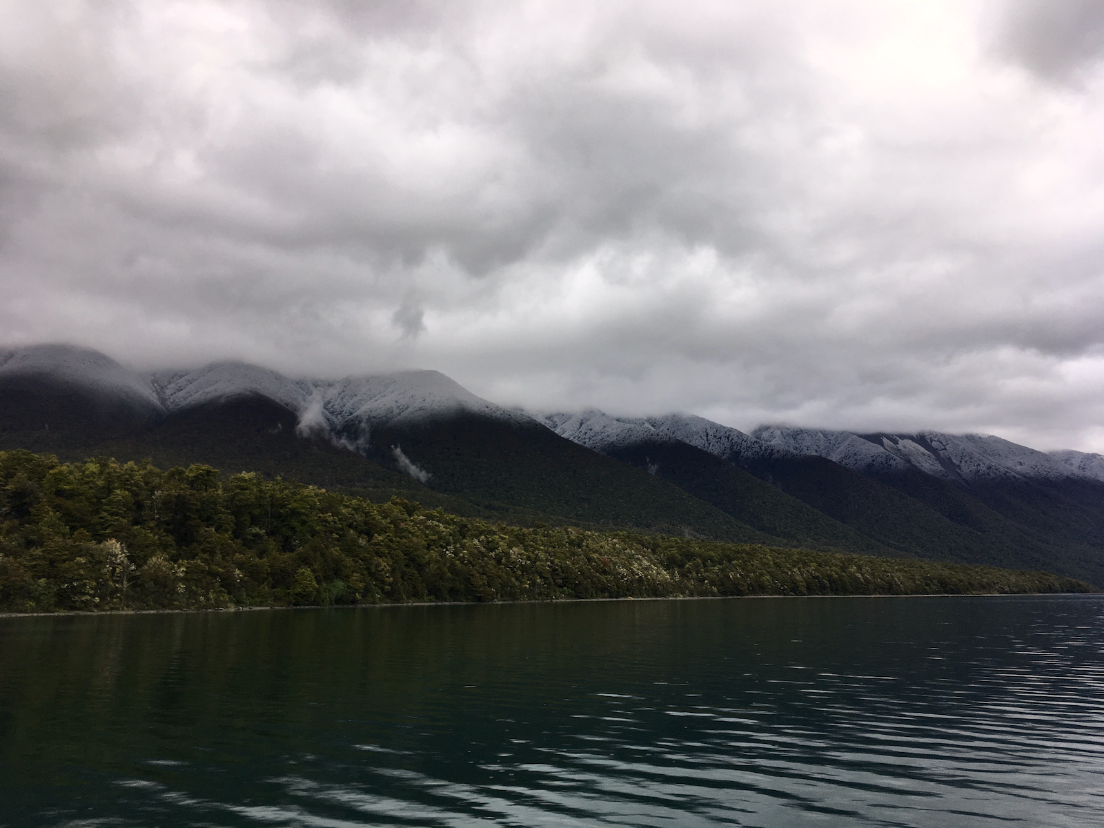


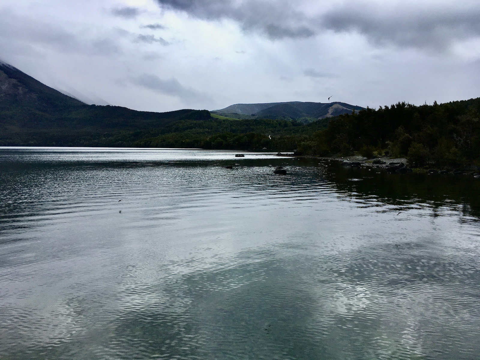


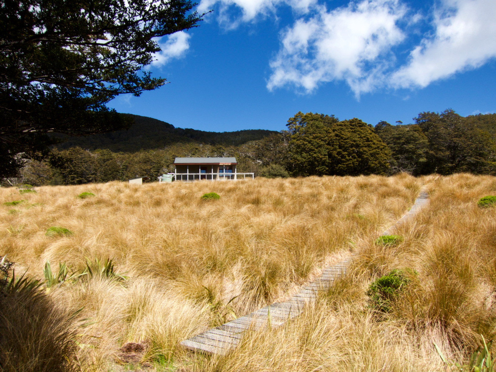
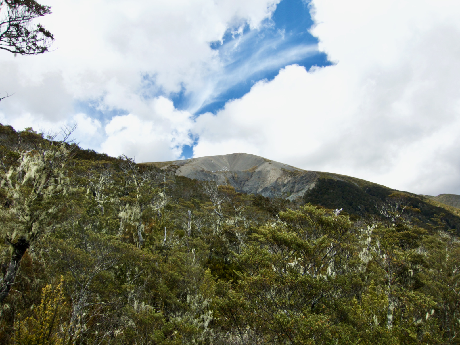
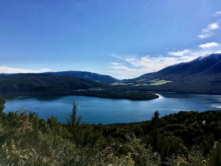
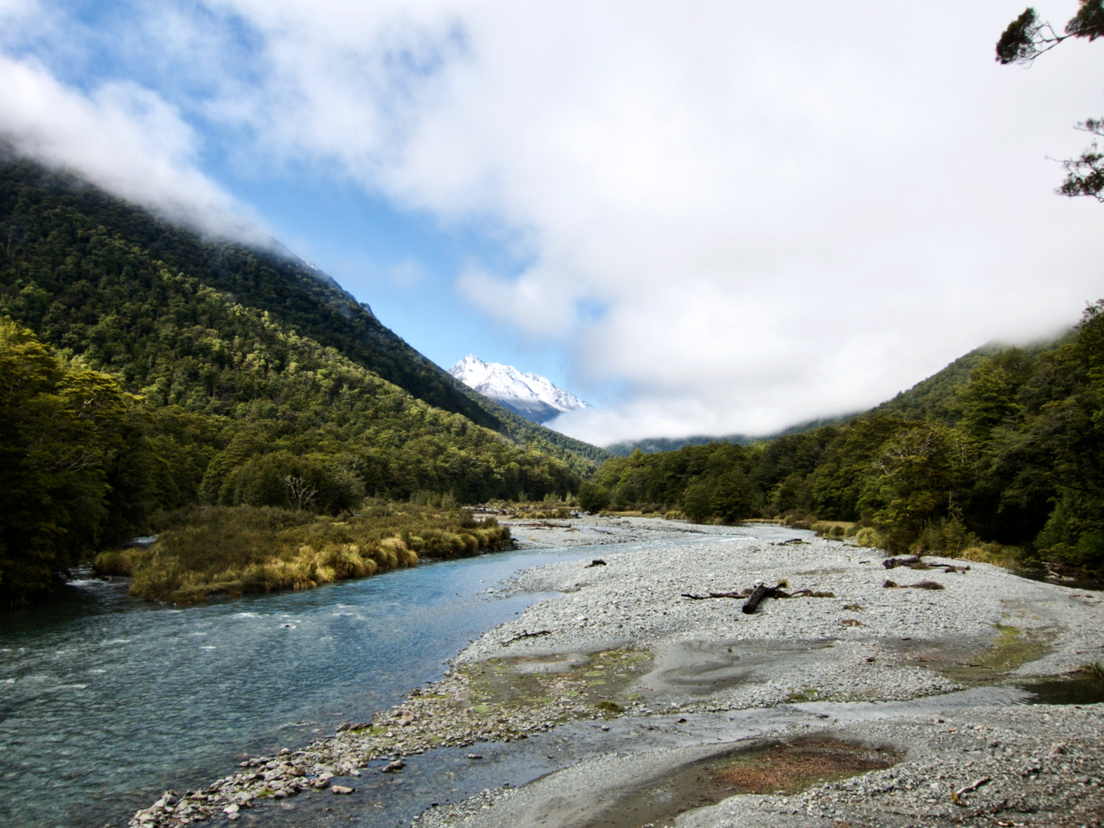
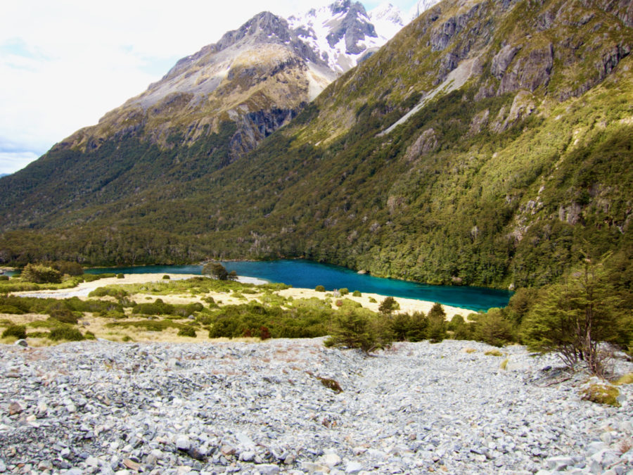
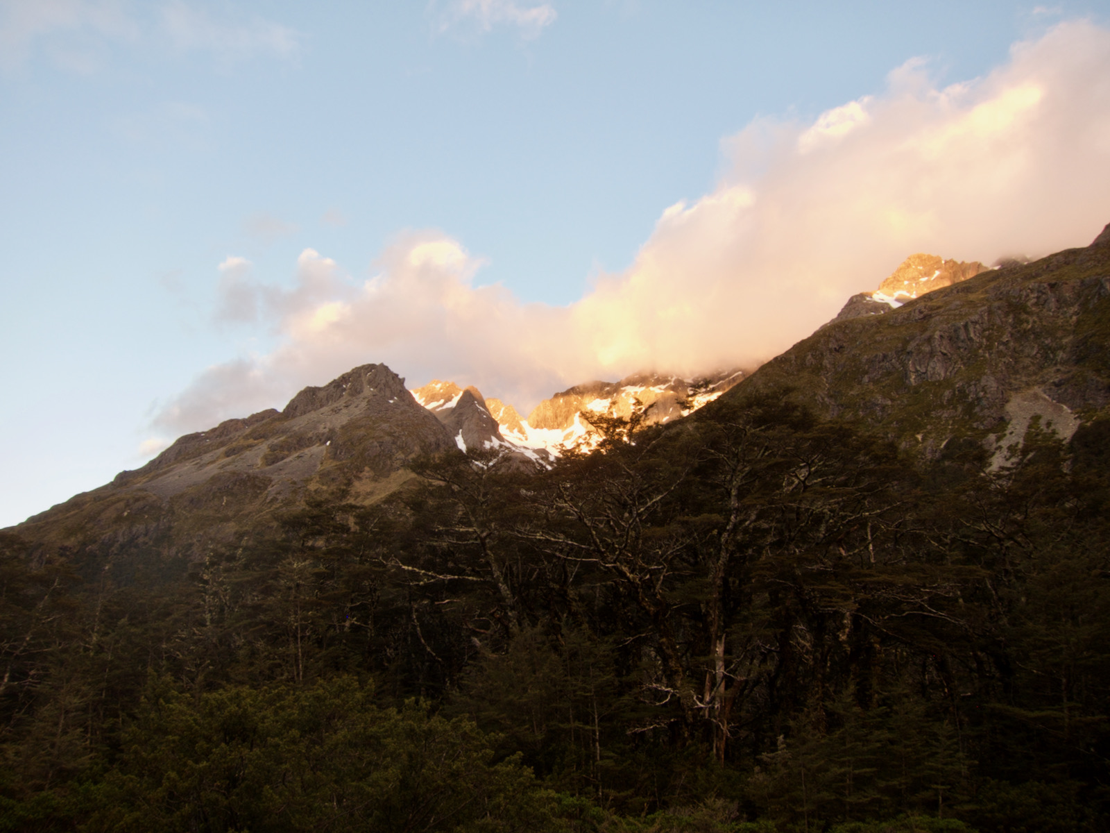
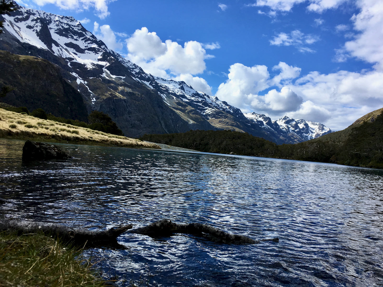
The next morning was beautiful and clear, but pretty chilly. It rained overnight, but it snowed up in the mountains, as was very evident. The visible snowline on the mountains was pretty cool. I arrived at the park hq just as it opened and talked to a park ranger. She was not particularly helpful I have to say. She essentially told me I shouldn’t go because of the snow. I was not keen on that. My initial that I had read was to complete the Travers Sabine circuit. Day one up the valley, day 2 over the saddle (and this was described a very steep), and on to the Blue lake hut, then hike back down the Sabine valley past Lake Rotaroa.
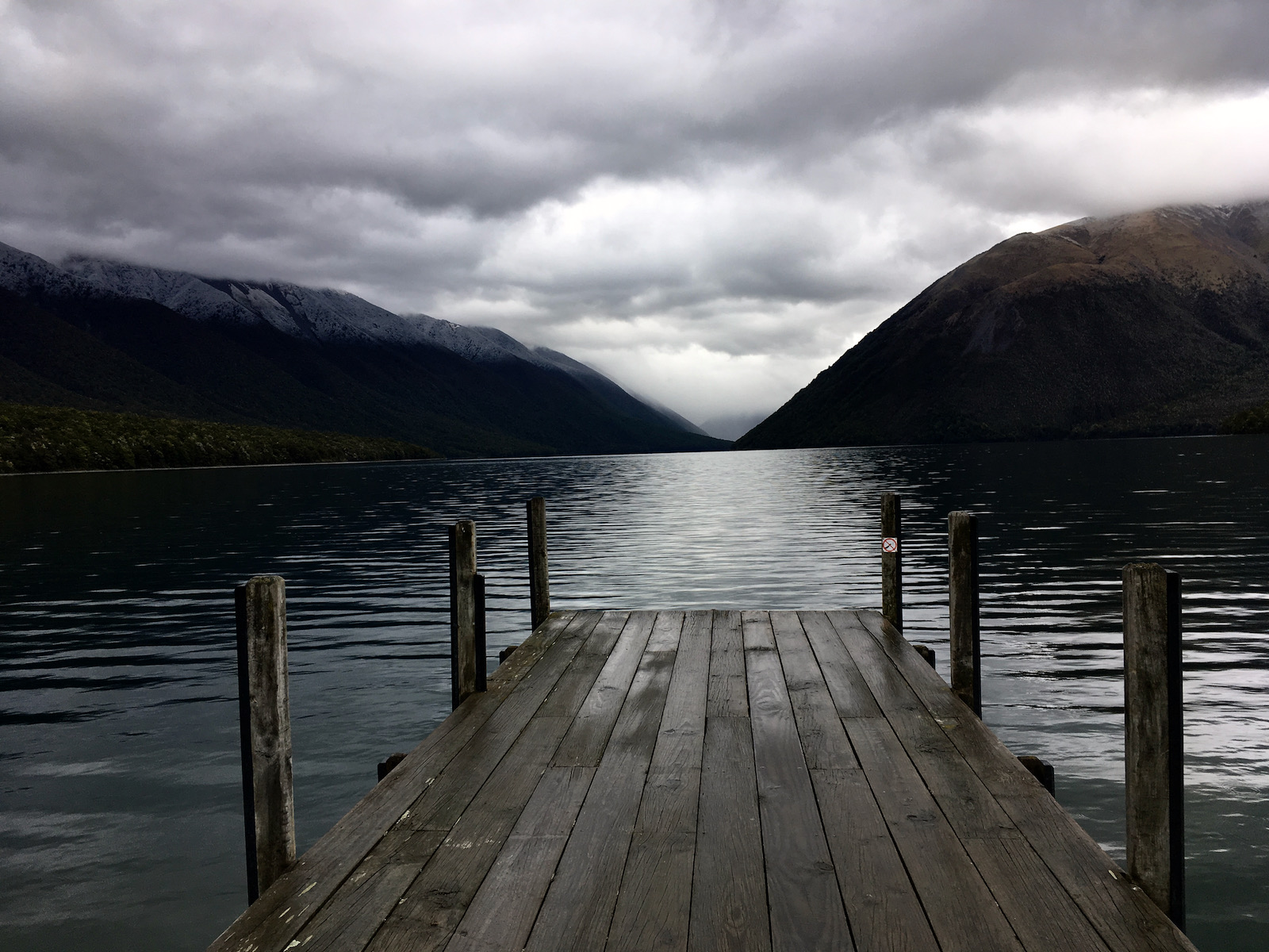
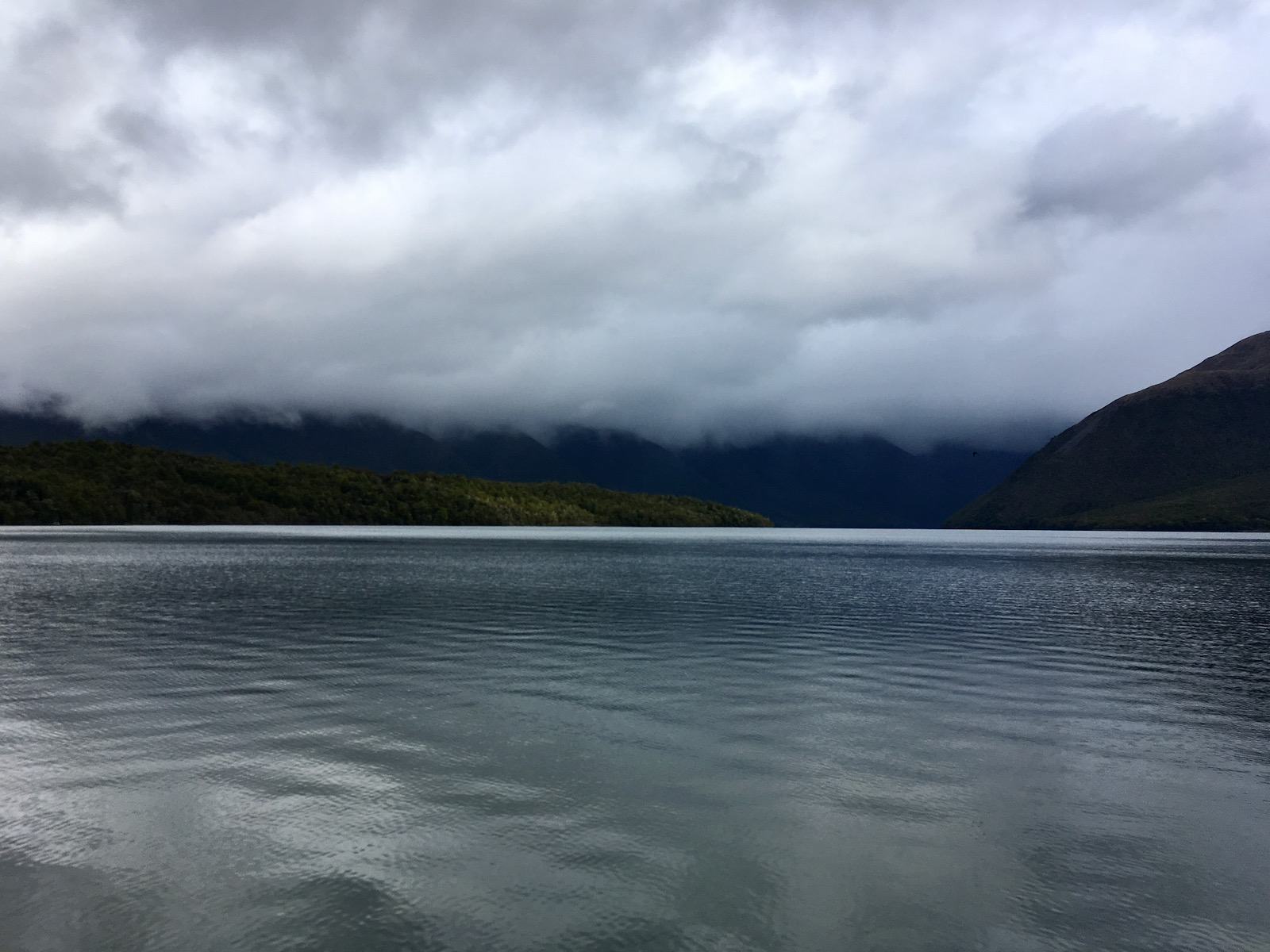
The snow (and ice that comes with it) was daunting, and I we feeling very wary after my trip in MRFP. It a trail was described as taxing, I was not going to downplay that. But I decided on this circuit. So, I headed out and parked at trailhead, which is just off the lake. I headed out on an easy lake side trail. I hiked for about 20 minutes, and kept thinking about a really steep slope with snow and ice on it. I turned around, went back to my car, and decided to go with plan b. A different starting point, but depending upon exactly how I traveled, a reverse of what I started, but with ability to avoid the snow the ice passes.
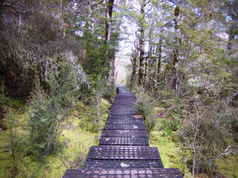
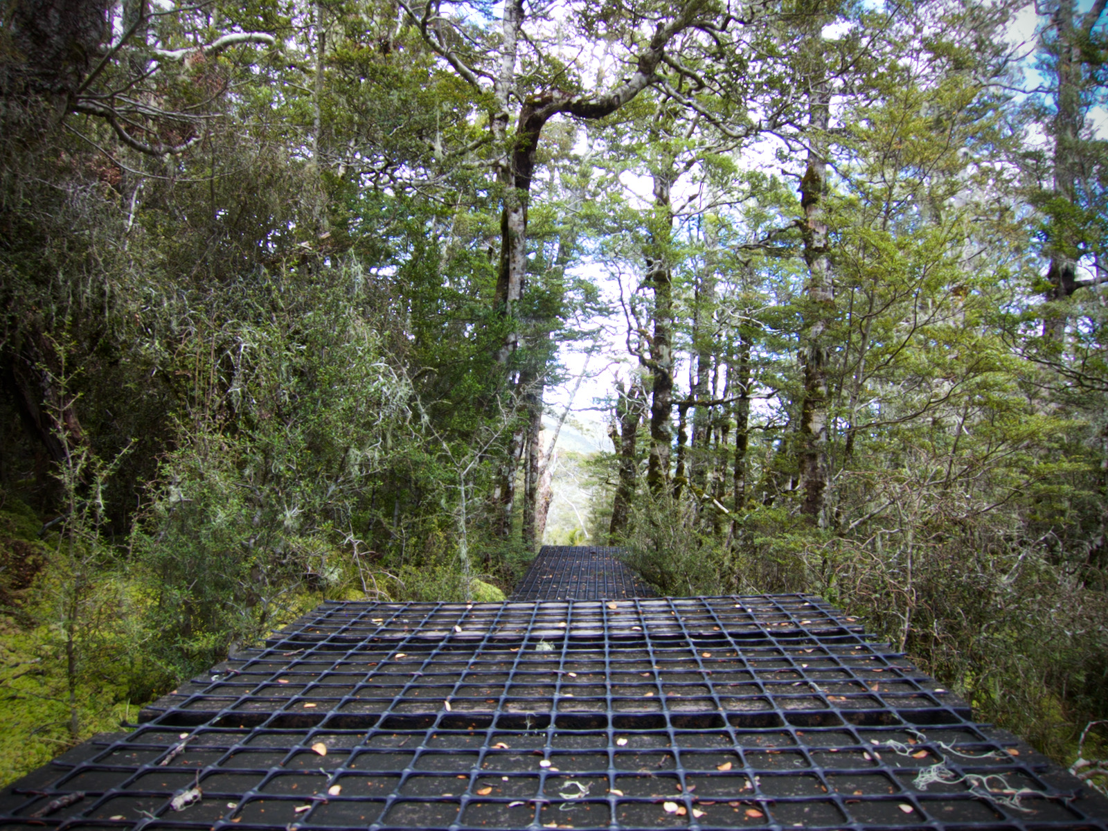
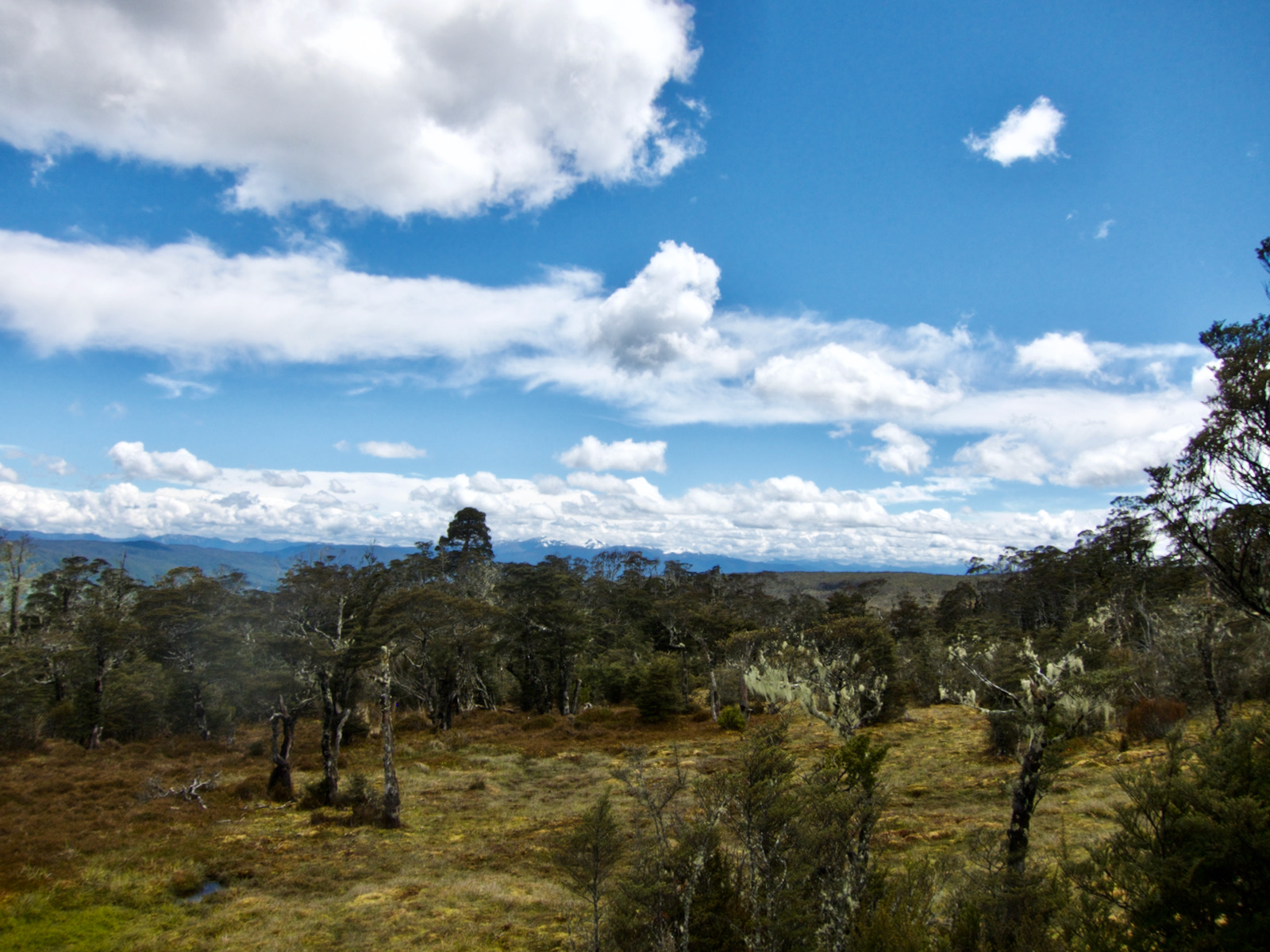
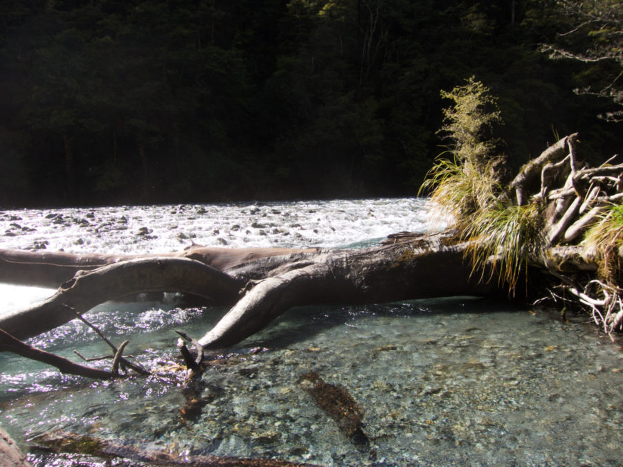
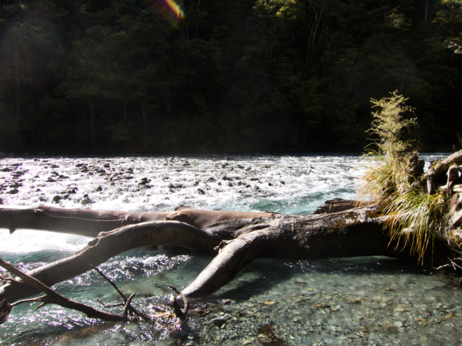
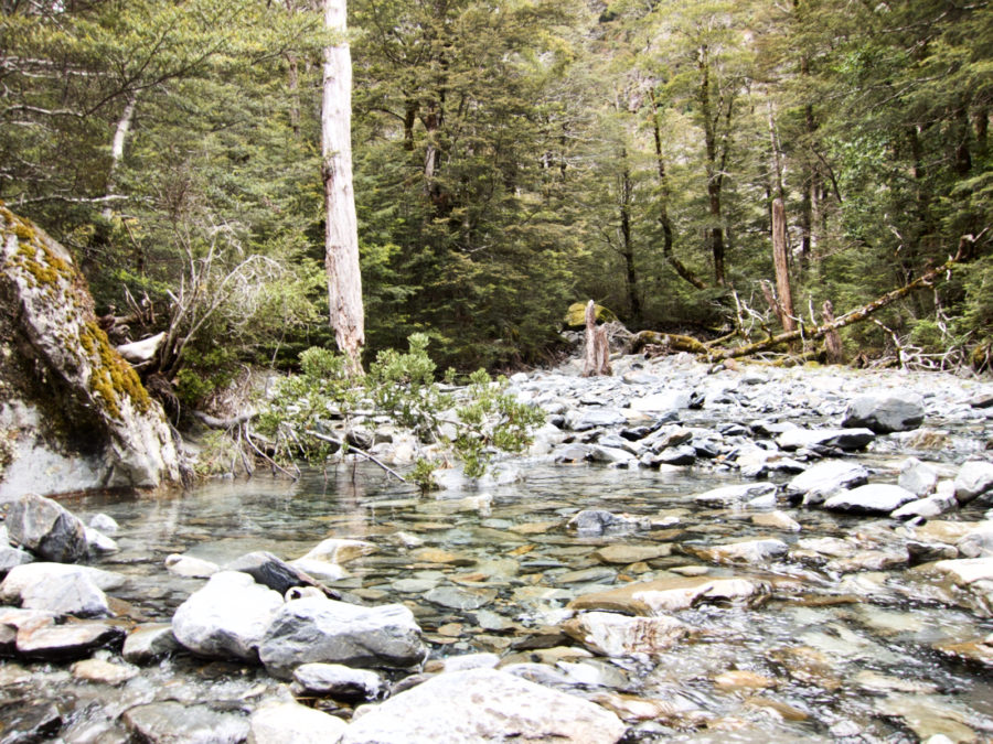
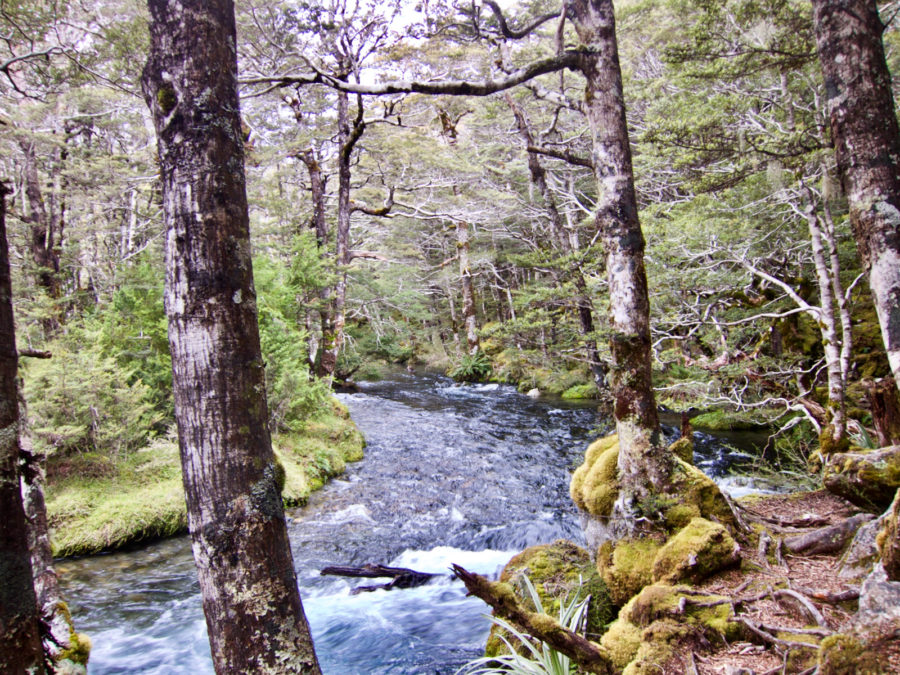
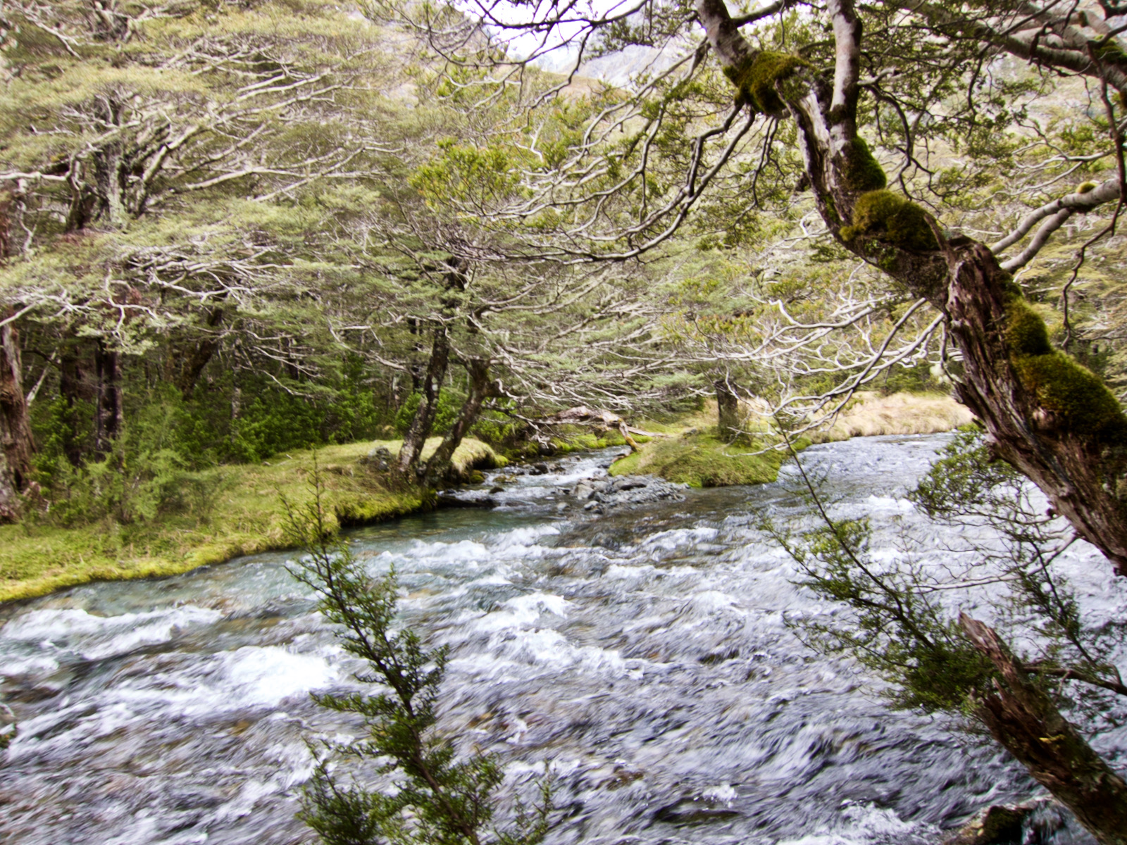
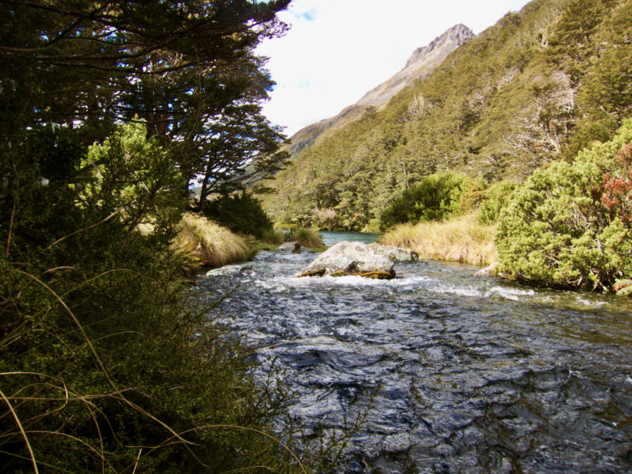
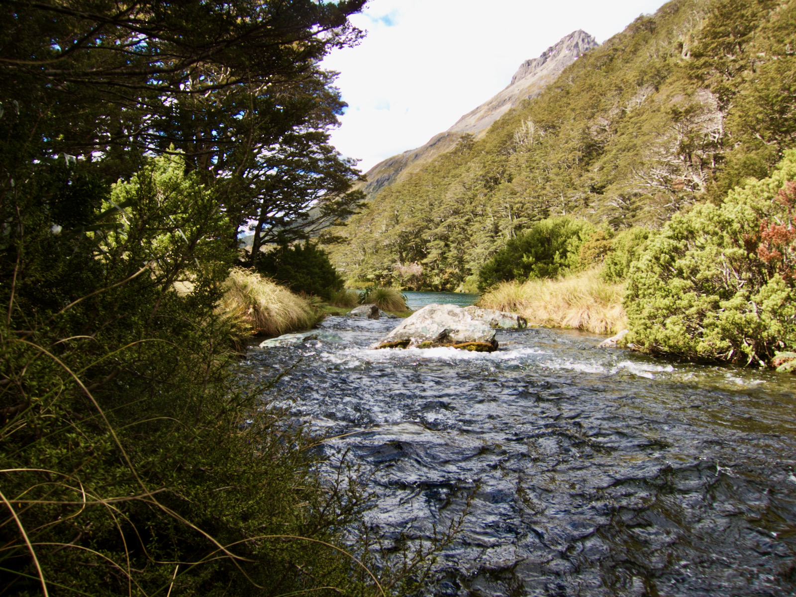
I started on this trip and early not too far along ran into a couple that had come down off trail from the Angelus hut, which is a route I had hoped to take also. They were kind of shaken from the snow and ice, I think it was a bit scary. I was feeling better about my choice. This was a reasonable trail, some easy walking, some boardwalk, some ankle twisting root filled areas, but all fine. I forded a stream, super cold on a chilly morning, crossed a couple of drainages, one with suspension bridge that must have lots of water coming down in the spring. I think if I had been much earlier in season, this trail would not have been open.
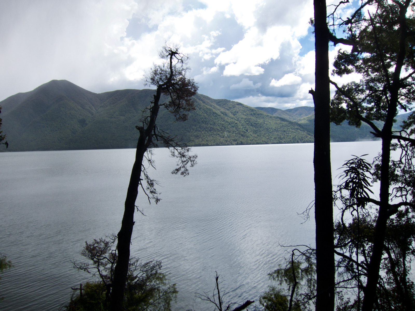
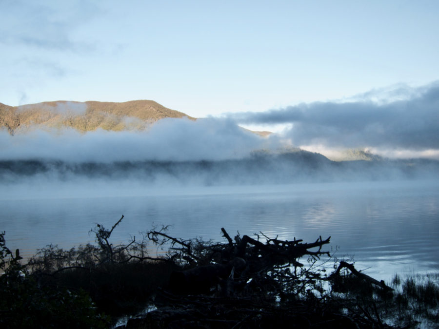
As I was getting close to Sabine hut, it started to rain, I did not think it would amount to much and that I was almost to hut. I was wrong, but the time I stopped to put on rain gear, I was soaked. This is when the hut system seems really nice. It took a bit of work, but I was able to get the stove fired up, and get a fire going and dry my clothes. Most are stocked with firewood. There were 3 of us in the hut that holds over 30 that night.


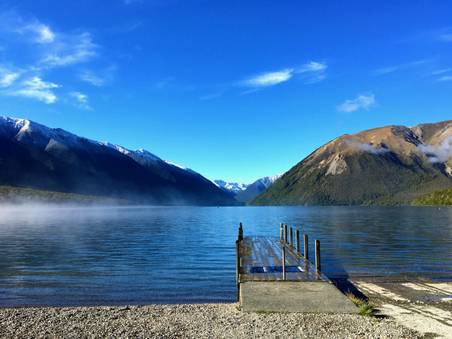


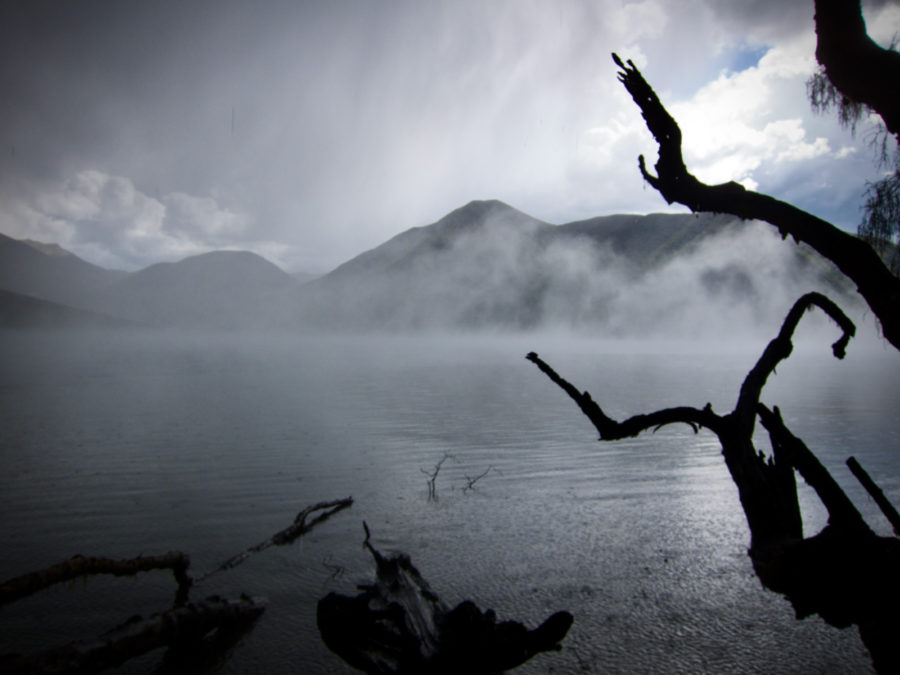


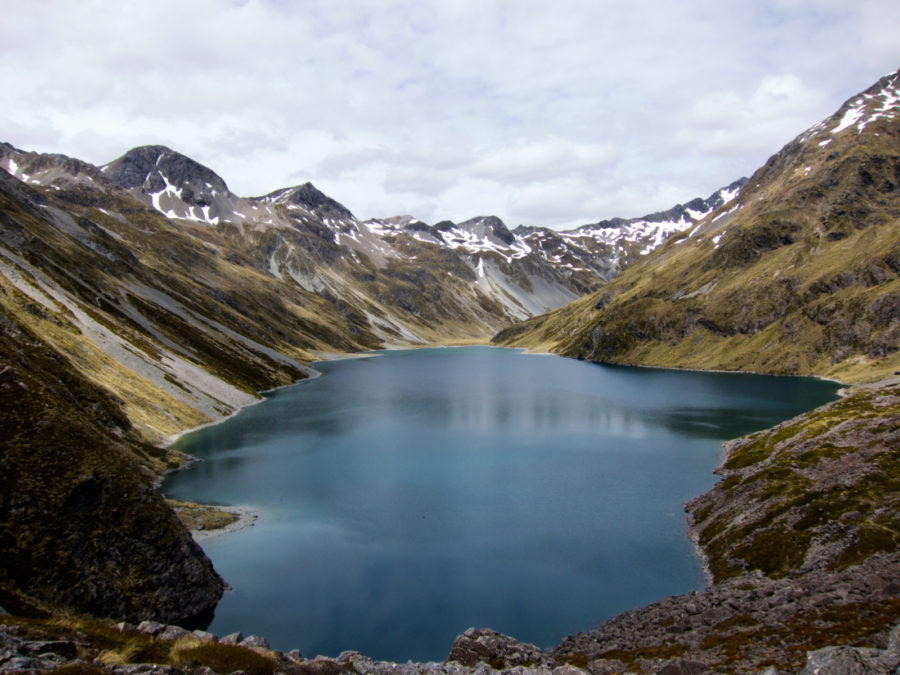
View from Sabine Hut on edge of Lake Rotoroa


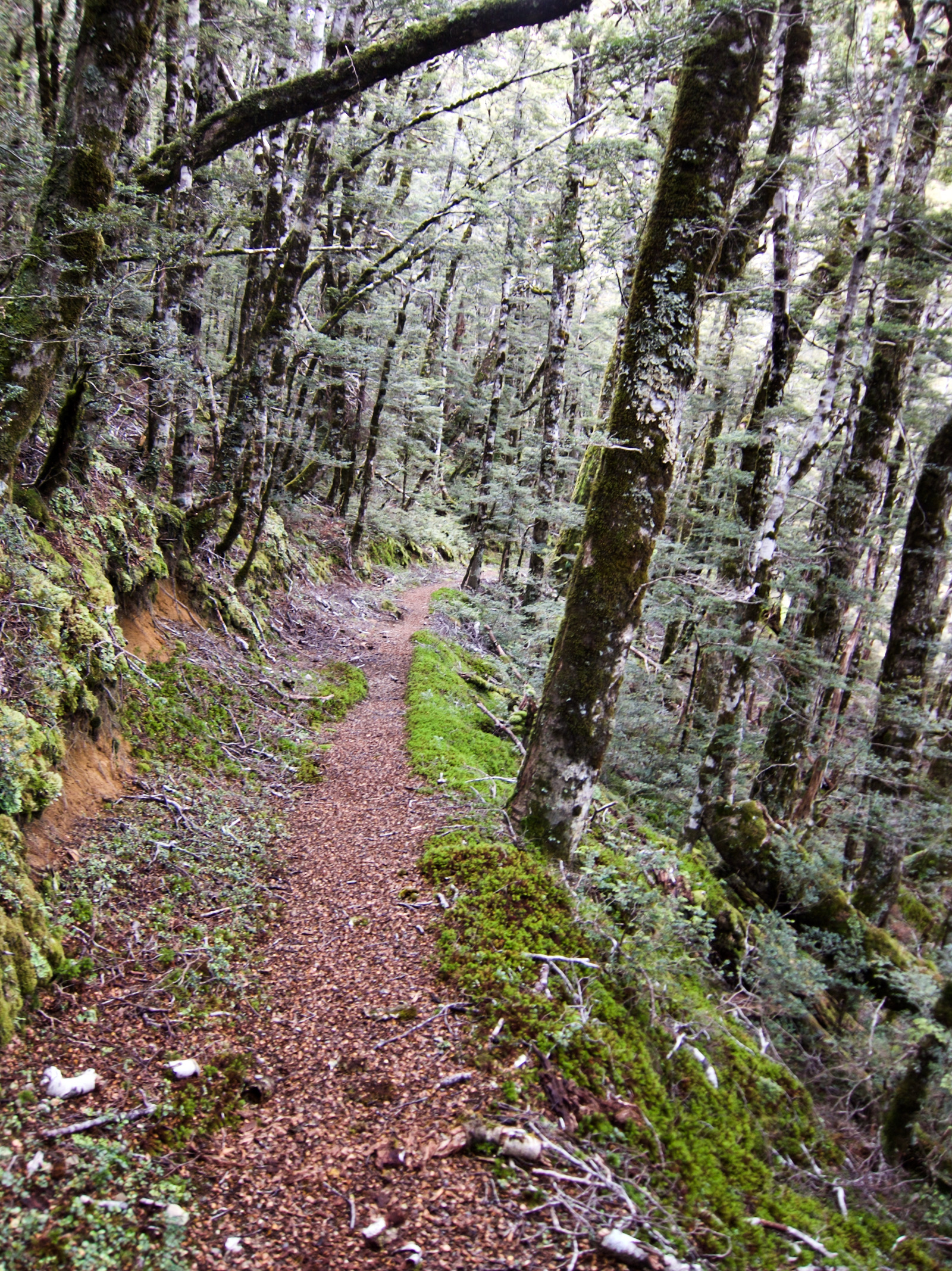
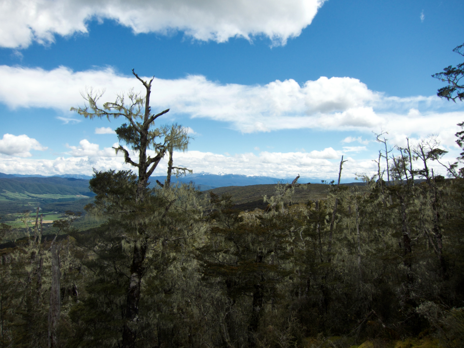


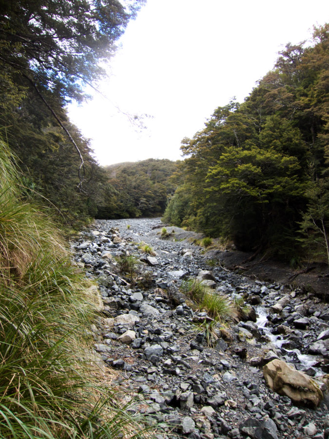
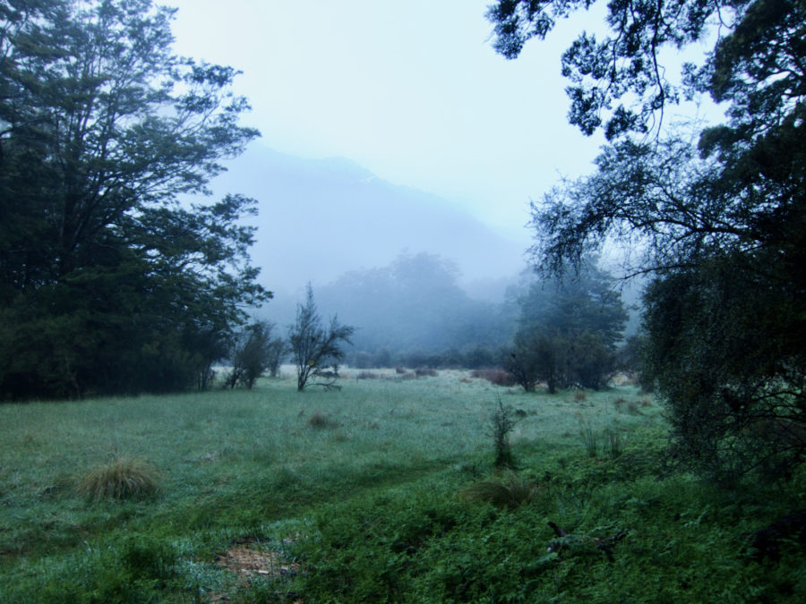
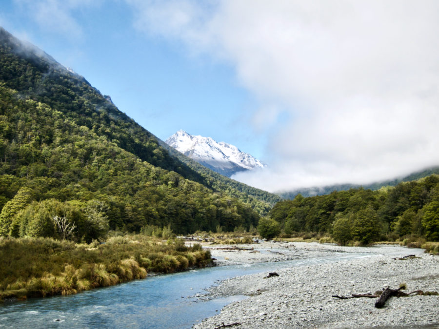
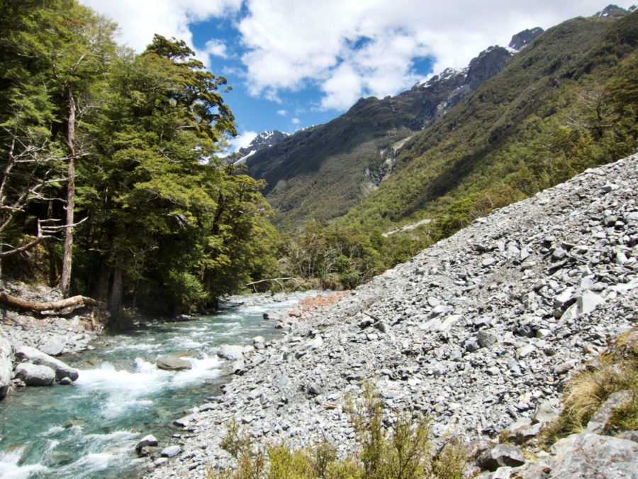
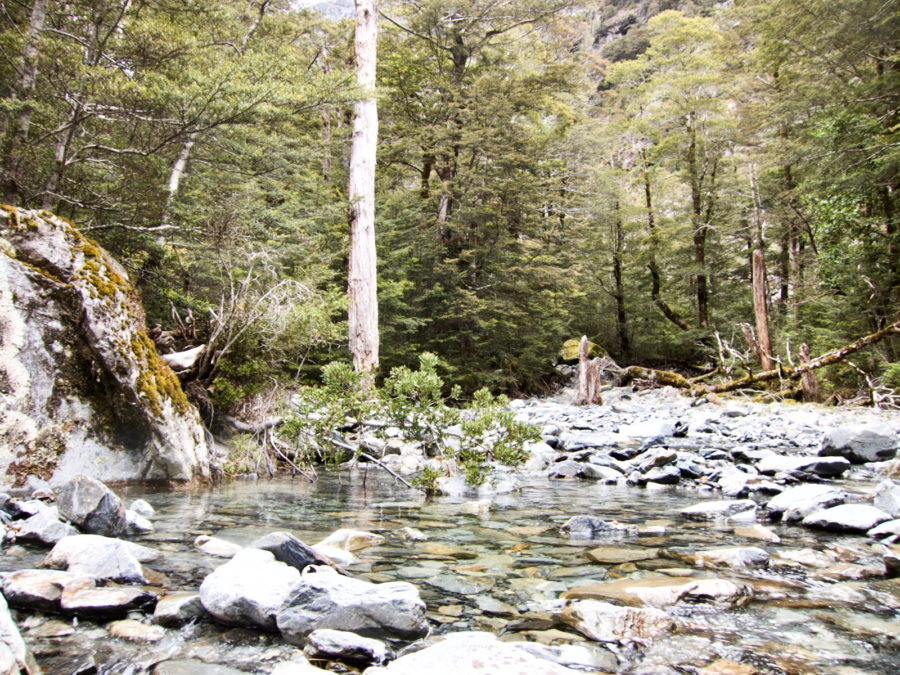
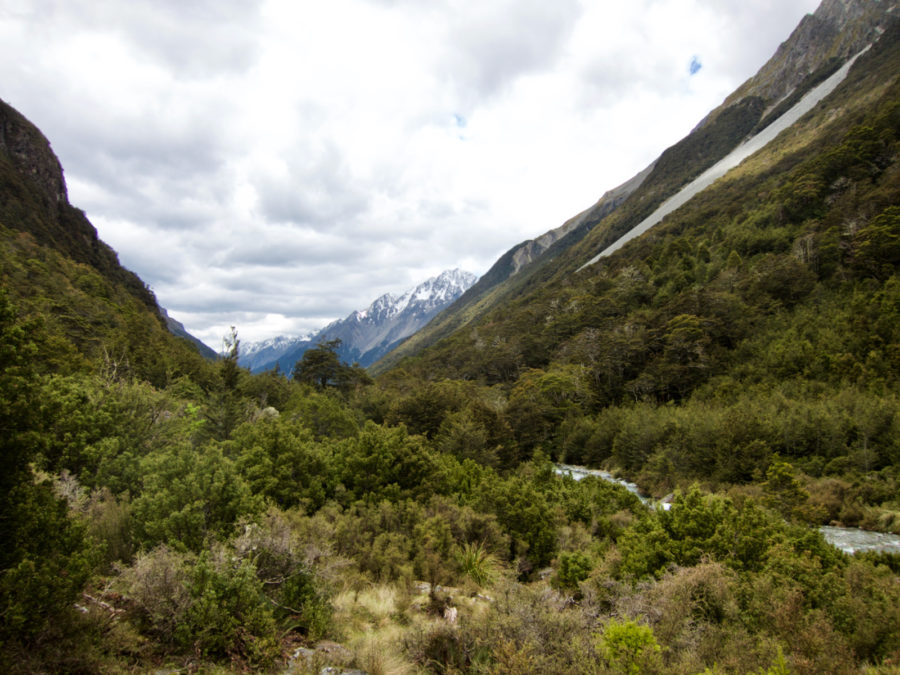
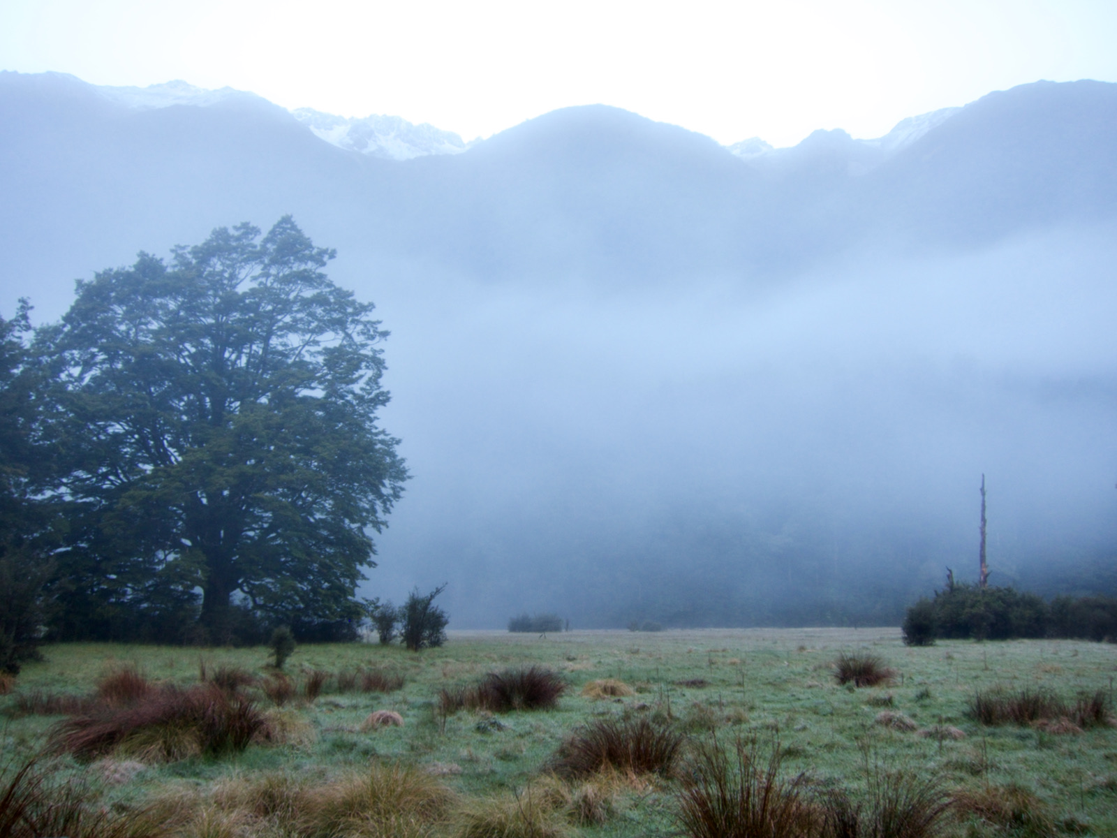
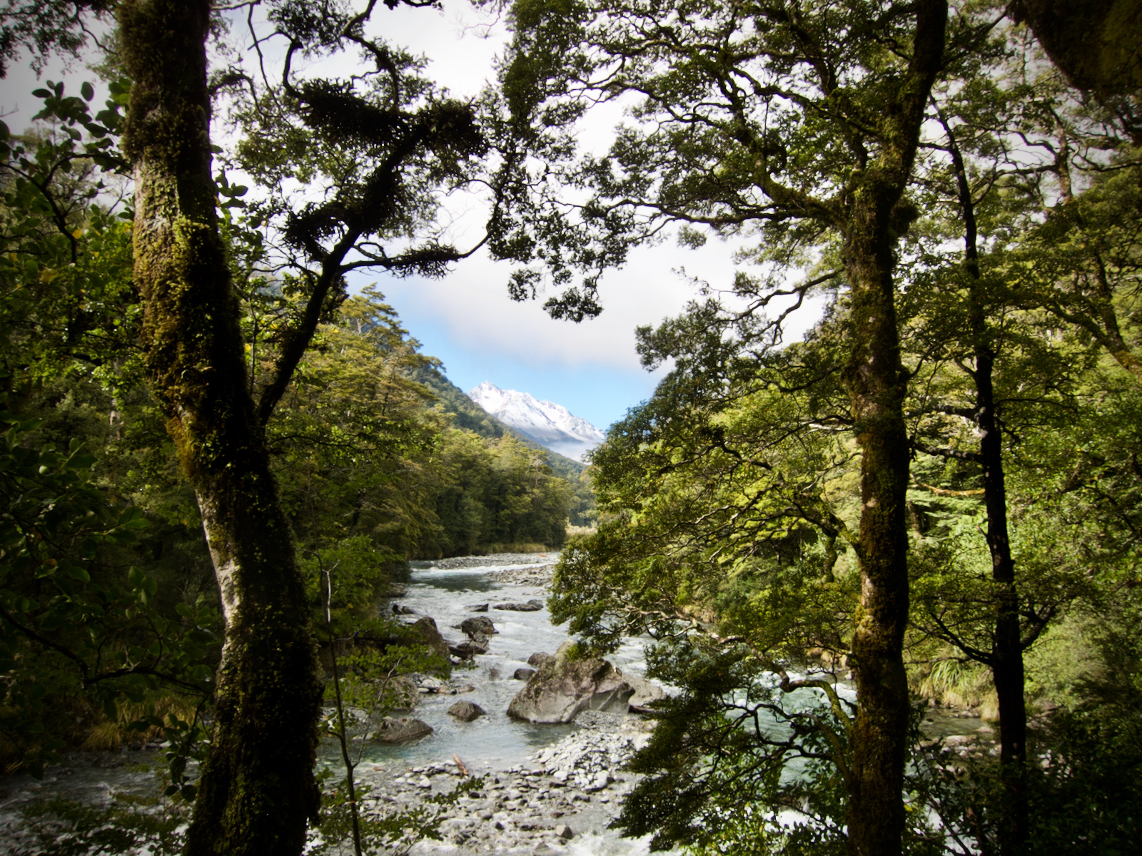
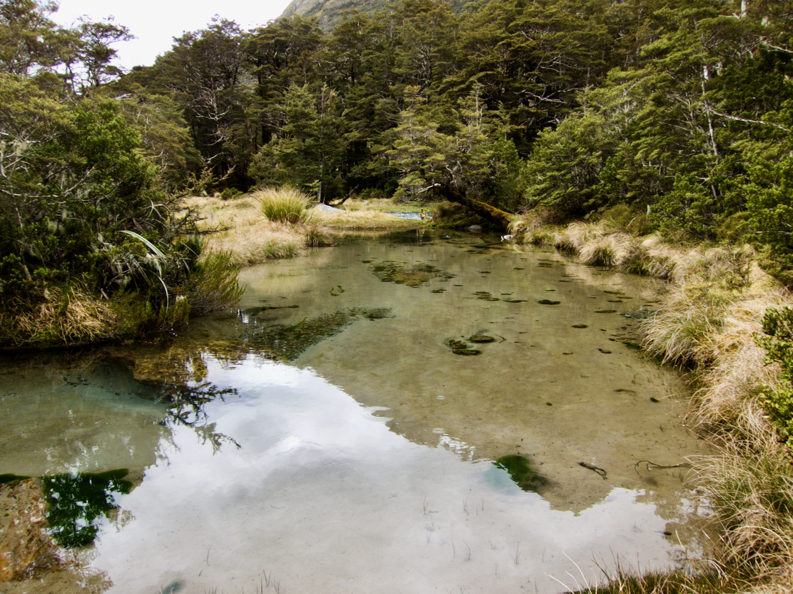
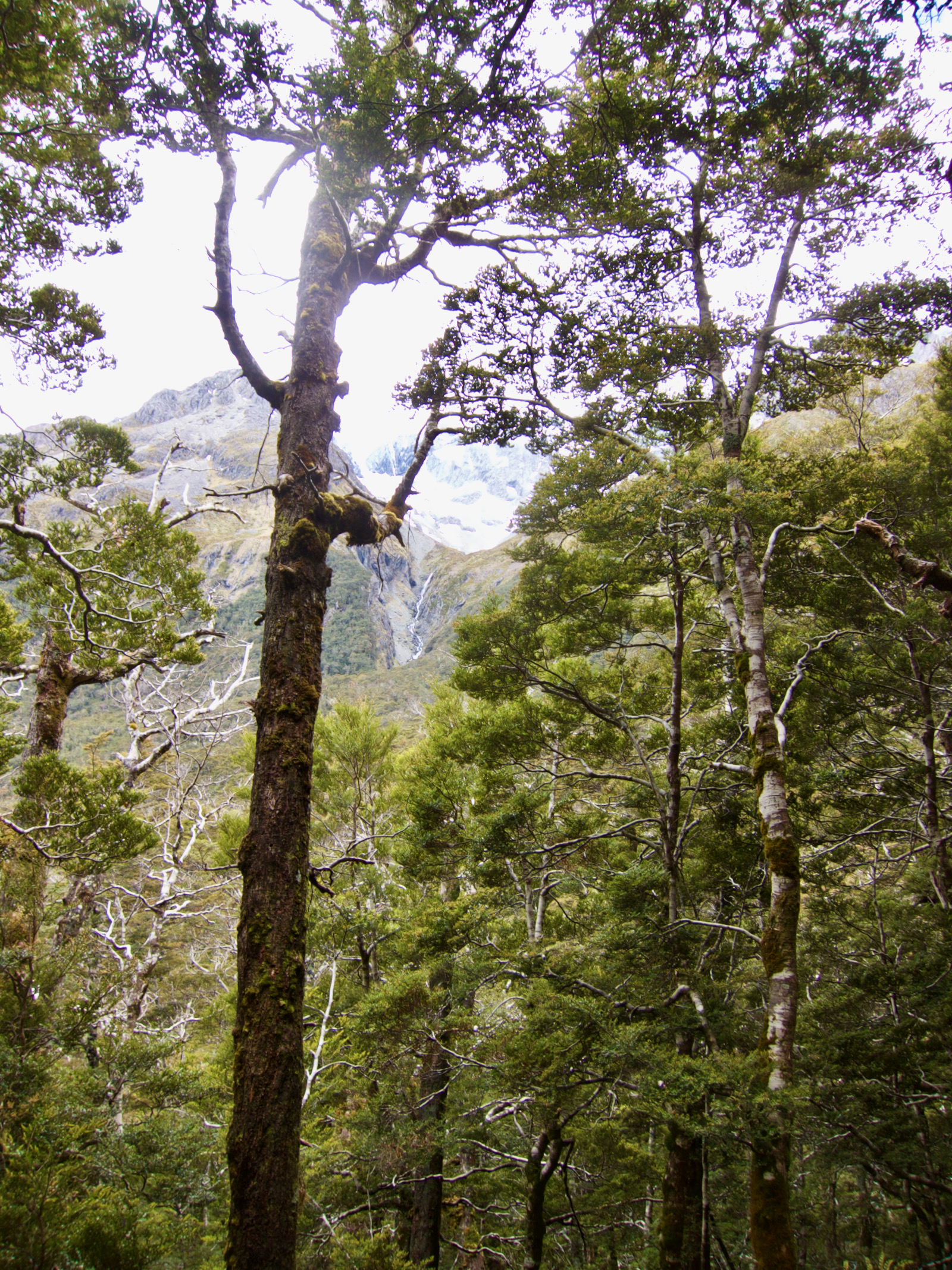
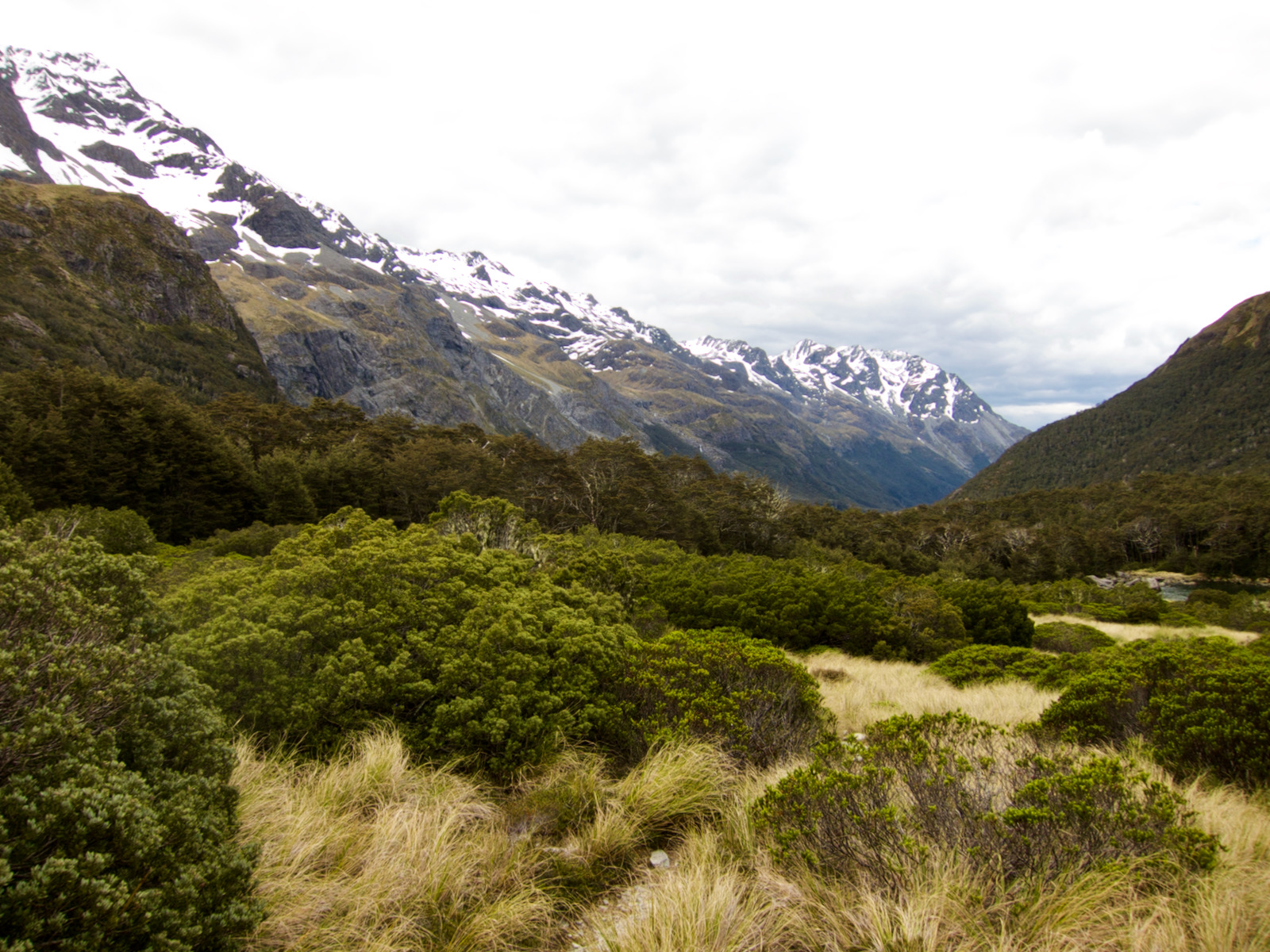
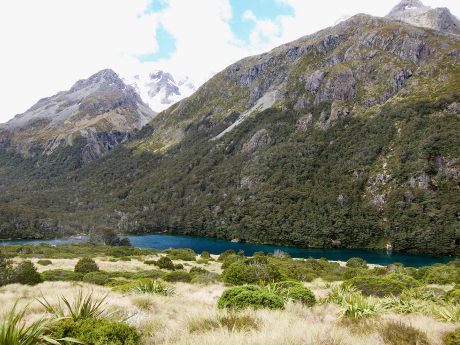
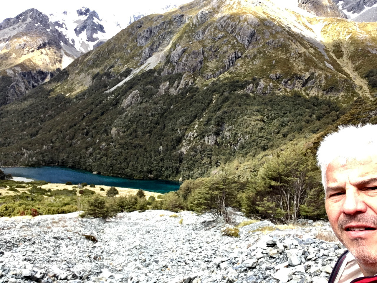
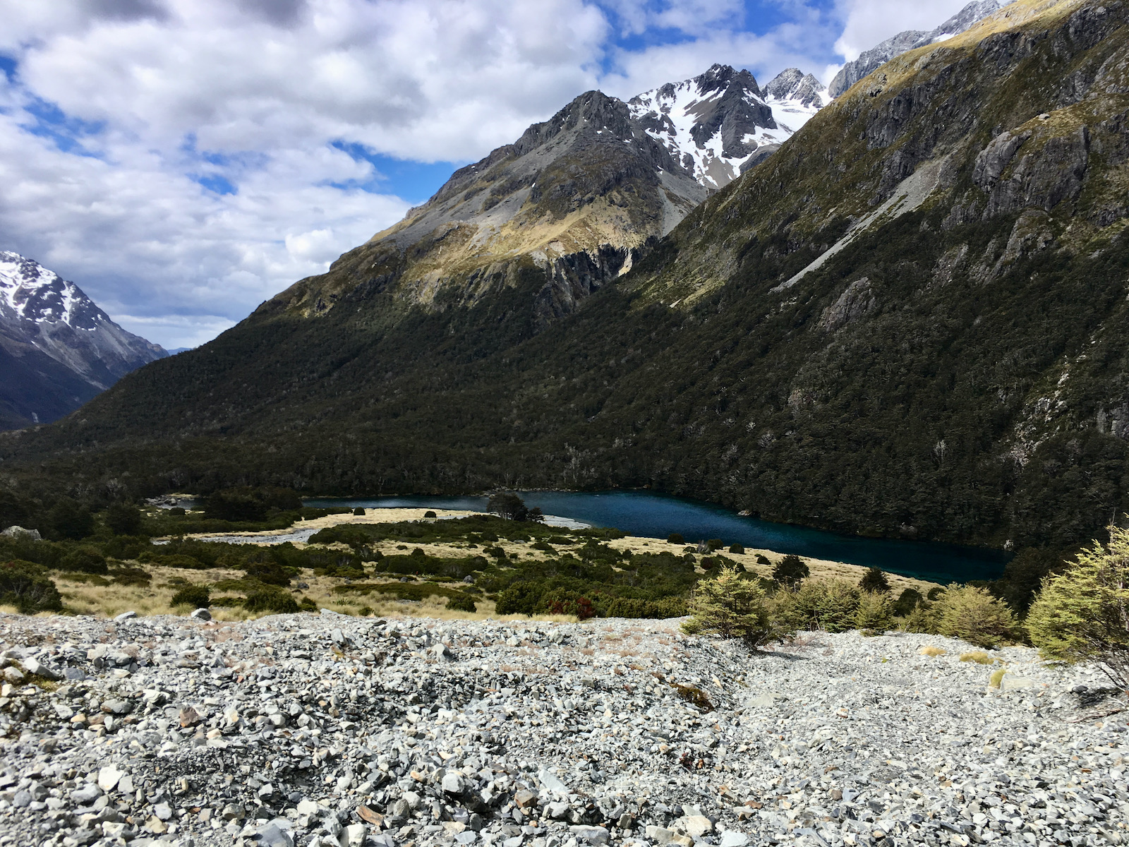
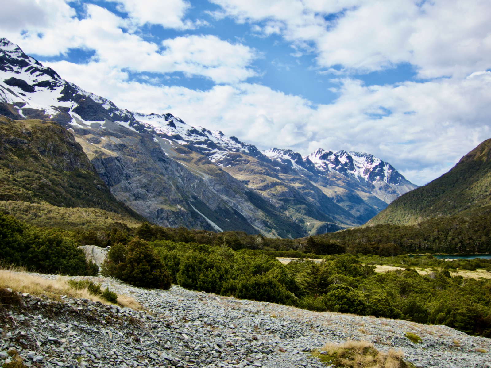
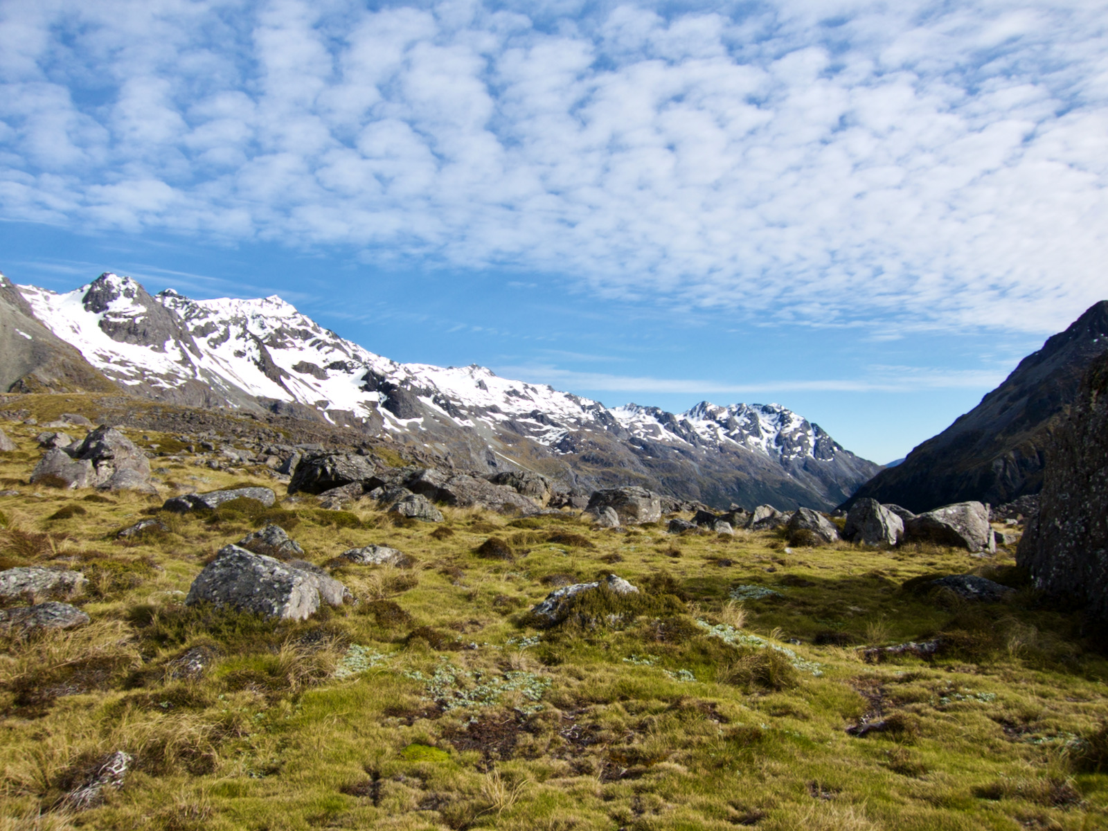
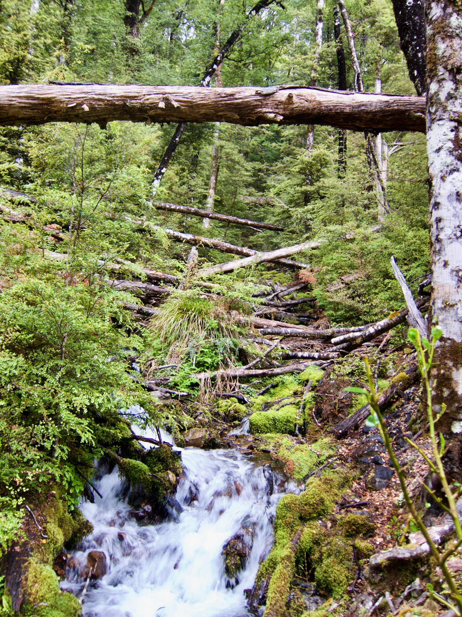
The second day was to travel to Blue Lake hut. Started as a chilly foggy morning. The first part of hike was on lower Sabine river in some open areas. As I got further upstream, the snow capped peaks and the V shaped valley became obvious. It was not a particularly hard hike, uphill, but gently so. The trail varied, from rocky, to leaf duff, to ankle twisting roots. Towards the end, the trail turned left, and went steeply uphill following the stream, going up beside some beautiful falls. Once at the top, there was this small but amazing open spot where the river rushed past. I stopped there for a bit. My pictures don’t do it justice. It was a sublime spot.
Not long after I got to the blue lake hut.


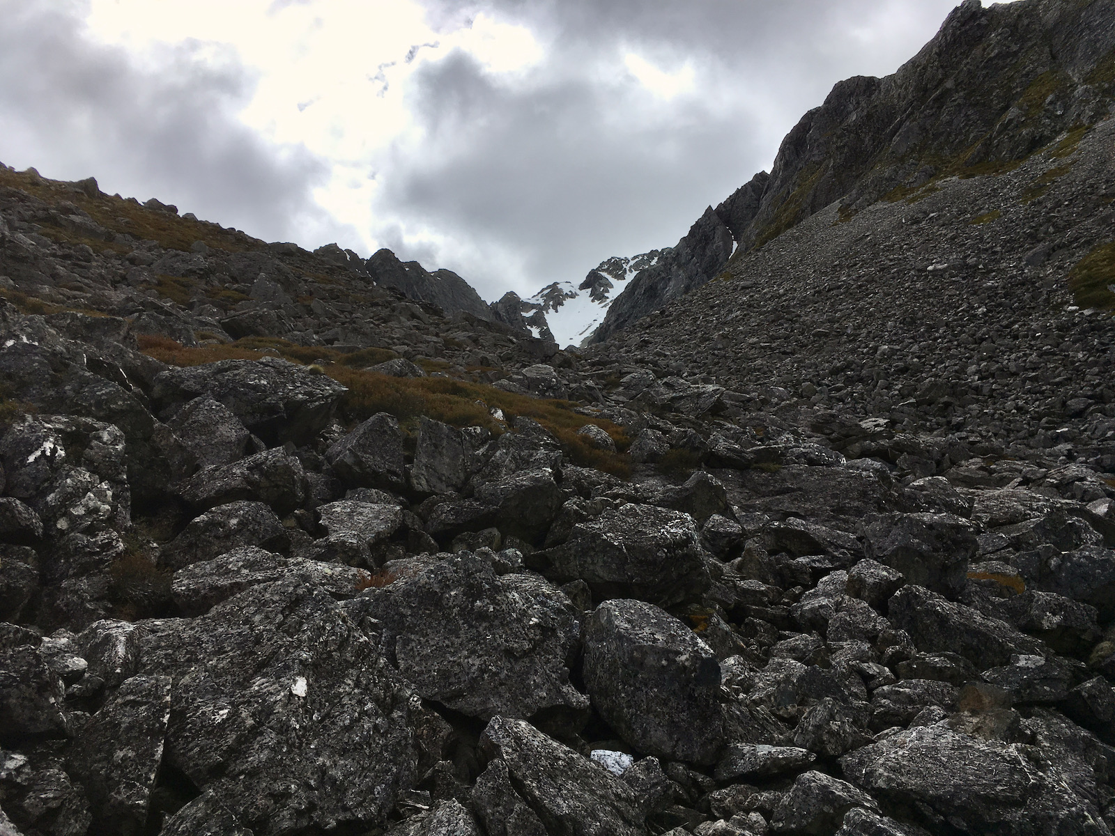
Avalanche zone – there were signs saying don’t stop. Went thru a few of these. 

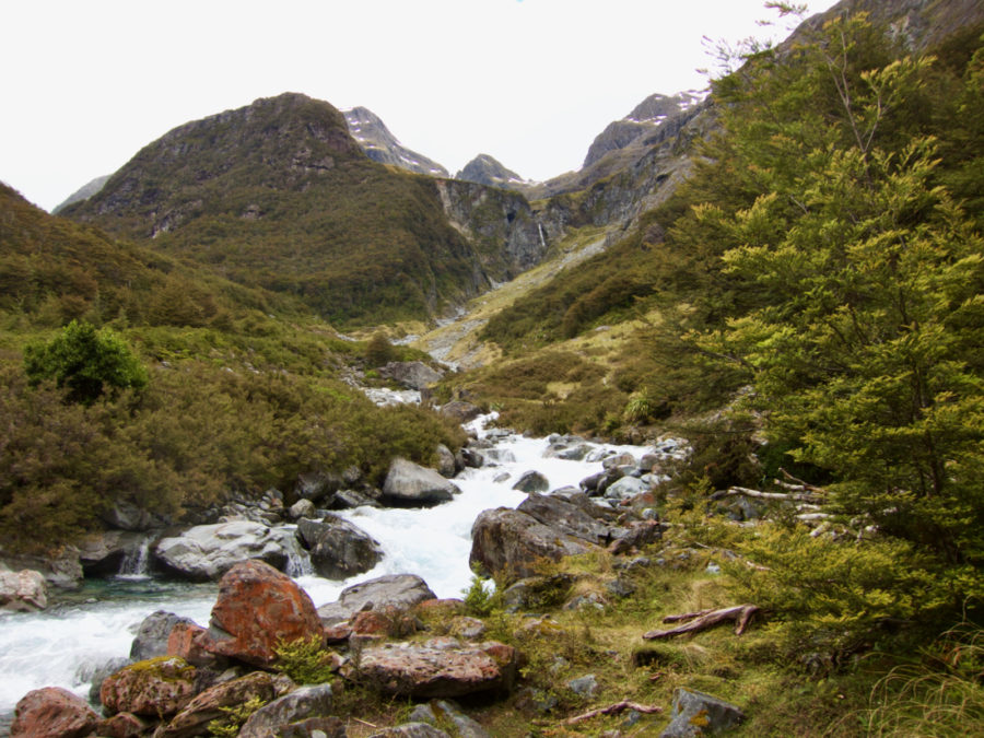
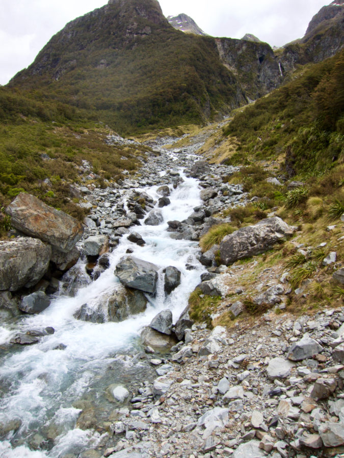

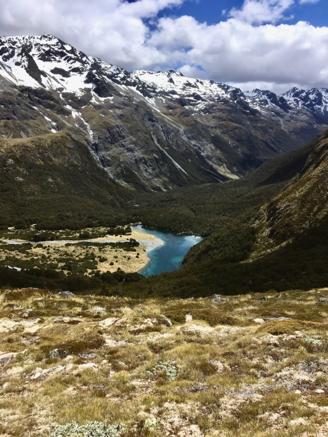
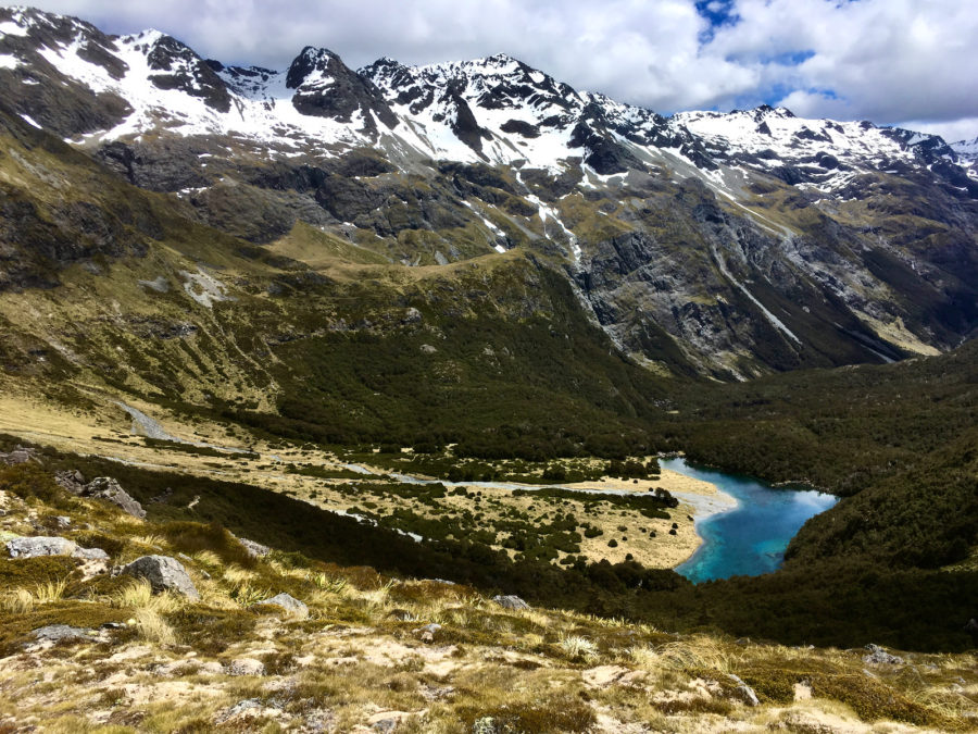
view down valley I just hiked up. 


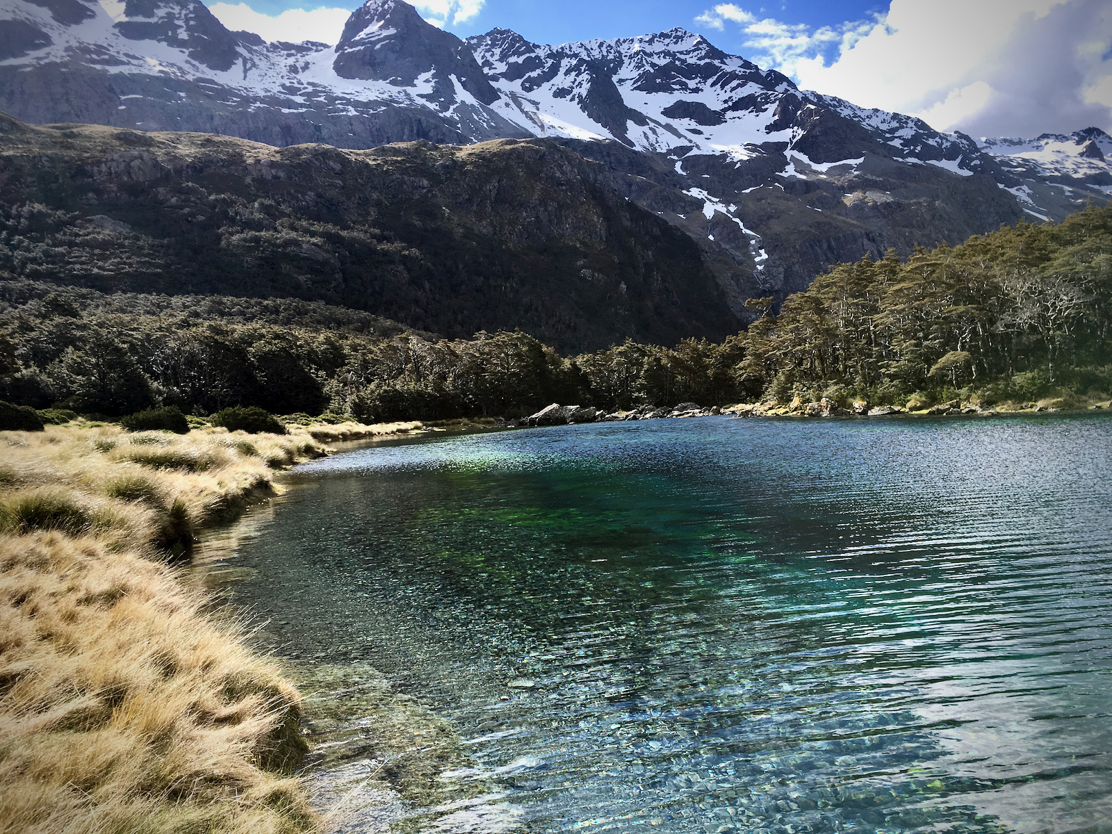
Idyllic spot. 
same idyllic spot 

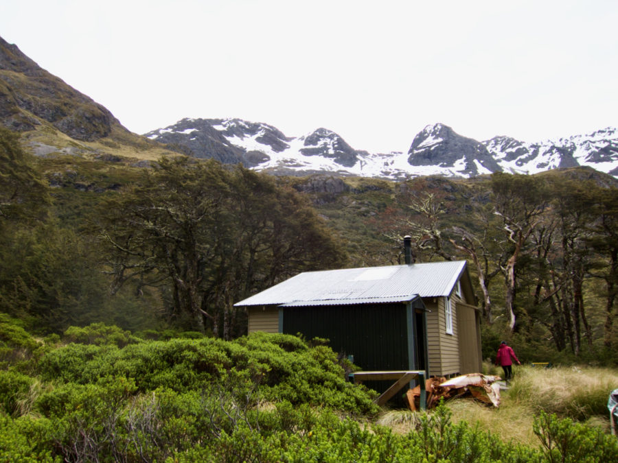
Blue Lake hut


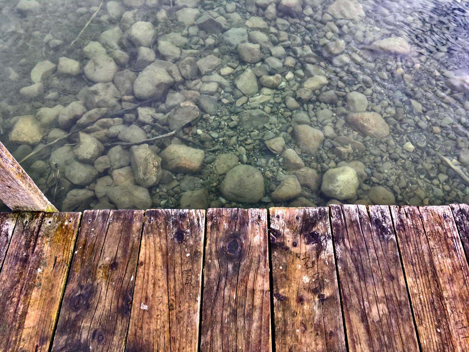
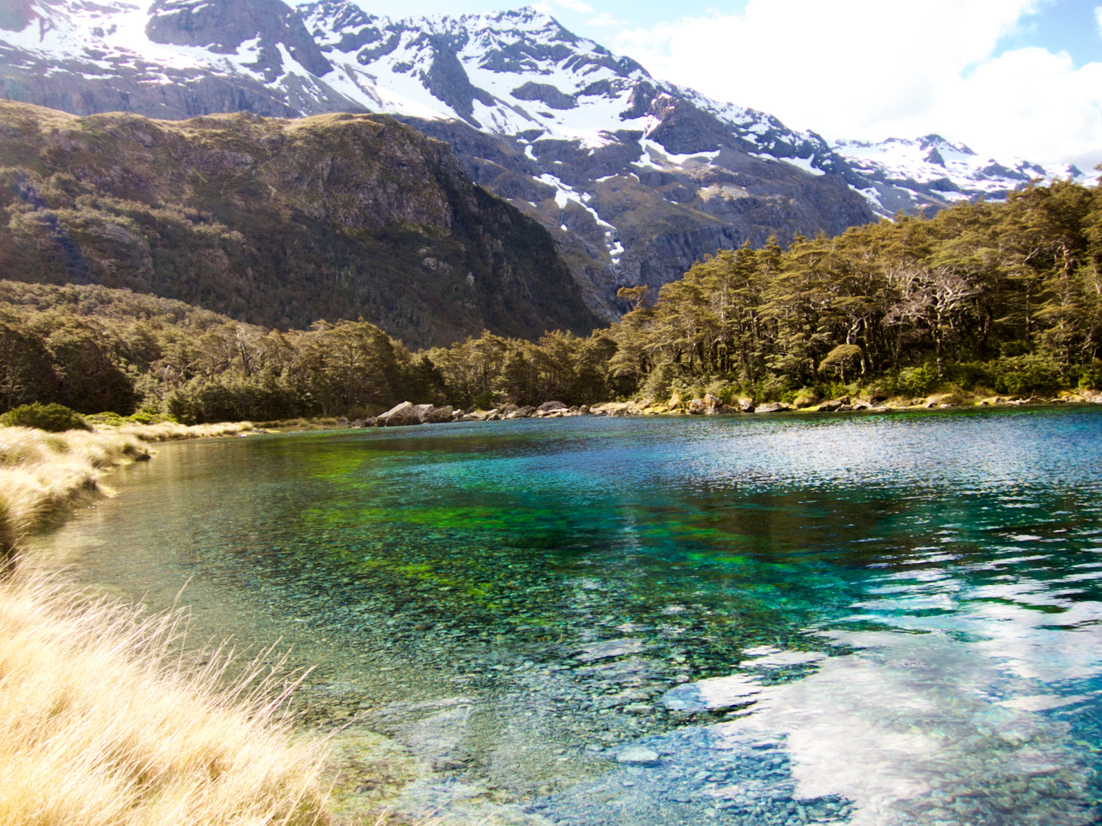
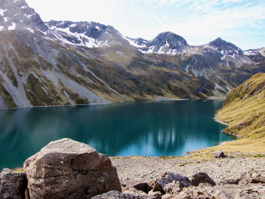
After dropping by pack at the hut, I wander over to the lake. Whoa. The clearest fresh water in the world. It is not a big lake, but the water clarity is striking. Yes, of course I wanted to jump in. Alpine lake, beautiful water. My vow to always or almost always jump in. I did not. Definitely the wrong thing to do here.
I wandered around for a while, going up the trail above the lake and getting over to the inlet. Took a bunch of pics. One of those singular places, unique, and fairly isolated.

Blue Lake! 


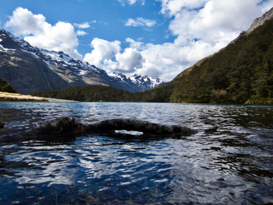


Clearest fresh water in the world. 


I startled a live possum up here in the evening. I wondered if I visitors are supposed to try and kill them. I expect not, and I did not.
The next day my plan was to head back down to the West Sabine hut, then I was going to hike out by crossing the Travers Range, and coming out where I had originally started and quickly stopped. This was an easy day, so I had time to wander around Blue Lake for while. I did not take my pack, just some water and a snack, and headed back up the trail above Blue Lake. This trail is another route, btw, but I was only out for a day hike. There were a 4-5 other people at the hut, and one man about my age, a local I think, heading out with his pack the same way I was going. I saw him on the trail ahead of me.
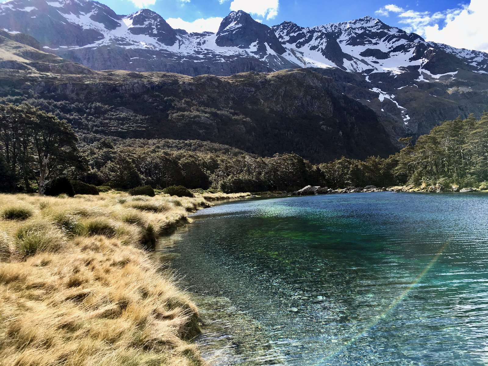
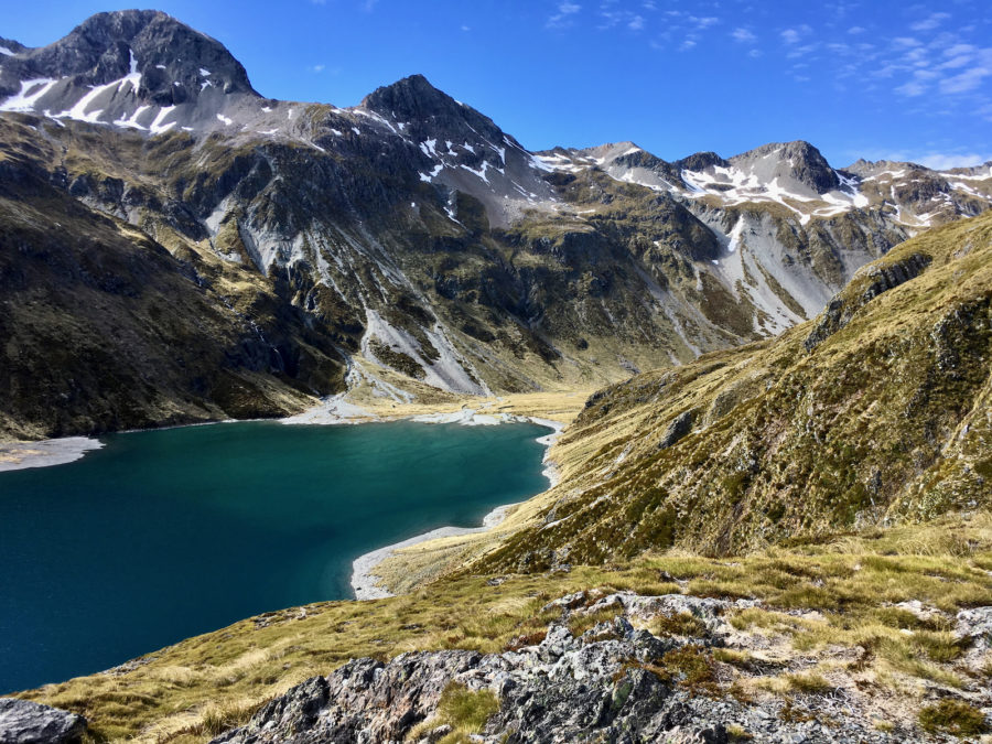
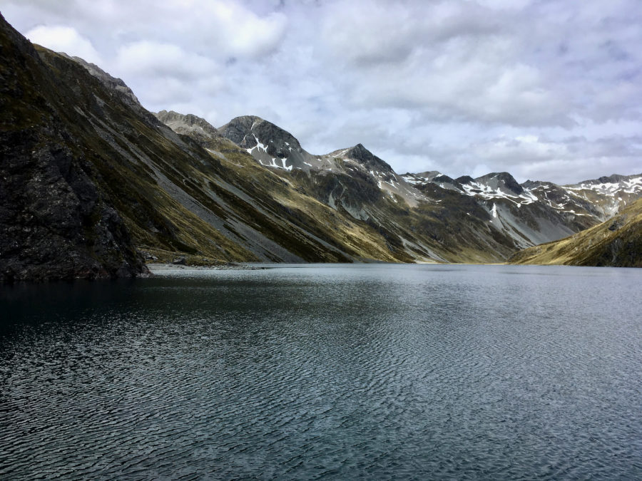
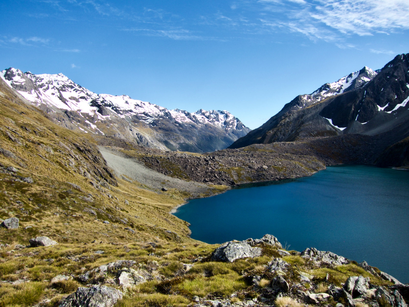
I arrived at the top of the hill behind blue lake to find another lake, much bigger, deeper, but not same clarity or maybe the depth is important here. The water from this lake filters thru the rock and them comes up and runs into blue lake. There is not a visible outlet for this lake. It looks like a huge chunk of the mountain collapsed, creating this dam, and the resulting lake.
After wandering a bit I kept going up the trail. I was thinking I would go to Waiau Pass, which wasn’t too far away. The path followed along the side of the lake, but it was fairly high up, and so very steep in places. It was not possible to travel on edge of lake without swimming.
The slope was coming down from snow capped peaks, and there were numerous drainage channels. It is kind of hard to describe, but you are on a side slope, but a lot of the trail was up and down, and heading down into the drainage channels was really steep. I got to one and there was a snow bridge, big chunk of snow across the trail, and water below snow. Well, there is no way I am walking across that snow, no way, that is bad choice, even though I could have crossed by taking only one or two steps at most on the snow.
There was no reasonable way to go upslope without climbing gear. But downslope was daunting. I could see maybe 20 yards downslope and then it got steeper, as I could only see water. It wasn’t a cliff, I don’t think, just steeper then where I was. The slope is also covered with a clumpy grass and because of snow melt, it is kind of wet, especially close to snow bridge. The snow bridge only extended down below the trail a few feet. So, after mulling this a bit, and seeing the trail just below the bottom edge of the snow by just a few feet, it seemed entirely reasonable to carefully make my way below the snow bridge. So, I sat on my butt, and nudged myself down a bit, and then unfortunately put my foot against the edge of the snow bridge. A pretty big chunk a few feet long broke off and slid down, and I went with it. Happily, I landed on my feet in a small flat spot, and really I probably slid about a foot. I did bang my ankle against a rock making a bit of a cut on the round part of the ankle bone. I still have a scar from that.
A bit stunned, I was, but certainly not hurt. Things happen fast, you are paying attention and maybe think you can do something, but nope, at that point you are just along for the ride. Luckily my ride was very short, and I was exactly where I was trying to get to. So, I took a few minutes to compose myself and decide if I wanted to keep going. At this point it occurred to me that NO ONE knew where I was. No one was expecting me to be somewhere anytime soon, except car rental company.
I decided to keep going. But this spot did not designate some demarcation where the trail got easier. It took some carefully scrambling to get out of that drainage. But I continued on, and a short time later I encountered another snow bridge. This one was bigger, more substantial. And I kept arguing with myself. The guy who stayed at the hut last night came this way. He passed this point. Again, there is no way to go upslope around snow, and if the the downslope of the last snow bridge was daunting, the slope below this one was just steeper, wetter, and grassier and must closer to drop off. I know that guy went across this snow bridge. There was no other option, and I know as much as I can that he made it over bridge just fine. But I was not stepping on that snow bridge. So, I did not make it to Waiau Pass. I turned around. Next time. ¯\_(ツ)_/¯
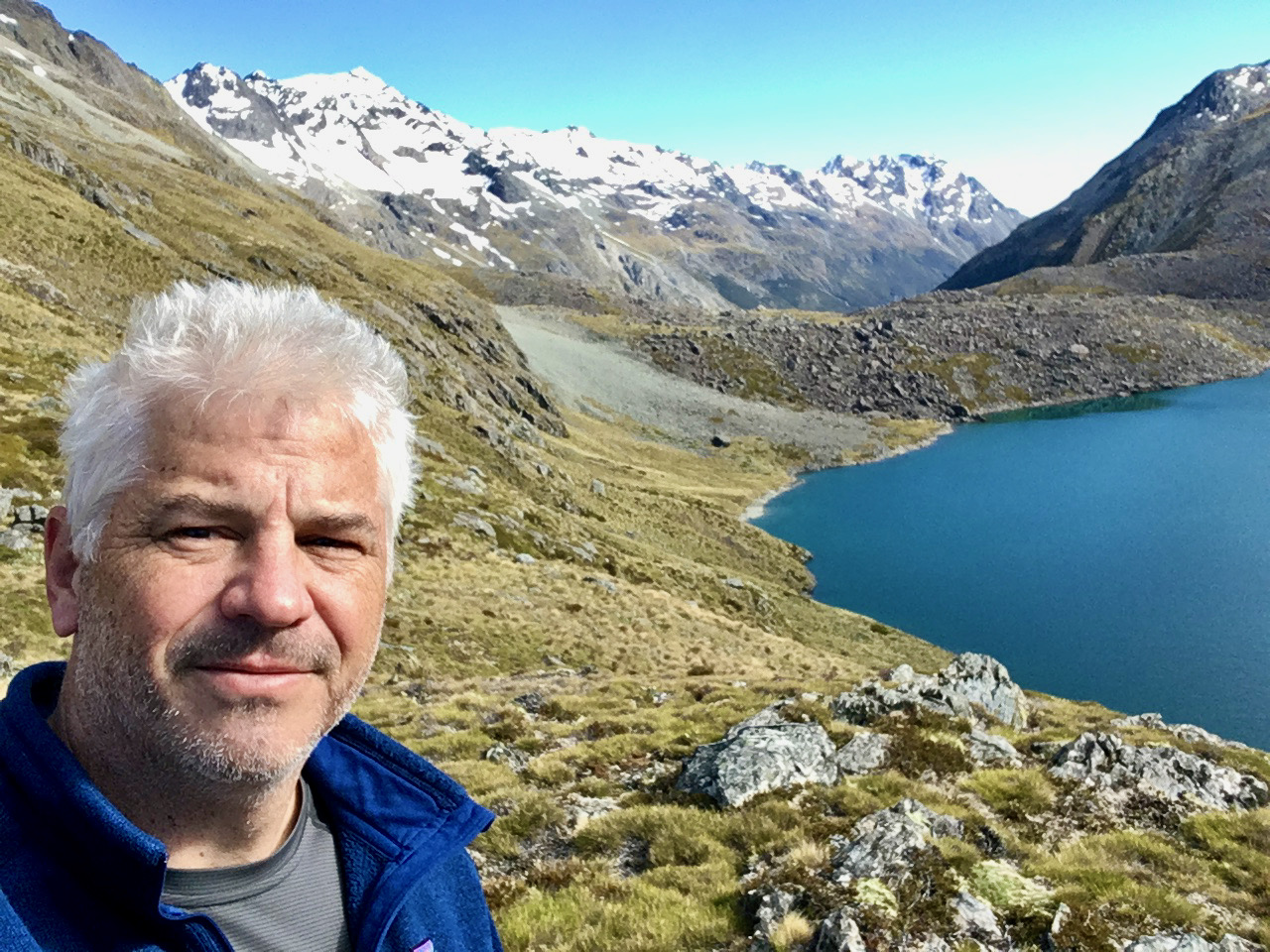
I made my way back to Blue Lake hut, but took some more pictures around Lake Rotopōhueroa, and Blue Lake. I grabbed my pack and headed downstream to the Sabine Hut.


Looking down outlet from Blue Lake 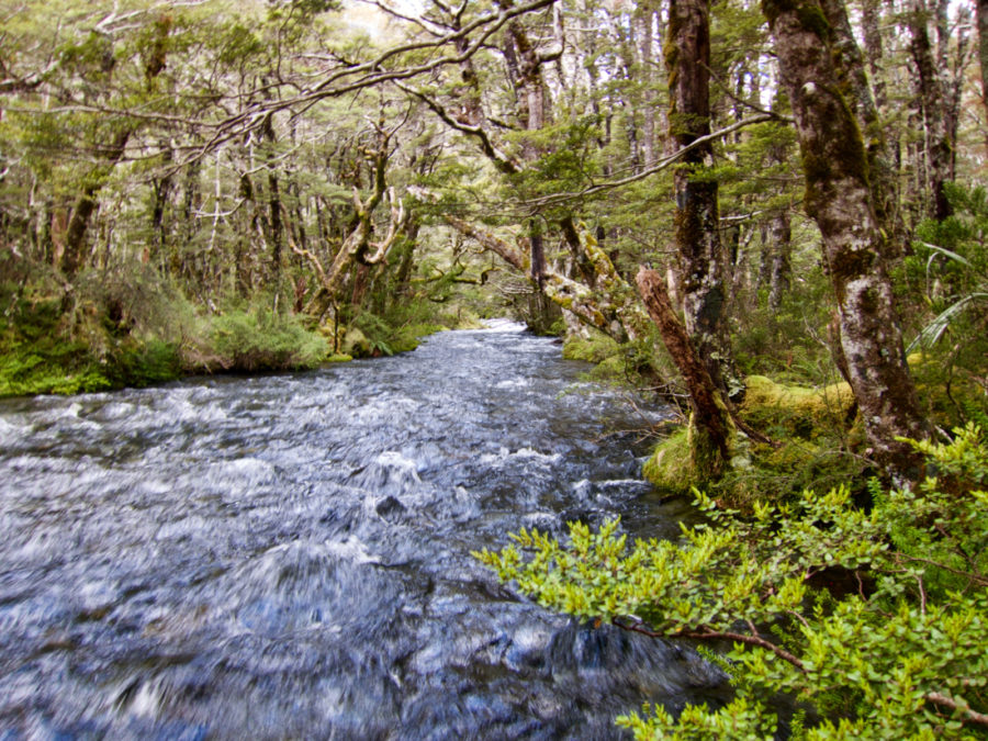
Idyllic spot again 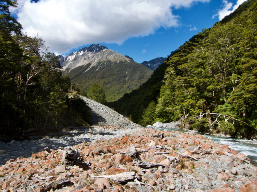


A the Sabine Hut I encountered a German shepherd, yep shepherd. He worked as a shepherd until he had enough money to travel to New Zealand, where he would wander around among the huts for 6 months or so. He had a hut pass, like I did, and since you can only stay in a hut 2 nights, you have to keep moving. He had done this many times I gathered. I figured he was 60, and lived about as low key a life as possible while still being a part of our modern world. Except for cigarettes, he smoked a bunch.
I also encountered a group of 4 young people in an outward bound course. They had spent weeks in alpine areas, then weeks on rivers kayaking, and this was weeks (I think each section was a month) in wilderness areas. They were not traveling strictly by trail, but were mapping out routes across ridges. None had significant outdoor experience before this trip. I was really impressed. They would get food drops by helicopter, so I think this was hugely expensive, but they were nice group of kids having a great time, doing really cool stuff.
The next day I either tramped back the way I came, or headed straight up and over the Travers Saddle. I wanted to go over the saddle, and I even started out that way, but it started to rain a bit as I headed out. After a bit of thinking and still being a bit unsure of myself, I decided to head back out the way I came, and because the weather was going to be crappy, I decided to just do the whole trip in one day. So, not many pics, the weather at my elevation was generally fine, rain at times but cloudy up higher, and certainly precipitation higher up. It was a long hike, at least 20 miles. I again thought about detouring and staying at Angelus Hut, but it was completely clouded over when I reached the Spearfish hut, where I could take trail to Angelus. So, again decided to just hike out, and get to my pizza.


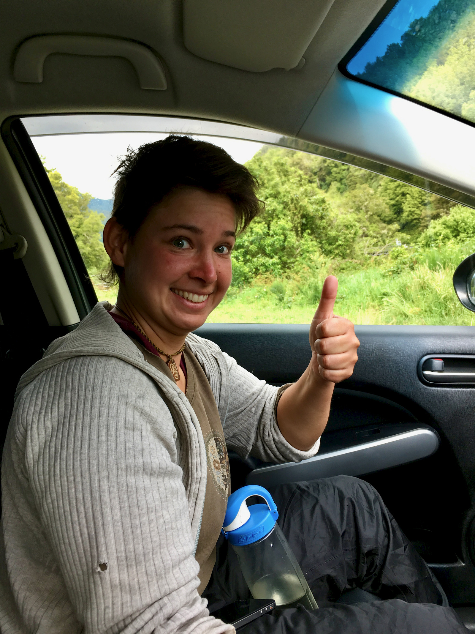
I still had the car for a couple of days. I made a flight reservation from the Nelson airport to go to Queenstown. The adventure capital of the world!!!!! I decided to wander a bit by car. I left the St Arnaud hostel in the morning and headed west towards the beach. Just outside of St. Arnaud, I encountered a hitchhiker, a young women from Hungary. A farmer, wandering around New Zealand, I don’t remember the extent of her travel plans, but shoestring budget. She was heading to Christchurch, so she rode with me for only 1/2 hour or so.
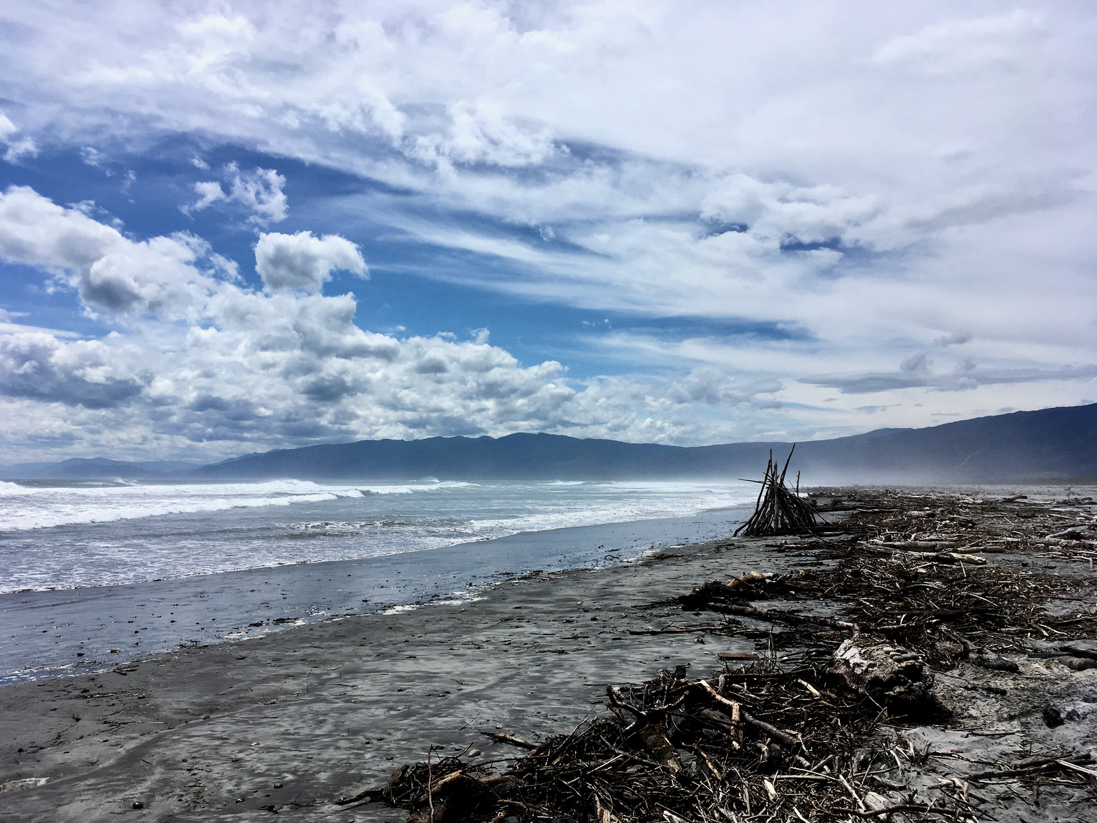
I continued on to the beach, the road travel was beautiful, and so very little traffic. If you like secluded beaches, and love a big beach campfire, I can offer a recommendation. There was still smoldering wood. I almost ran out of gas getting back to Nelson, there was very little in way of towns, gas stations, much of anything. It was fantastic. I took a route that went to Motueka, which is around the bay from Nelson. I ate pizza again, and eventually went back to Nelson.