Mount Richmond Forest Park
After the Queen Charlotte Track, I boarded a bus for a trip to Nelson, not a long trip, just a couple of hours. The trip went thru the Marlborough wine region and Blenheim, which in my mind was very similar to a city in the Central Valley of California, flat, dry. The bus trip also went past a swamp with lots of dead trees that was used in the Lord of the Rings movies, and it was a bit foggy when we drove thru.
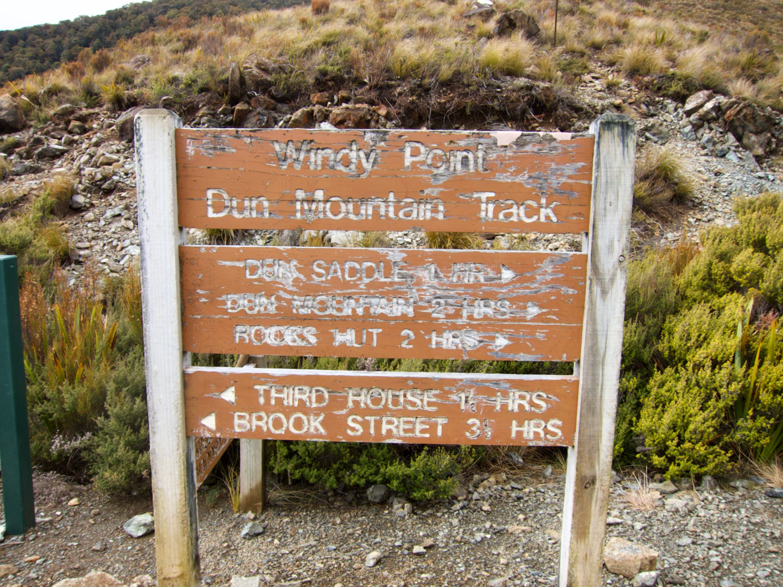
Nelson is right beside the Mount Richmond Forest Park, a place I was most interested in hiking thru after reading the Te Aoroa trail book. During the Queen Charlotte Track I started to get some blisters on my feet, as it was pretty warm. That was rather frustrating, as I really thought I was in good shape on that front. But I decided to see if I could get some toe separators, little silicon pads. I found some, and 3 approximately 1 inch square pieces cost about $25. But oh so worth it.
This trip was 7 days, 6 nights, I spent 2 nights in my bivy sack and 4 nights in huts. I initially wanted to hike thru the park on the Te Aoroa trail, but logistically that was going to be a challenge: 1) getting to the north end to start, and 2) once finished, I would be significantly south of Nelson in a fairly remote location, with no reliable transportation available to get back to Nelson. So, I talked to a park ranger and figured out a loop I could hike, with some flexibility to add to the loop, as I assumed I would make it thru this hike without too much difficulty, and I would spend about 1/2 the hike on the Te Aoroa trail.
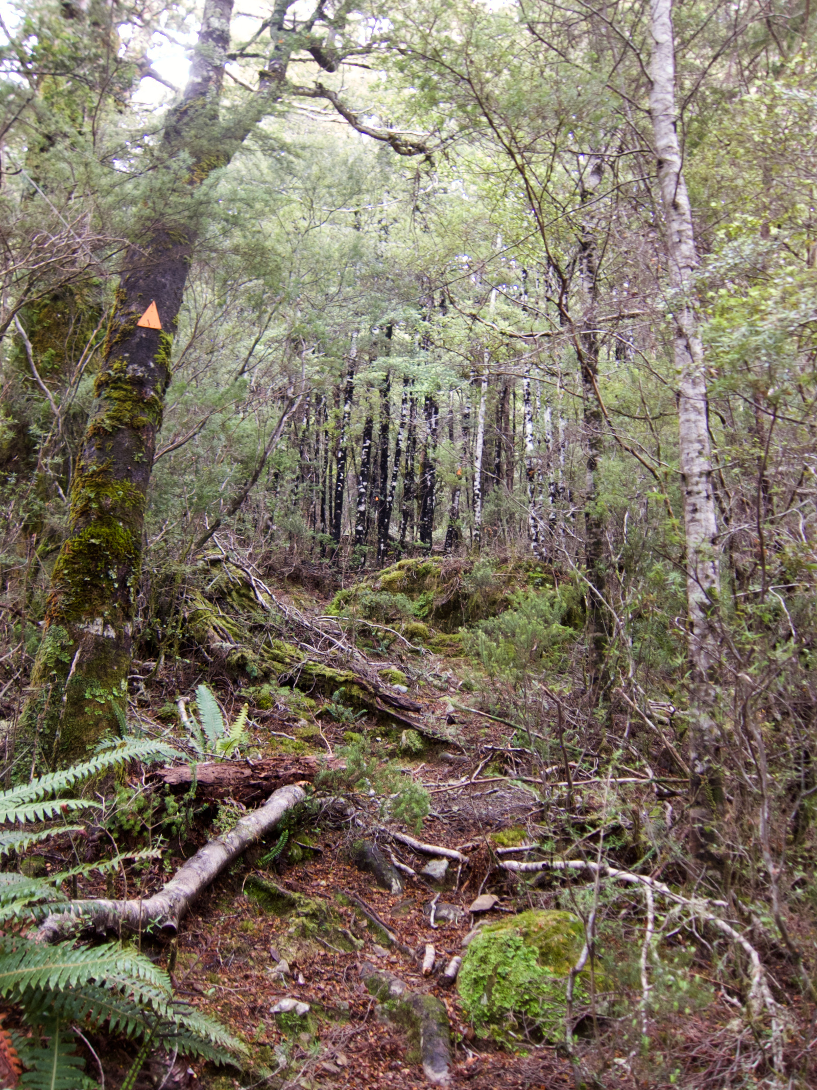
I have marked my trail on the map image that follows. The significant factor in choosing a loop that I was unaware of is that I was going to be traveling on routes for part of this trip. In New Zealand hiking parlance, there is easy tramping, tramping, hard tramping and routes (need to check this, confirm that I remember properly). While I have a pretty good amount of hiking under my belt, and some fairly remote and fairly rugged trips, I had no idea what a route entailed in this context. In short, a route may or may not be a trail, but it is marked with orange triangles on trees so you can follow it. Some might call it bushwacking. The trails go straight up the slope, there are no switchbacks, and you don’t realize how much difference that makes until you experience it. And most significantly, routes will put you in situations where you need to make good decisions, not simply be careful, but really think about the decisions you make. Do I put my foot there? Do I grab a hold of that branch or rock?
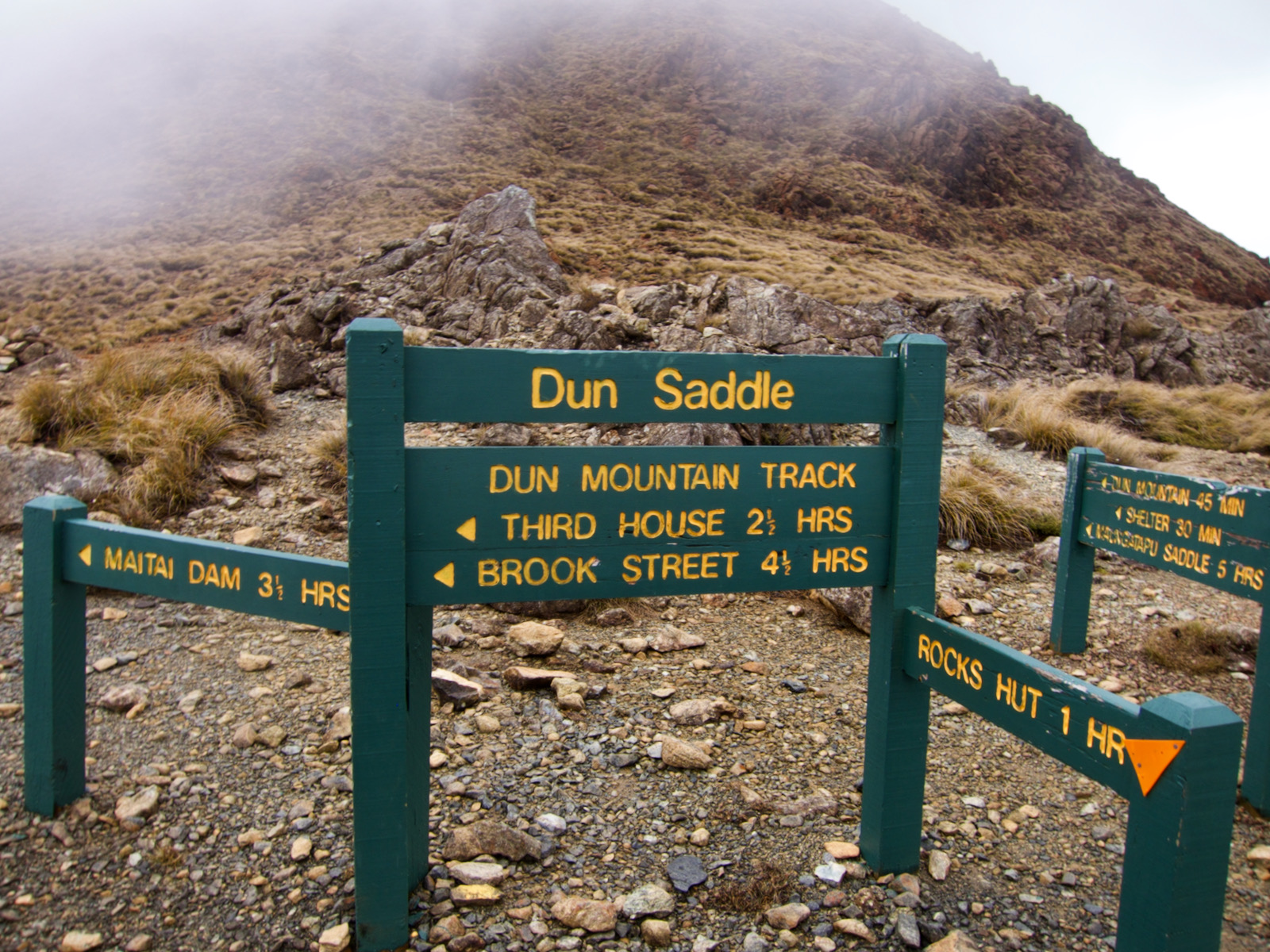
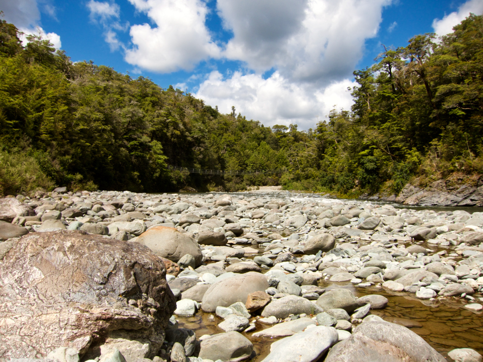
Once my trip was planned, I took a city bus to the trailhead. The first day was easy, walk uphill a ways, cross a saddle and then hike to the Rocks huts, my first hut stay. Apparently I did not take pictures of the hut, which is mystifying to me, but that is what happened. After leaving the Rocks hut early next morning, I traveled steeply downhill for maybe 2 hours and reached my first real suspension bridge. I took a break at the hut that was there as the route up Mt Fell started branched off just a few yards from the hut.
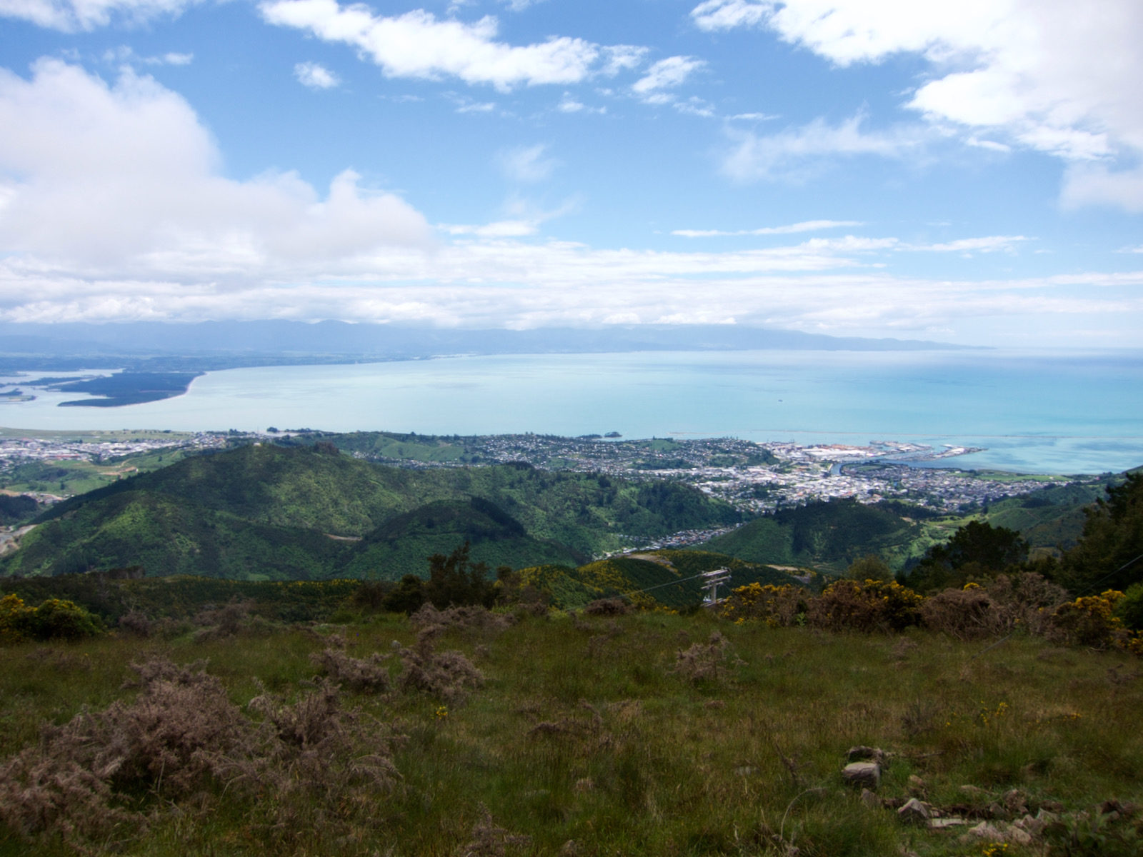
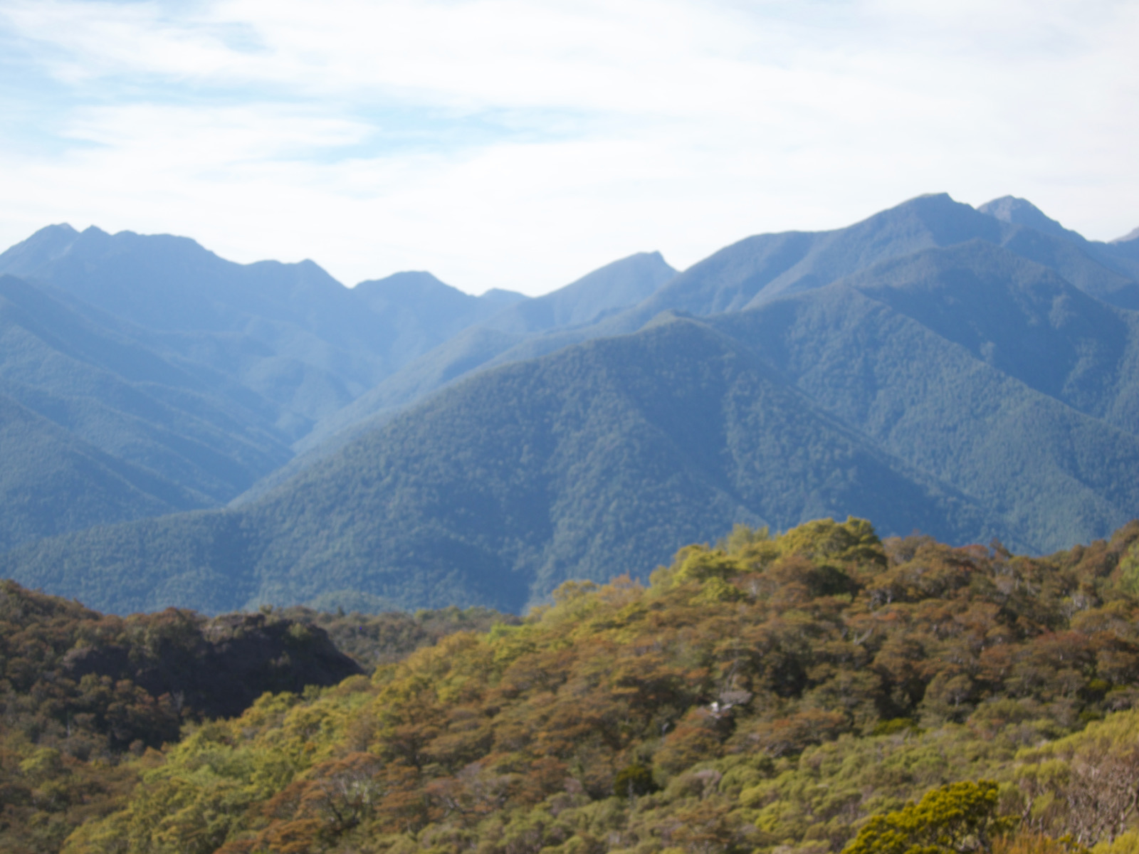
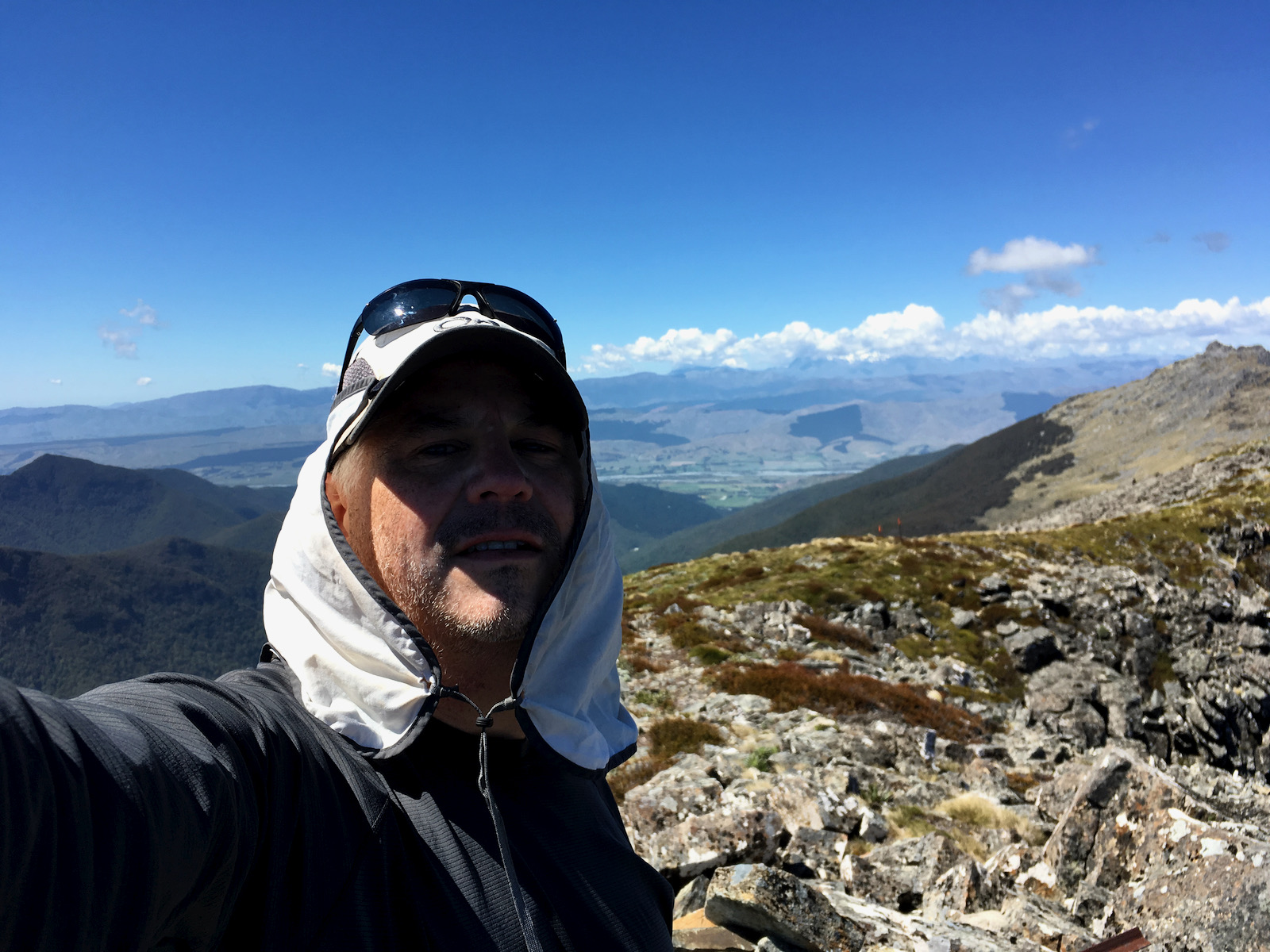
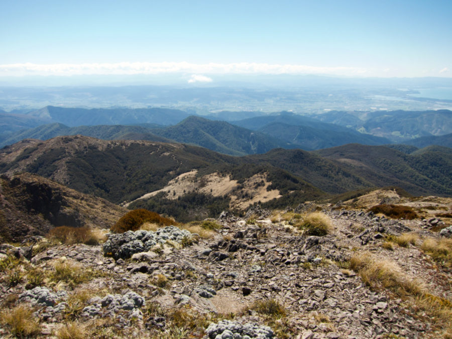
View of Nelson 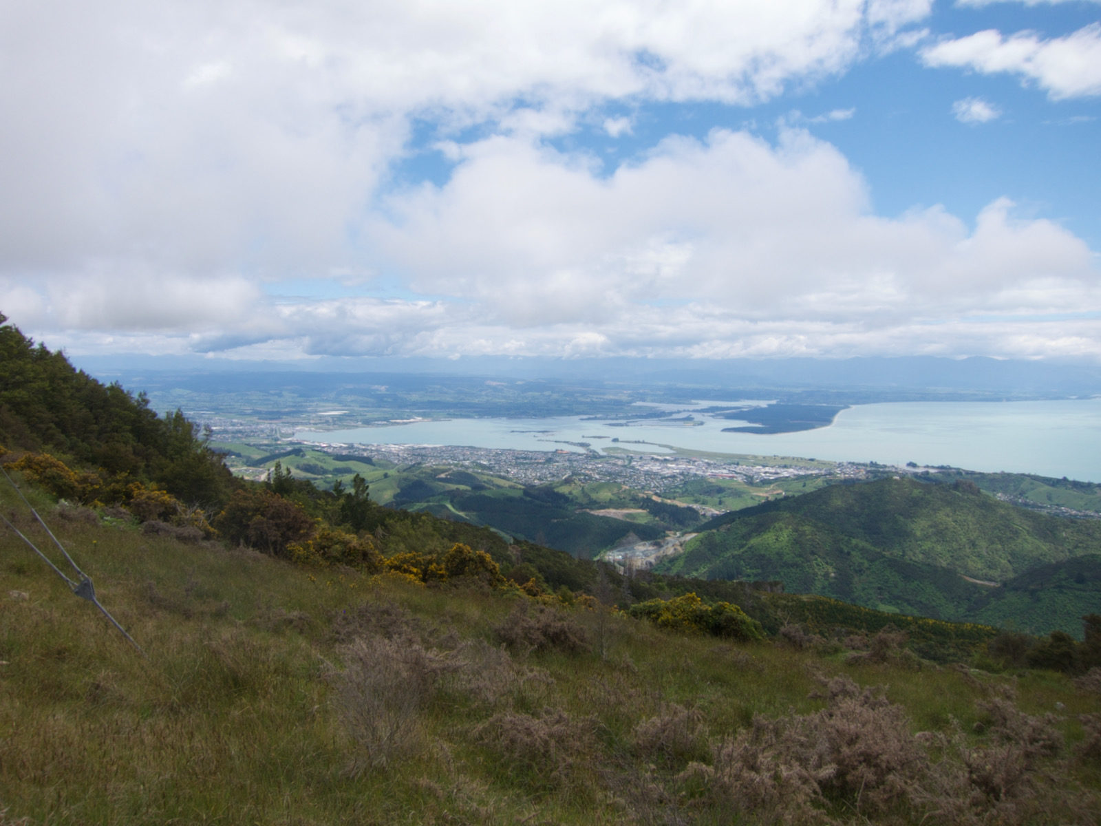


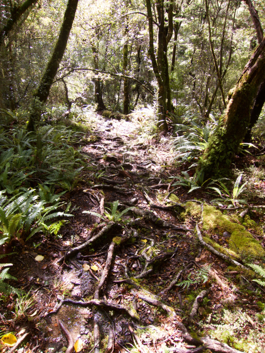
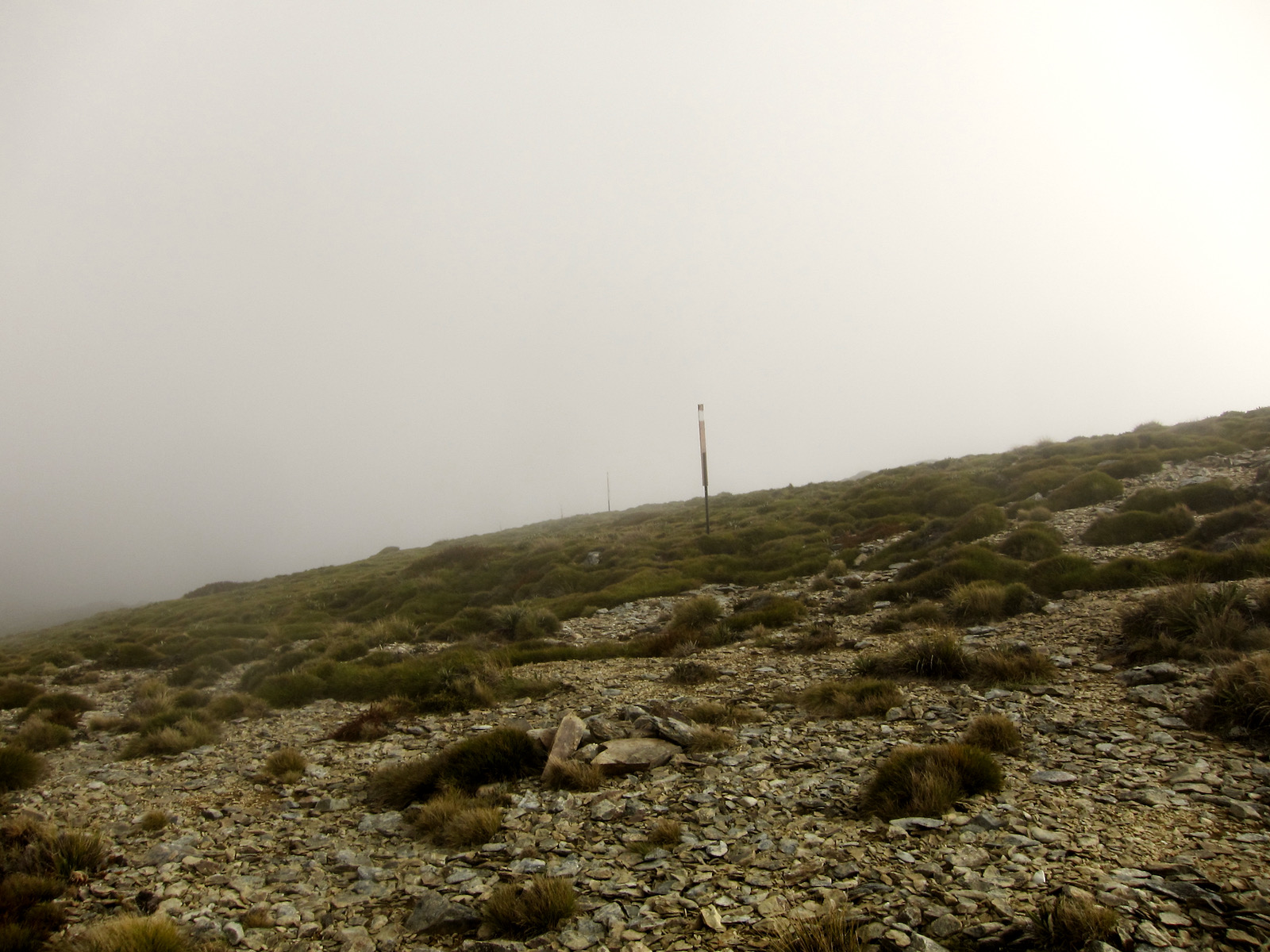
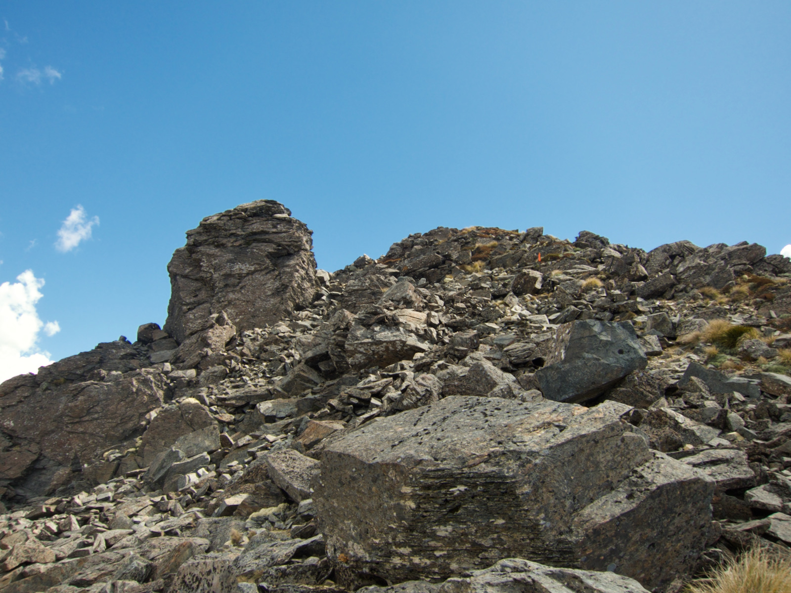
Lots of trail looked like this. Just required careful walking 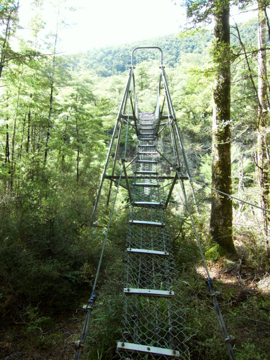

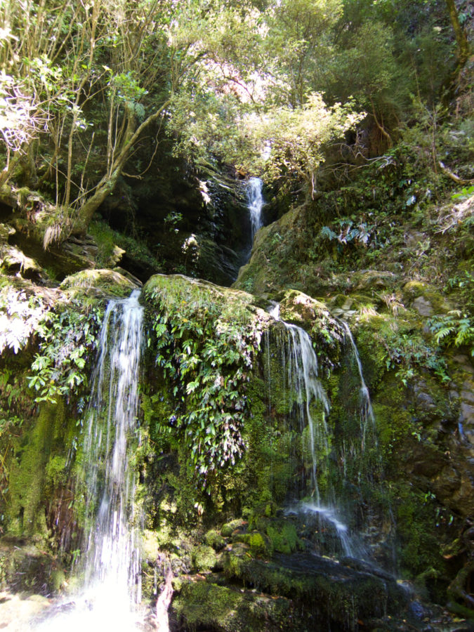
suspension bridges are fun! 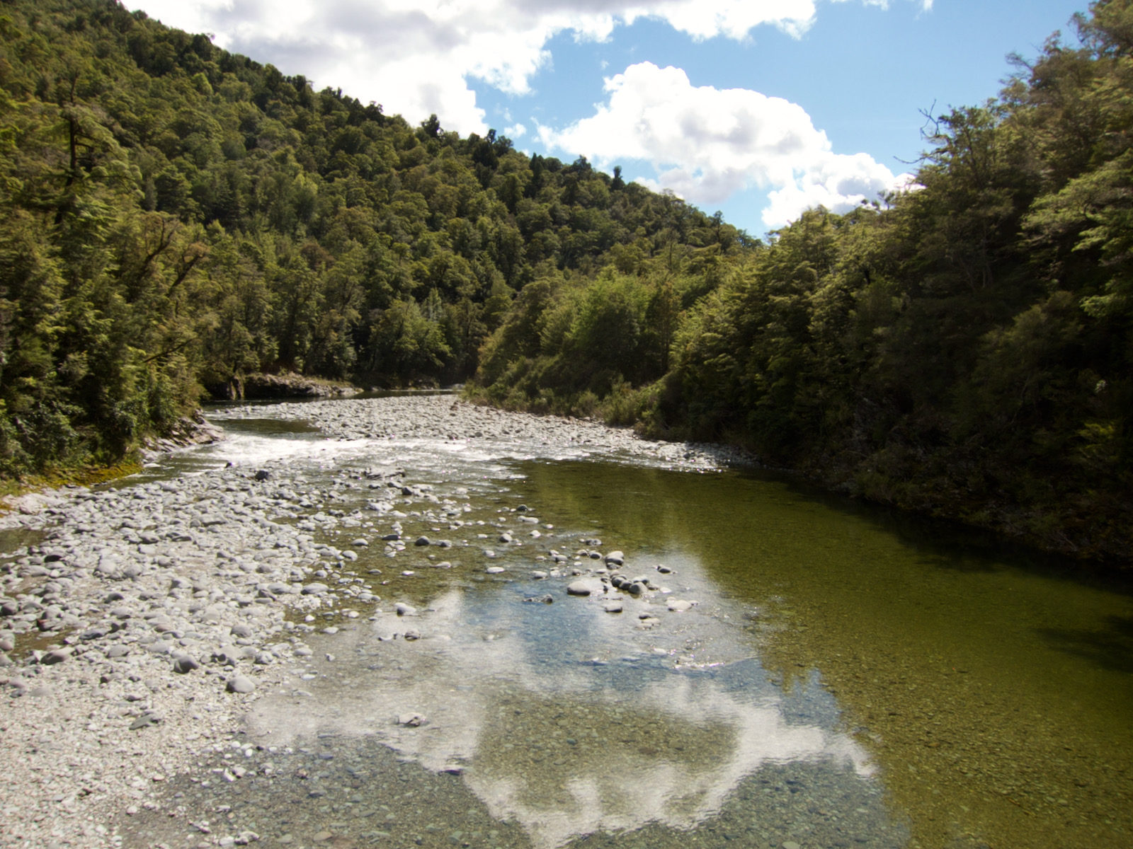


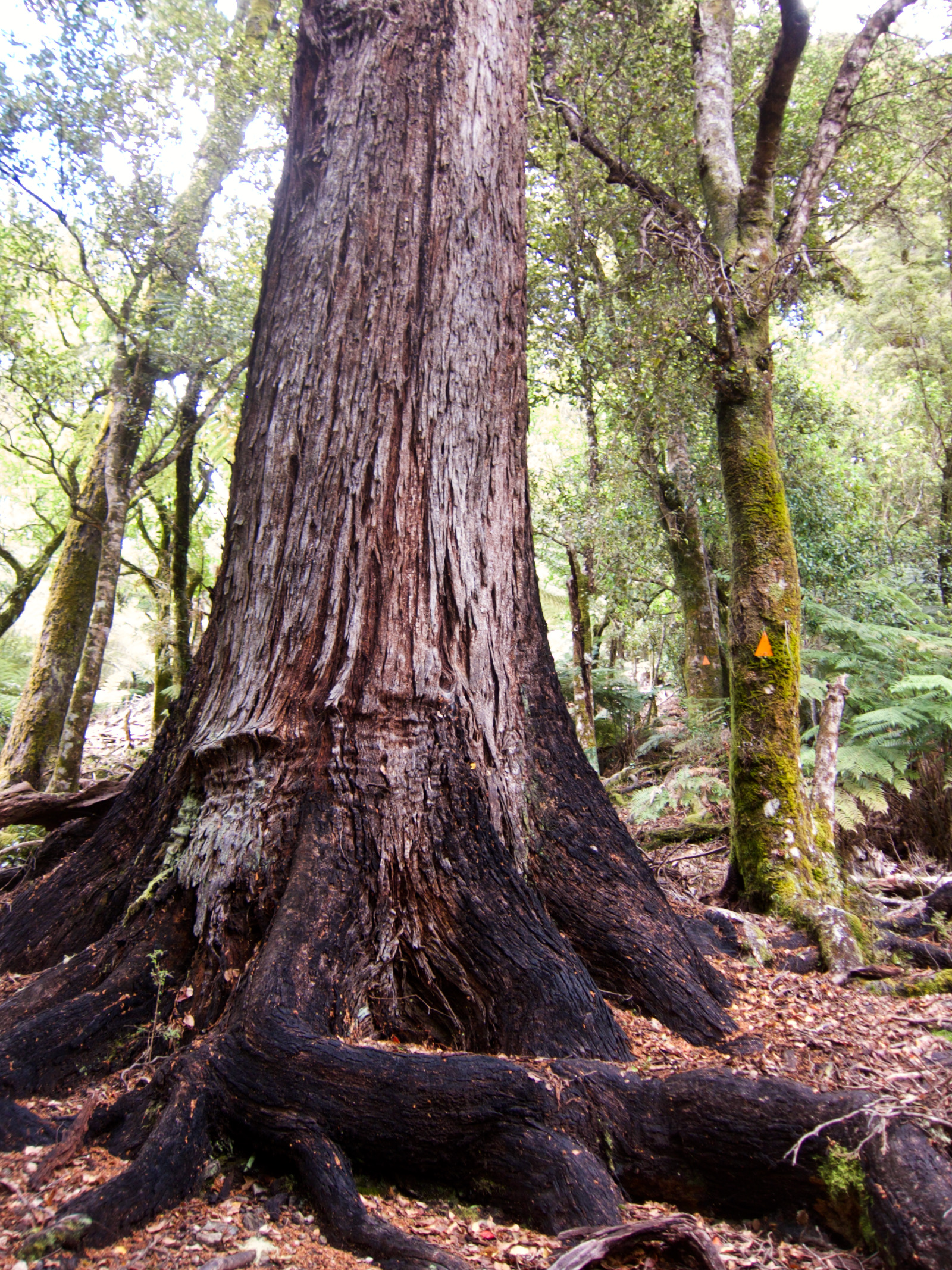
The rest of the day I spent traveling up Mt Fell, I knew there was chained section at the top, but I really did not know what to expect for that. I also knew that water was going to be scarce, so I had stocked up when I took a break, I don’t recall being able to get more water till I reached the next hut at the end of second day when I started. I did encounter and emergency water box while going up Mt Fell route. It looked like a mailbox, with a sloping top you could lift, but a sort of gutter on lid with some small holes, so when it rained, the box would collect some water. I did not take any of this water, but it was pretty interesting.
I spent maybe 6 hours hiking uphill, steeply uphill. When I first started up trail, I was really happy, it was so different than what I am used to, as any semblance of a trail disappeared after maybe a couple hundred yards at most. But it was steep, sometimes slippery, and pretty unrelenting. I got my ass kicked on this slope, no doubt about it. It was awesome, but really hard. Towards the top, I reached a spot where I had to take off my pack and boost it up as I wasn’t going to be able to scramble up it with my pack. Eventually I got to a spot where I was on a ledge, with a chain and a steep drop off to my right. Very nice spot, but the valley was foggy, which made it interesting. Right after that I reached the spot with the chain. It was a steep rock crevice/corner. The chain made it easier to climb up with pack on, but it wasn’t especially daunting, although I am not sure I would have wanted to do it without chain, especially as I was exhausted, with no clue where I might find a place to camp for the night.
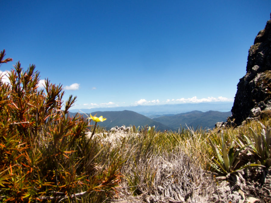
At the top of the chain I emerged onto a rounded peak, where I encountered for the first time this bushy grass you see. I will refer to it as razor grass. That stuff was sharp and pointy. It would poke my feet thru my shoes. It was quite foggy, but the route markers let me know where to go. There were a bunch of goats up here, but I did not get any pics of them on the grassy area. After hiking up over the peak, I descended into a wooded area, and after a bit of searching, found a decent flat spot to camp. I did get a picture. I encountered a weka bird, which are fearless little guys that enjoy chewing on tent ropes and searching thru your pack if you give them a chance.

this is looking down 
you can see orange markers 
Looks kind of like a trail 
um, not so much 


small section of chain. Flat area, but cliff on right 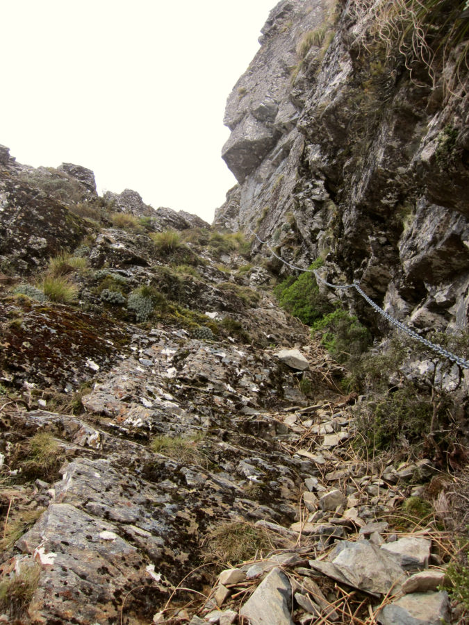
the chain climb. was fun. I was beat by this time though 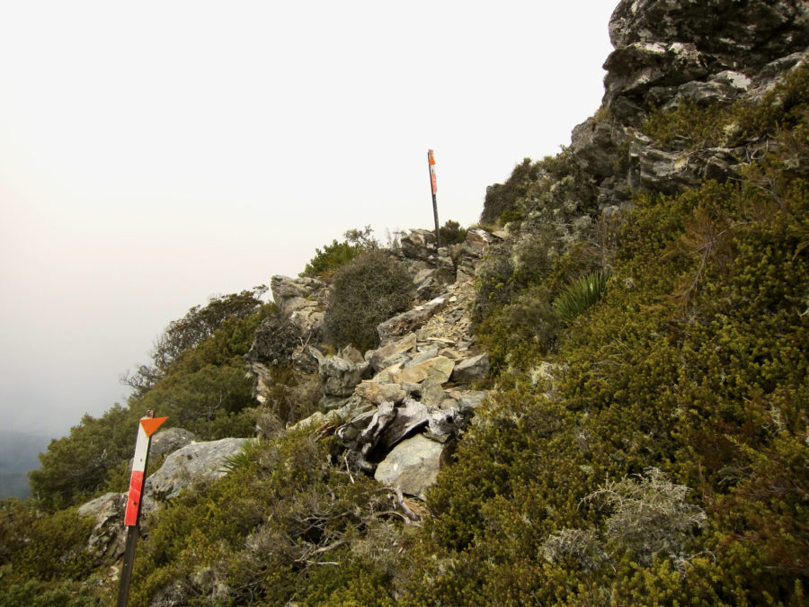
then a bit more trail before topping out 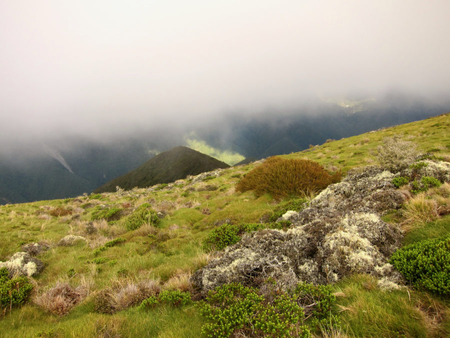
and getting to rounded razor grass filled peak 
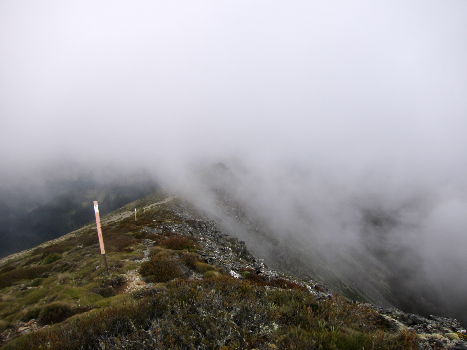
was still kind of foggy 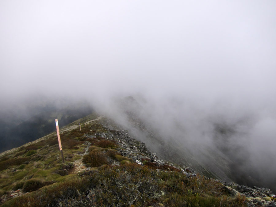

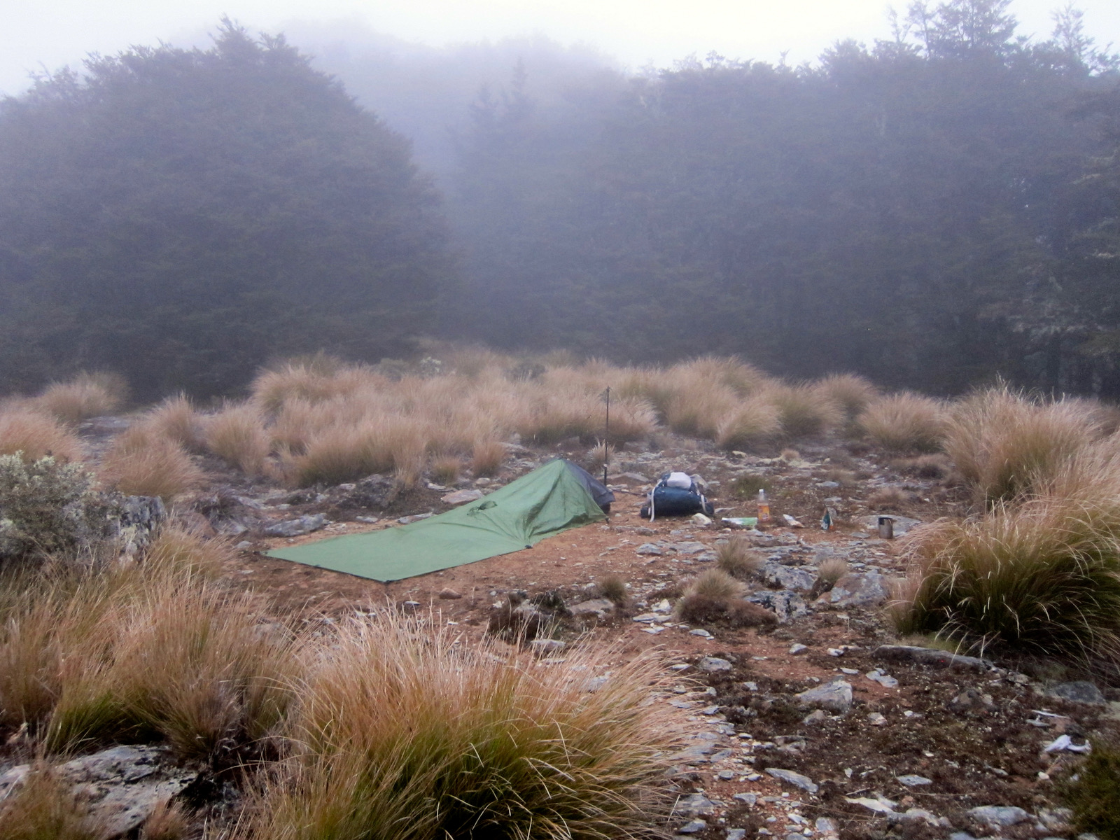
not a bad spot, but by this point, flat was all i needed.


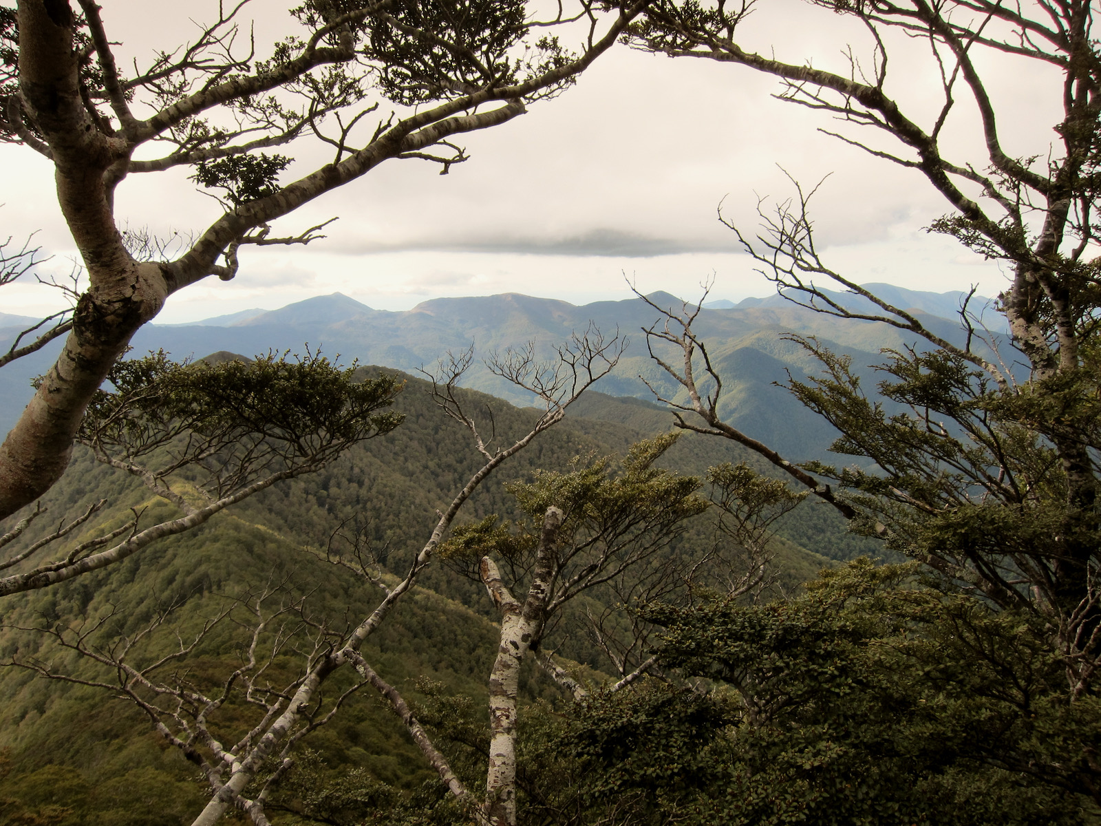


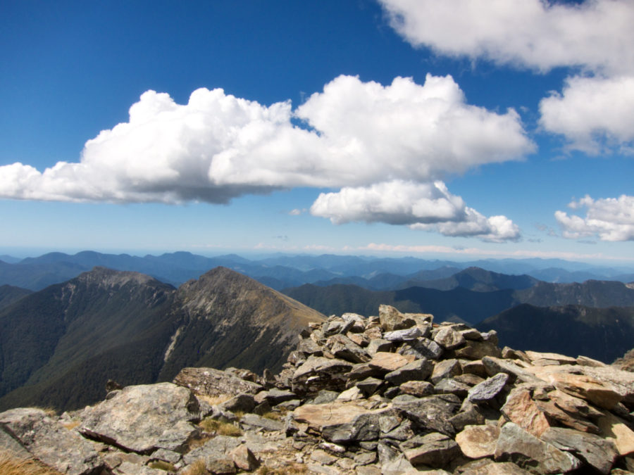
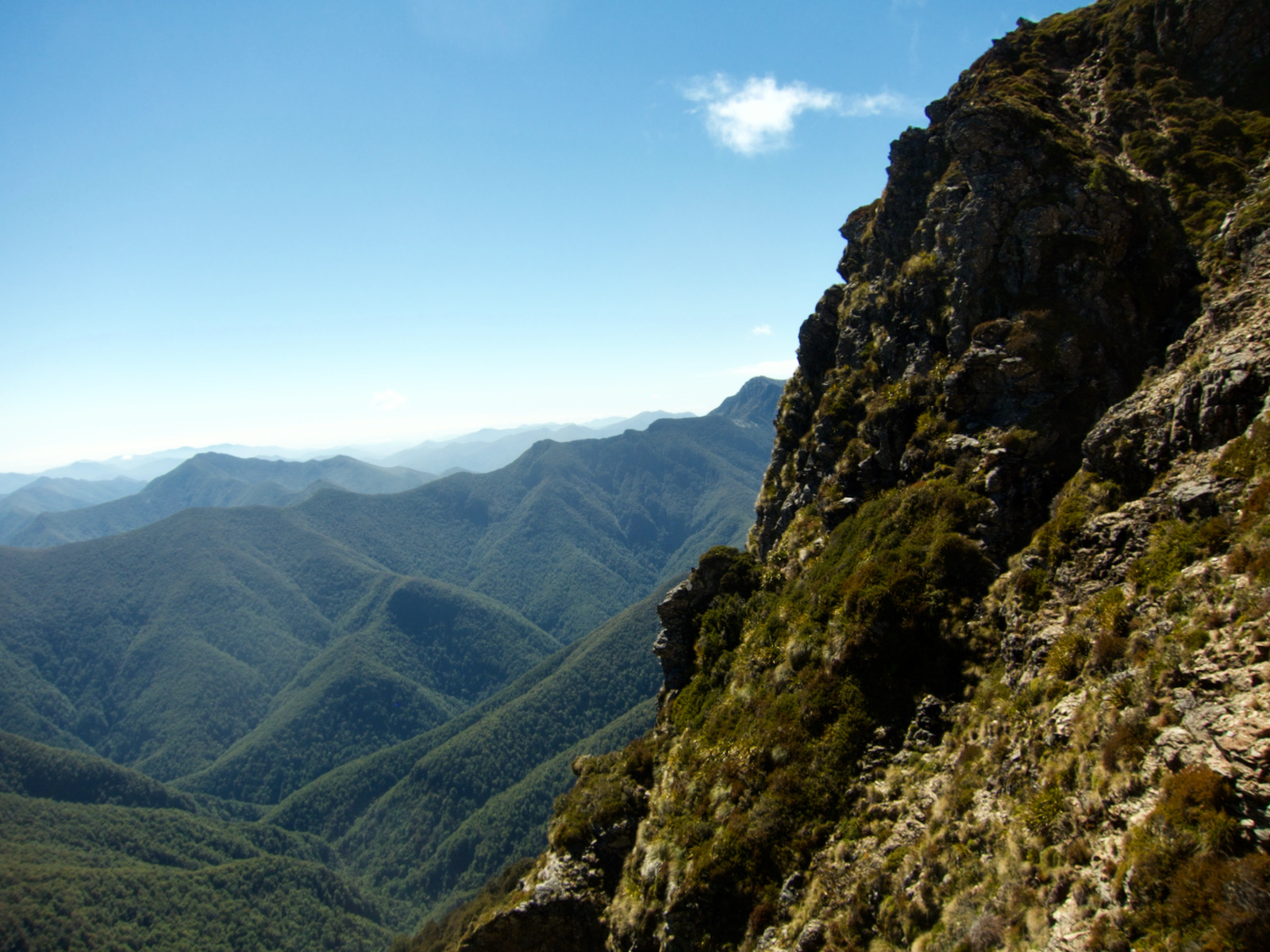
The next morning was nice, but it rained a bit overnight, so I had to take a bit of time to dry out my stuff. I was also pretty tired. This second day is a bit fuzzy at the beginning, but it was not too difficult for a bit, but I did reach a section in the late morning that was really dicey and steep, and chock full of razor grass. Steep enough that I had to step carefully and in places I could almost reach out straight and touch the ground. There was a bit of four limbs touching ground. It was a rather daunting slope. I tried to take a few pics, but nothing came out, at least in any way that makes sense. It was pretty awesome to go up it. Once at the top, I was on a ridge and just kept hiking along that ridge. Which seems like it should have been an easy day, but nope, I was moving slow and there was more up and down than you might think.
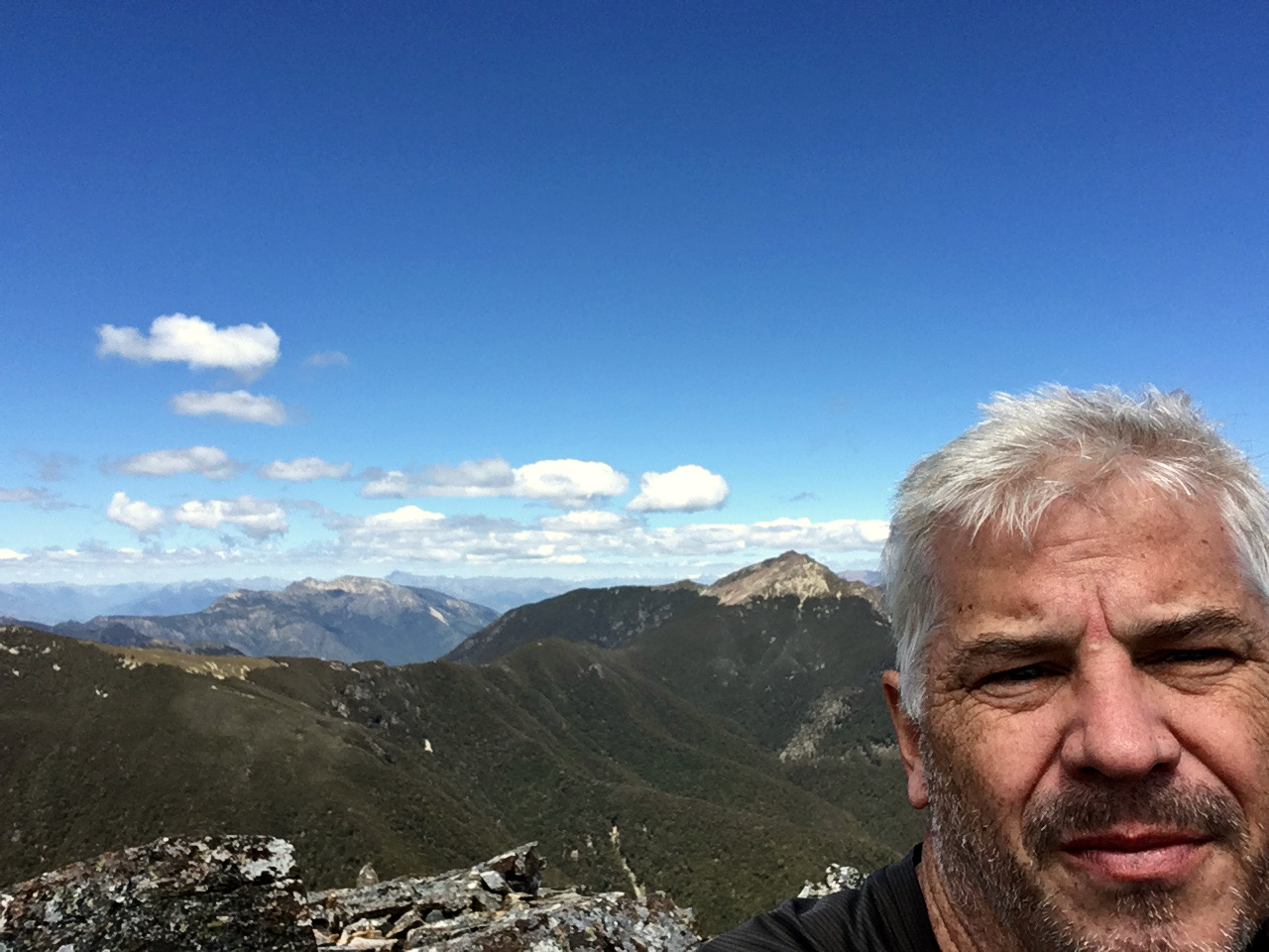
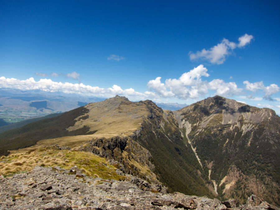
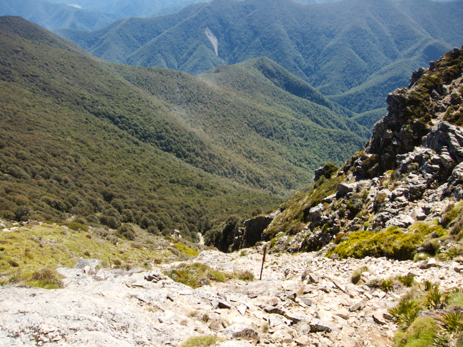
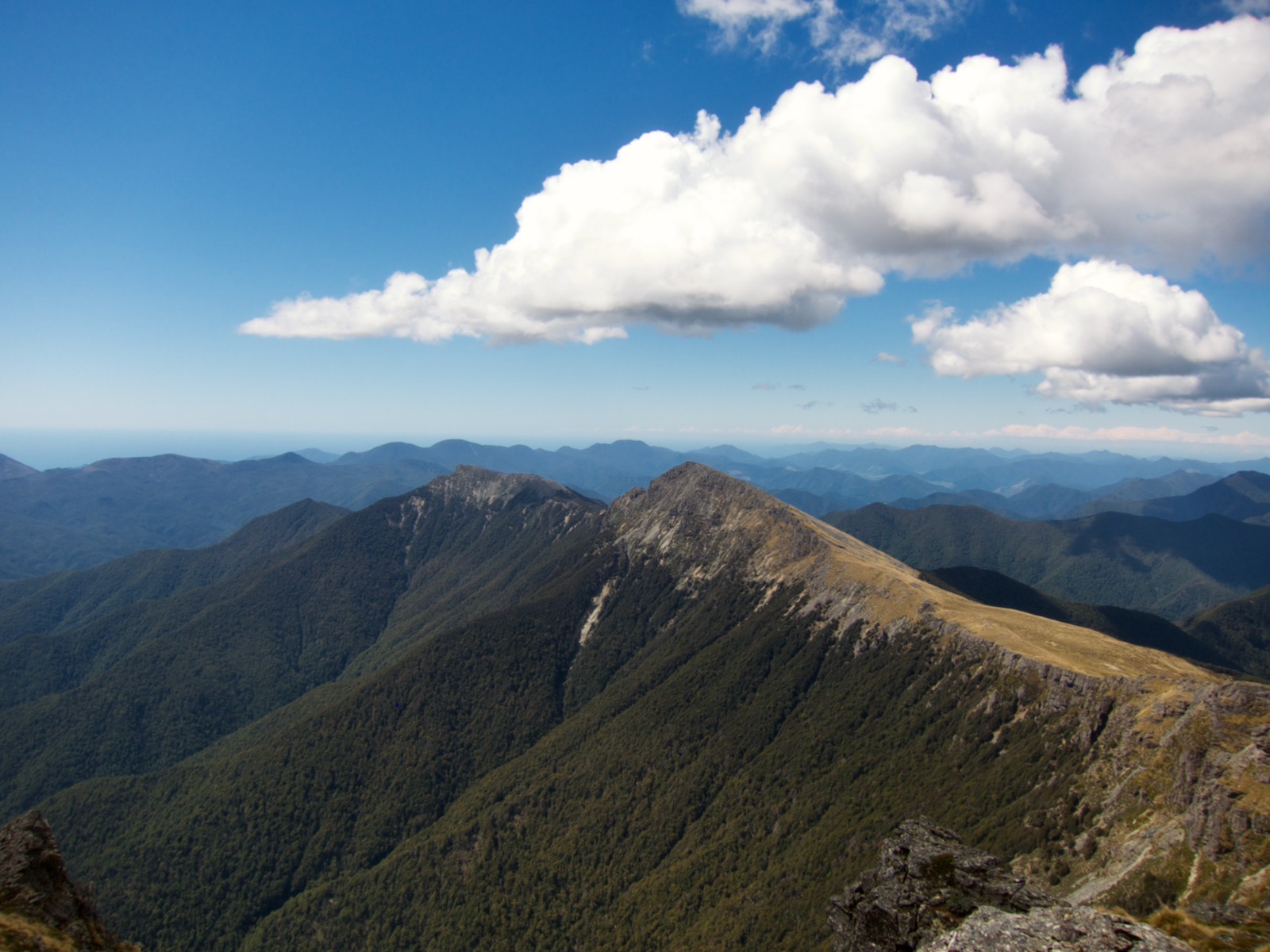
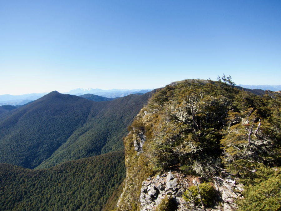
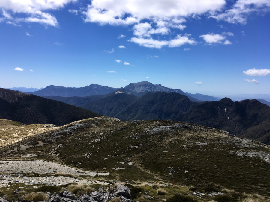
I could see Mt Richmond in the distance, but was a bit confused as I did not think I was going up that particular mountain as the trail did not seem to directly to it. So, a lot of my hiking experience I as I look around, I think, hey, wonder what it looks like from up there. Well, in New Zealand, all the trails seem to go up there, where ever that is. This was true of Mt Richmond. Once I reached the end of the ridge, I took a right turn and went up Mt Richmond. It was just a really steep rocky slope, the trail of course went straight up. It was probably about 1000 feet. The top was an excellent view, but damn, I was tired. The descent was not easy. Most of it was spent on a talus slope, parts with large boulders and parts with very loose much smaller rock. I detoured a bit as I was out of water and I saw a small seep. I worked my way over to it and got a wee bit of water, but it was really hard to get myself into a spot where I could get just a bit of water. It was a challenge as trying to get some water in container from not much flow, on steep slope of slippery rock. At the bottom of the talus slope I entered the trees and after a short while I made it to the Mt Richmond hut, which had space for 4 people. I encountered no people from the time I left the Rocks shelter thru to this shelter.
Lastly, just before I made it to the shelter, literally it was almost in view, I slipped on the leaves, and as happened a lot in NZ, my hiking pole happened to get stuck in the ground. So, as I fell on my butt, my knee hit my pole, and before I let go of it, I bent my pole. This was an example of why I don’t use the wrist straps on my poles, this could have been much worse if I could not have released the pole. I spent the rest of my time in NZ with a bent pole. urgh. AND I discovered that most poles can not be repaired. I bought the poles for this trip to NZ, and they can’t be fixed, except by bending them back.

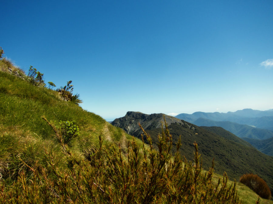
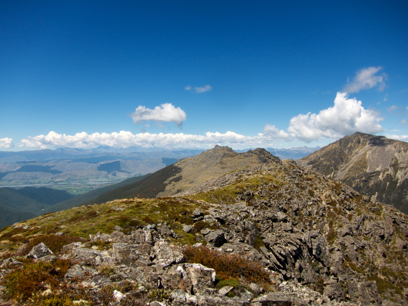
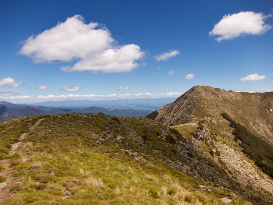
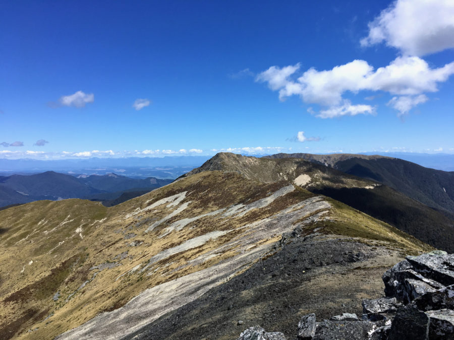
hike along ridge. Awesome New Zealand hiking 

view from another super steep slope. I had to scramble carefully up thru razor grass. Was really fun, but precarious. Could not get good pic. 


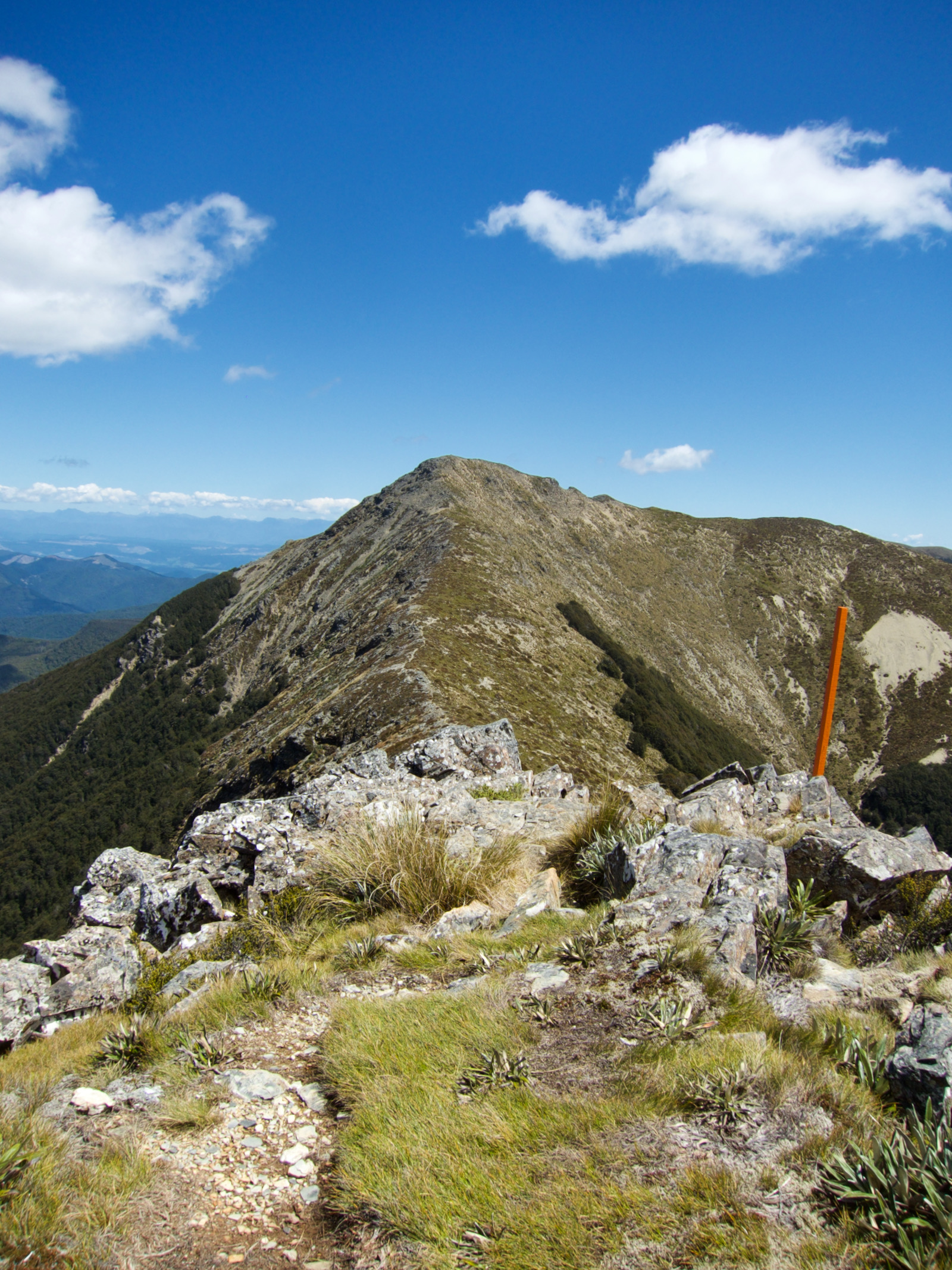
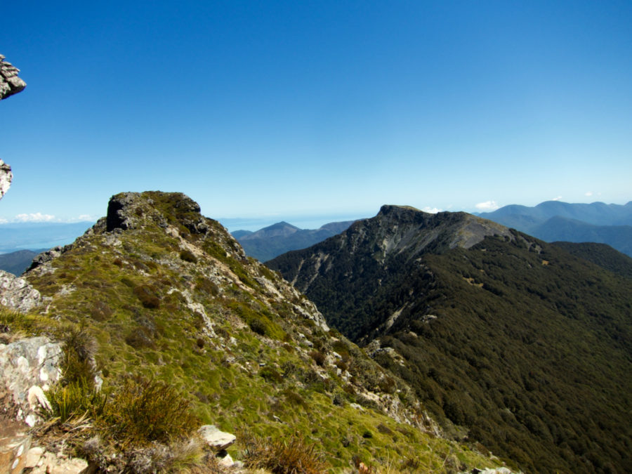
follow the ridge to the end. 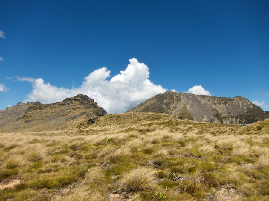


looking up mt richmond. 
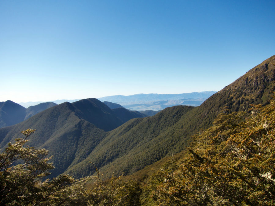
That there is wine country down below. Well close to it. Just upstream from Marlborough.


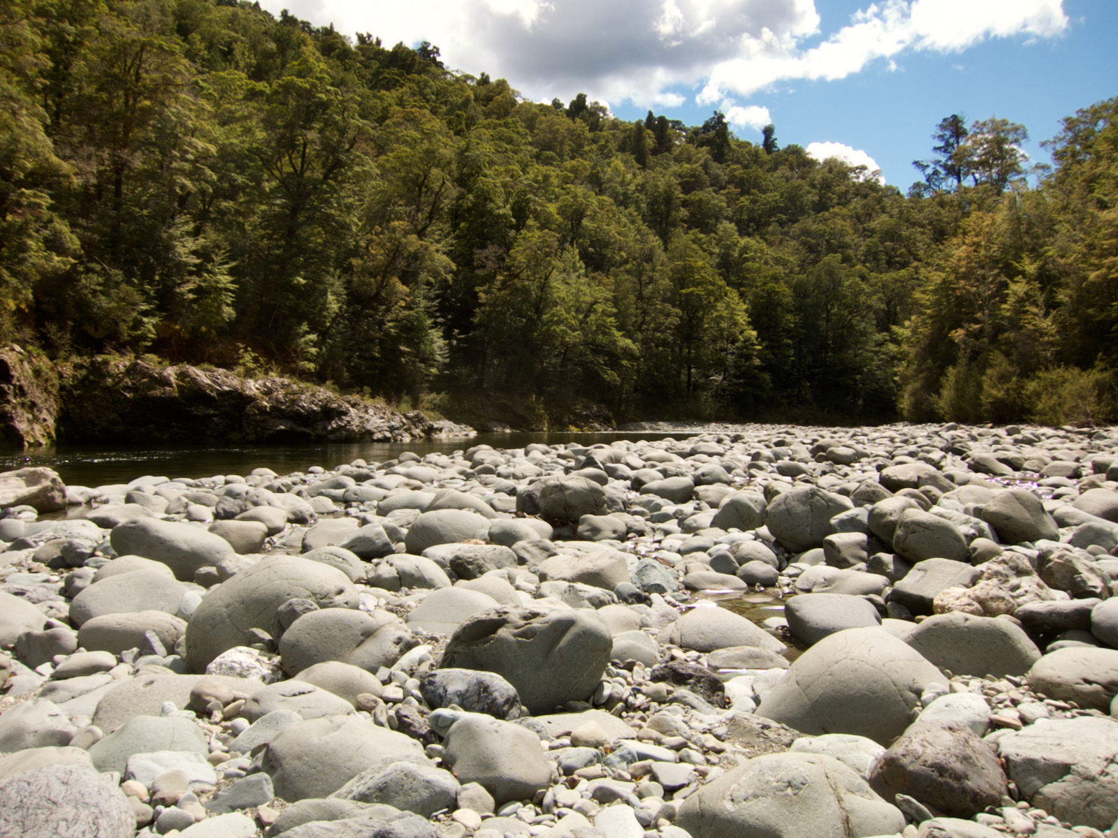
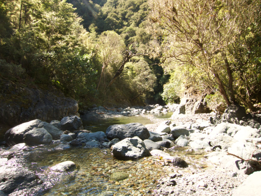
After a very quiet night at the Mt Richmond hut, I headed out, and actually felt pretty good, especially considered how difficult the last two days had been. The first part of the day was pretty easy, downhill, and I was back on a trail, not a route. This trail dumped me at a parking area, and I followed a dirt road down hill for a couple of miles I guess. Once I reached the bottom, I forded a rather beautiful stream, maybe knee deep, it was cold, but felt great because the sun was beating down upon me. After crossing I had to hike uphill on a dirt road to get to the trail. During this stretch, I passed a couple of loggers who we up a steep slope cutting trees. These were only people I saw until later the next day.
The next bit of trail once the road ended was again a route, but it was definitely a trail, although I did lose it a few times. It was not particularly tough stretch, and I did run into a couple of goat kids lounging directly on the trail. Obviously I was in a high traffic area. Later in afternoon, maybe 3pm or so, I reached the point where trail crossed the stream I had been following all afternoon. At that point I knew from map that the slope would be getting steep again. But I crossed stream and could not see where to go. I spent 10 minutes or so just looking for the orange triangle trail markers.
I found them by kind of looking up a bit. I had to scramble up a rather steep rock that did not have hand holds and not much in the way of spots for your feet. This was one of those moments where I had to think a bit. I was tired, had a couple of long tiring days behind me, but I was in a really remote spot in that no one was coming by anytime soon. But I had to get up this little spot. I guess looking back that if I didn’t have a pack, I wouldn’t have thought too much about this, but I don’t know. Slipping meant sliding down onto some largish rocks, and slipping seem quite possible.
Anyway, I scrambled up rock without a problem, but the slope here was about the steepest I had to go up at any point in NZ. It was fairly thickly covered with small trees, but it was super steep. It took me maybe 45min – 1hr to get high enough that the slope became a bit less, but it was really challenging. At one spot, I was trying to figure out where to step, I reached out about waist height and touched a rock that was maybe 18in wide, kind of tube shaped. Say 50lbs of rock, it was not small. I touched it and it started rolling. It rolled just to my right, missing my shins by a few inches. It happened so fast I could not have avoided it. Jumping was not possible because I would have just fallen down the slope. I got lucky. I figure if that rock hit my shins it would have taken me down slope a bit till I was stopped by a tree. Which maybe would not have been too far, but it was a really scary thought at the time.
Anyway, up I went, and up. The forest opened up a bit, but I was one damned tired person, it took me till not too far from sunset to get to the top of the ridge, at which point I joined a regular trail. This was my point to decide if I take a larger loop or smaller loop. There was no decision, smaller loop. I was hiking on this trail, but only as far as it took to find a flat enough, open enough spot to lay out my bivy sack. It took a bit, as roots and rocks and trees were thick. But I did find spot, and I am really unhappy that I did not get a picture of this spot. While it was not very flat, or smooth, it was very close to the cliff (within 10ft for sure), and the clouds/fog was rising from the valley up over the edge. Cool spot. I was so tired, I just set up my shelter, climbed in and ate a little peanut butter and nutella I think, and went to sleep.


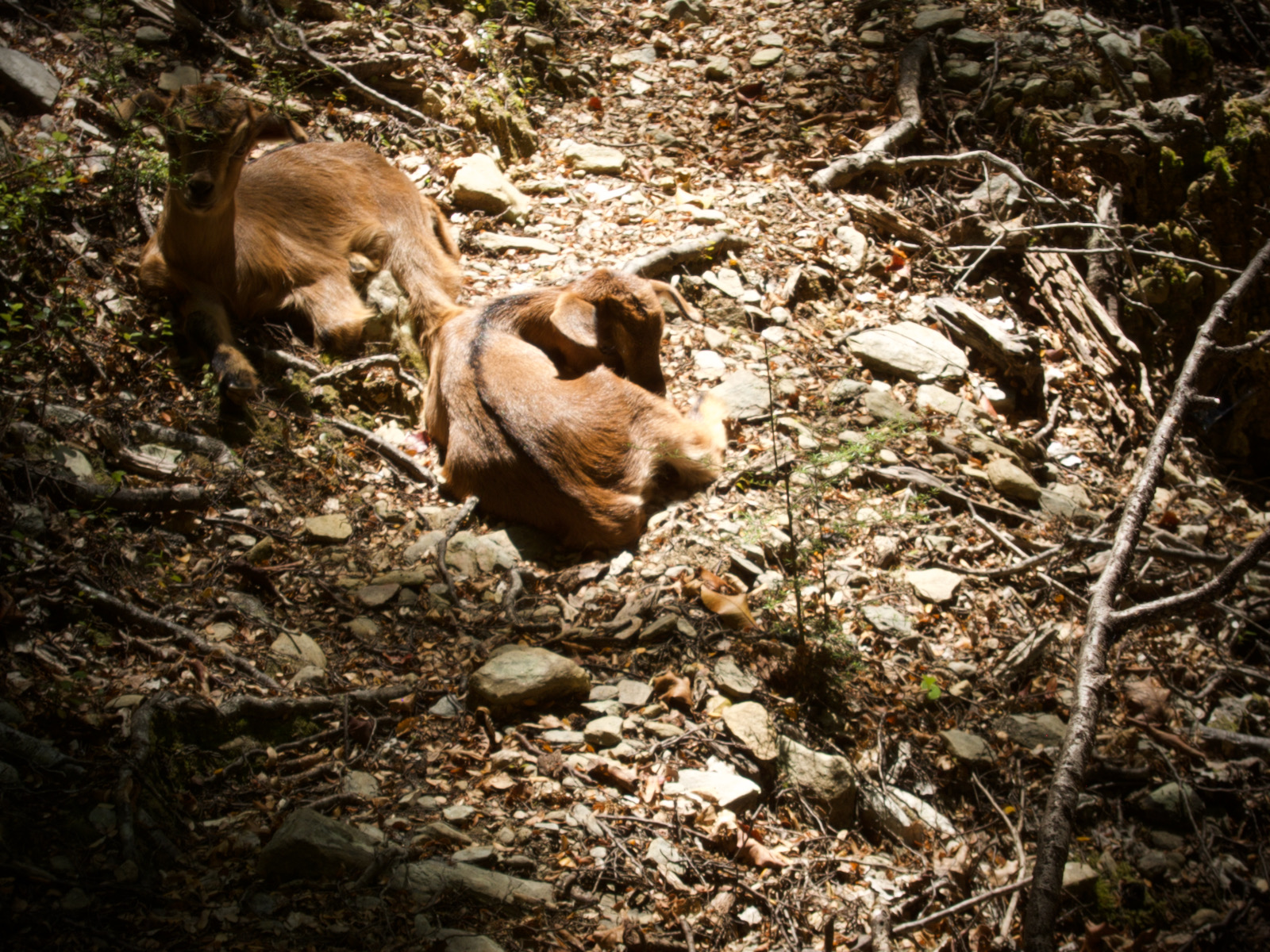
goat kids. not very bothered by me, although they did move off 

searched in here for trail a bit. Was up steep slippery rock, then got difficult. 
this was almost to the top. I was getting desperately tired, but needed to find reasonably flat spot.


I don’t have many pictures from the rest of the trip. At this point, I was trudging along. I did get to the Te Aoroa trail and starting passing people heading the other direction. The trail is along ridge lines, so great views above tree line. I stopped for a nice break at the Slaty hut, and chatted with someone hanging out there. I think I stayed at the Starveal hut for the night, but I am not sure. I shared the hut with another single hiker heading the other way. I was planning on going a bit further, but was warned there was a strange, somewhat aggressive person staying at one of the huts I was thinking about. The next day I continued on back to the Rocks Hut, stayed there for the second time, and my last day I hiked back to Nelson. I ended up hiking all the way back to Nelson, as I did not return down the same trail, as there were a lot of trails, but not a big deal.
After I got back to Nelson, I was very much taking stock of myself. I was definitely thinking that maybe I was not cut out for New Zealand hiking. I have had my fair share of hiking failures, but every one of them involved blisters and bloody messed up feet. This hike was the first time I finished a hike without a single blister, but was completely spent and beat up. I think this loop was maybe 50 miles, the highest elevation was 1756 meters (5761ft). As a comparison, just 2 months earlier, I hiked almost 100 miles in 5 days all above 10,000 ft on the Colorado trail, and that was tiring and I had a really bad day during that trip, but in know way was it remotely close to as difficult as this loop. I can’t wait to go back. This is such a cool place.
I did not get pic of overnight spot, but it was right beside this ridge. 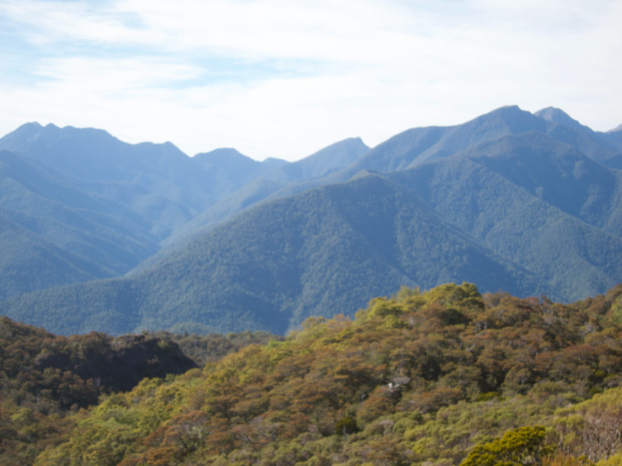


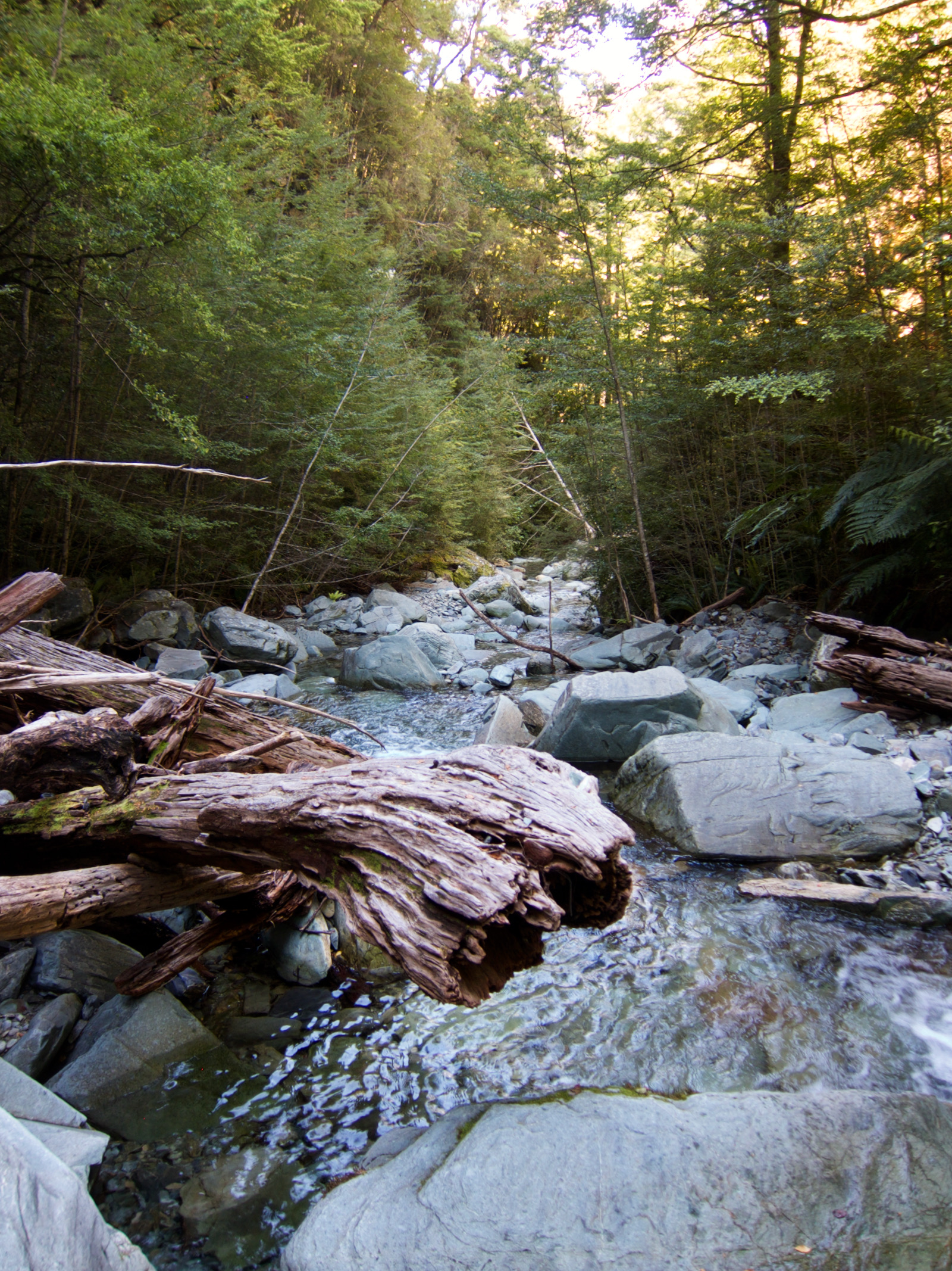
The trail was pretty much in the stream for a while. 
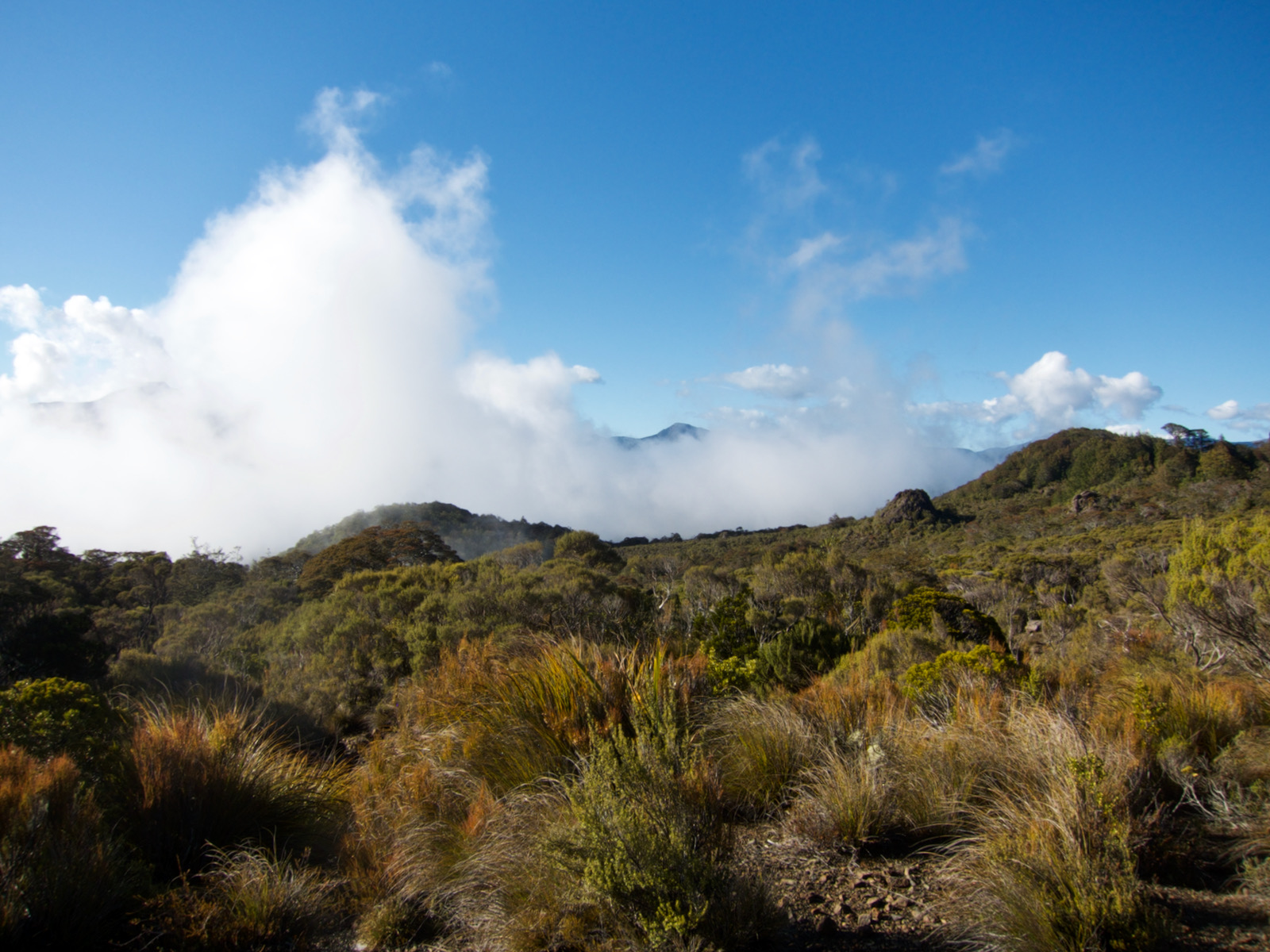
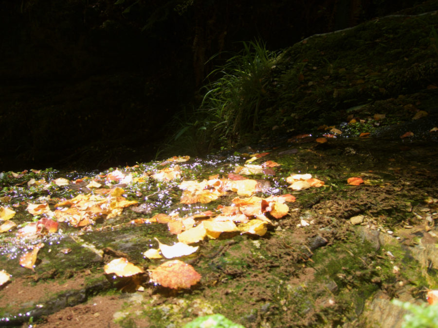
If it is not obvious, I was in dry areas and wet areas during this hike. Microclimates!!! 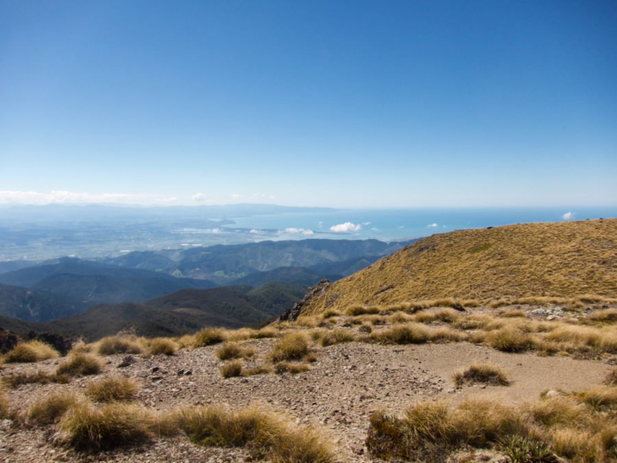
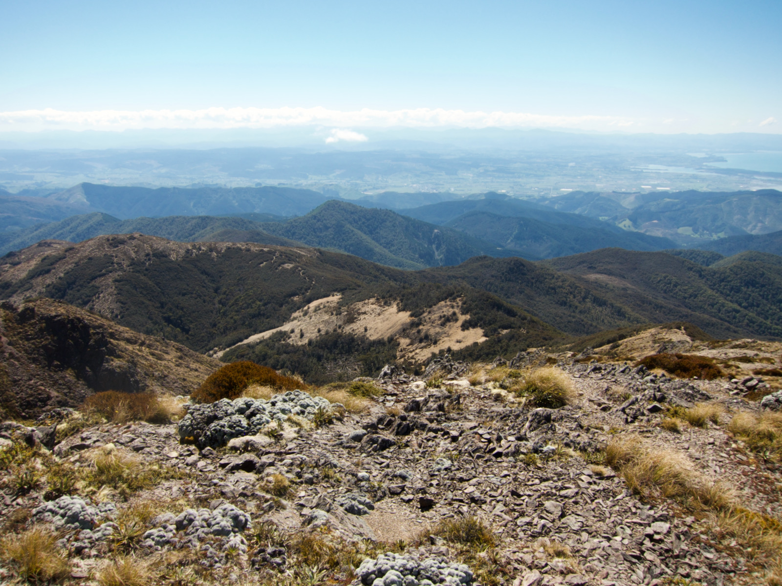
Nelson view 
Beautiful spot for hut, took a long break here. 
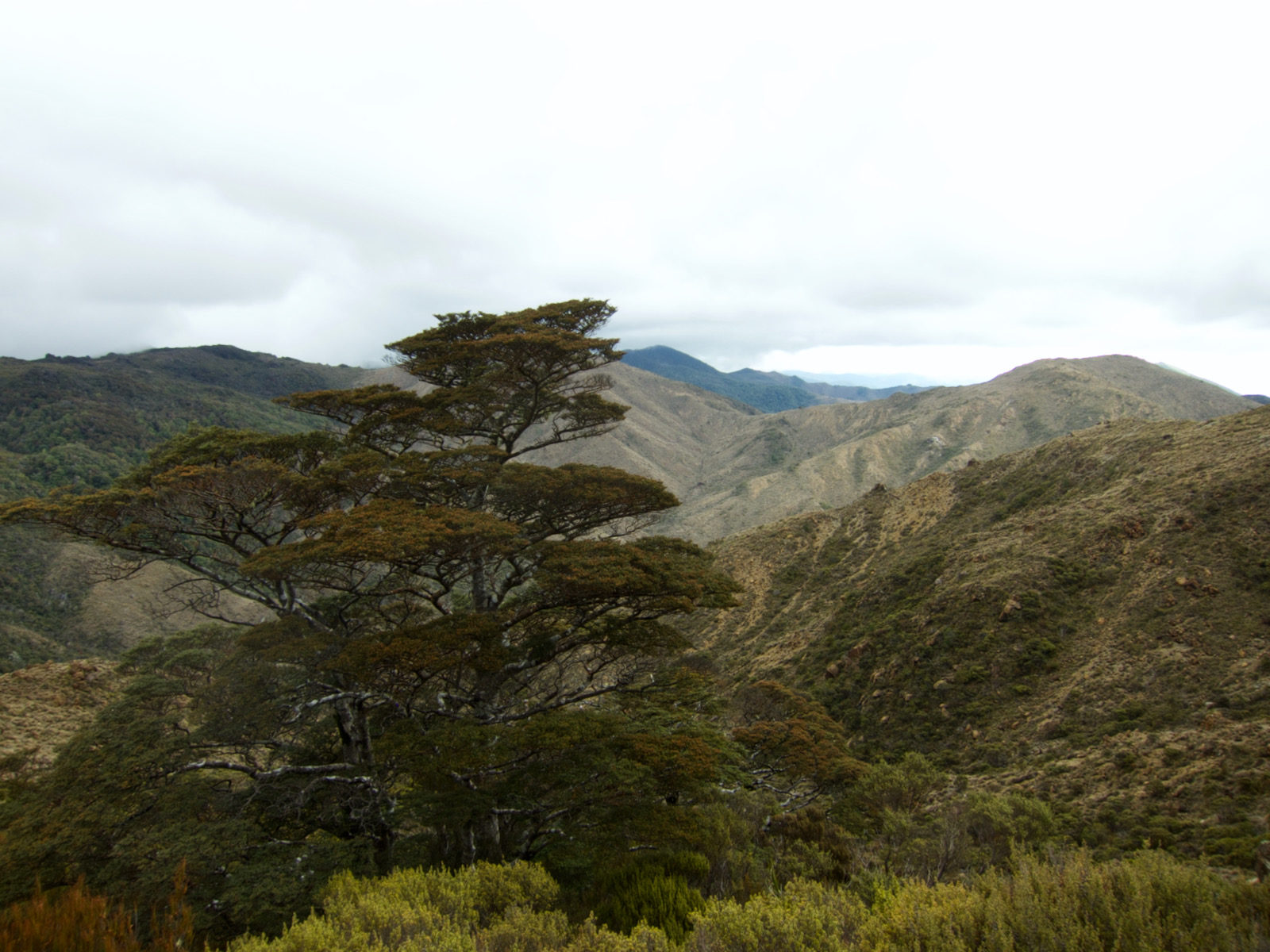
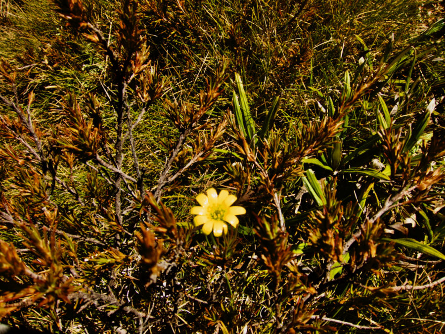
lichen and moss 


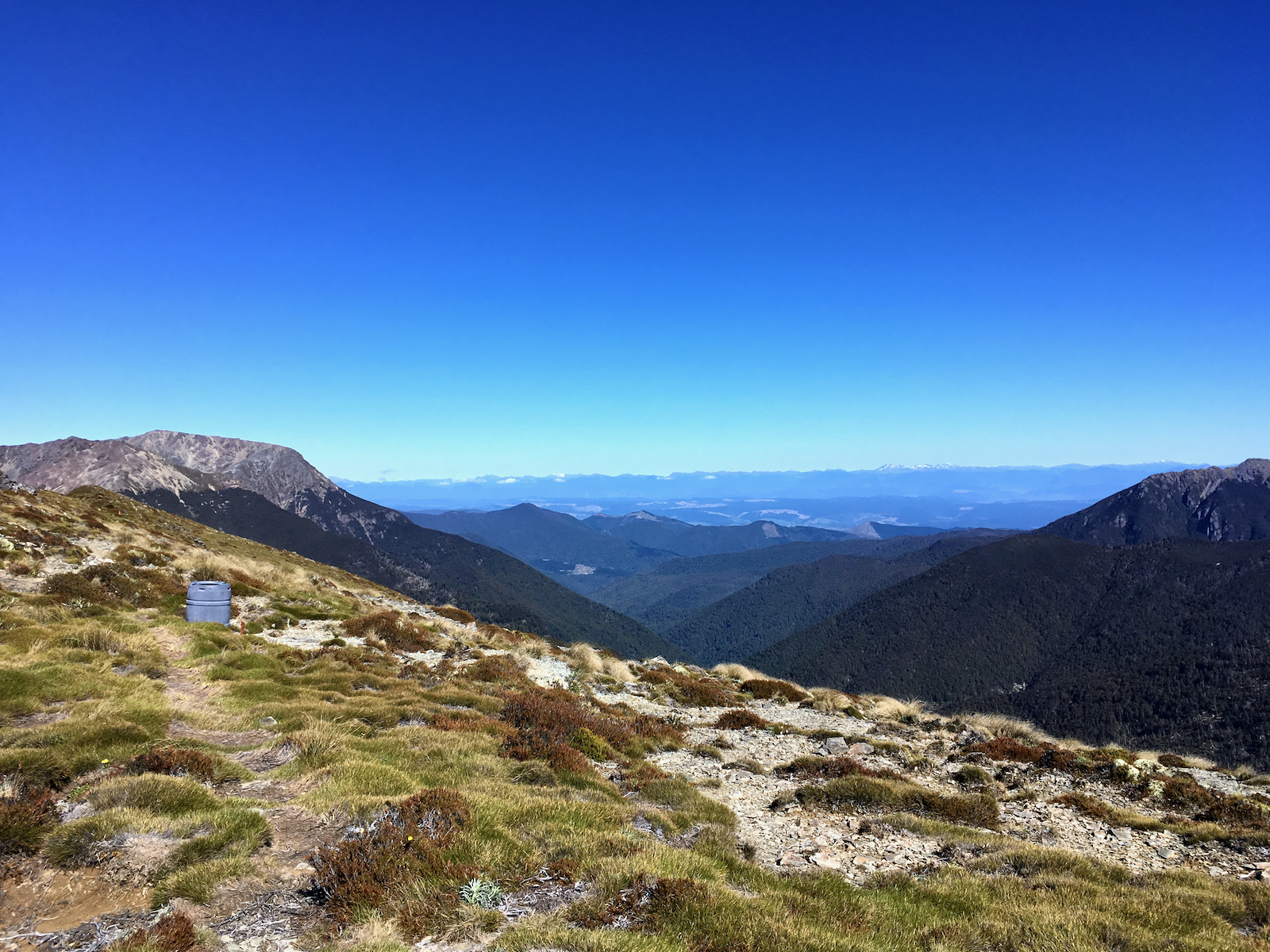
the barrel is I think another emergency water spot.